Bear Boxes in Hockett Plateau (HP)
Generated on 2 Aug 2022 - see revision history - please send updates to the webmaster
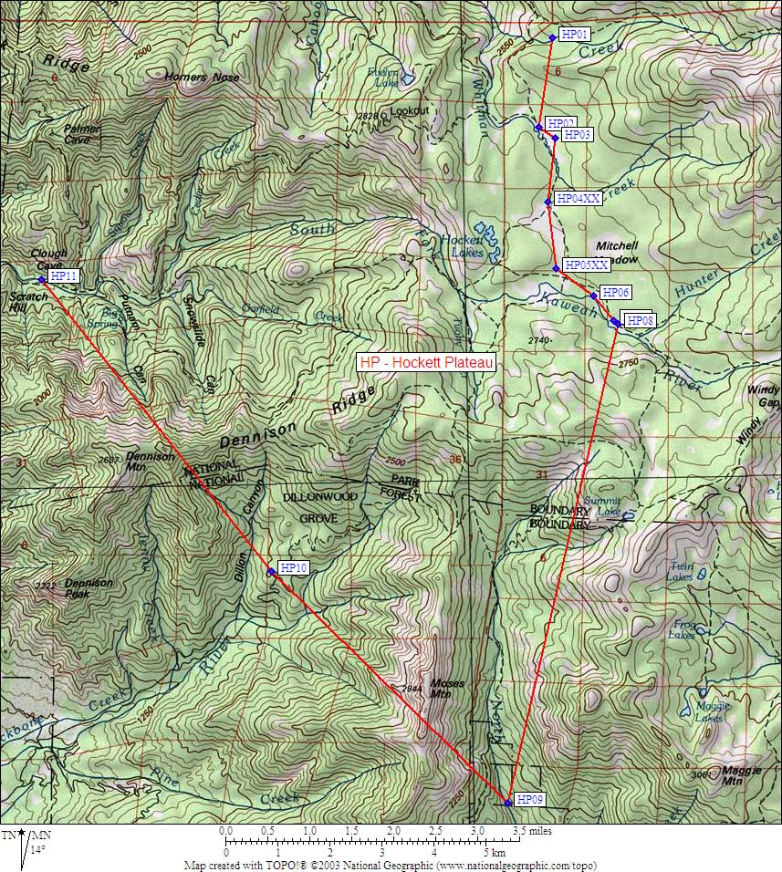
| 11 Bear Boxes in Hockett Plateau - GPS route HOCKETT PLATEAU | |||||
|---|---|---|---|---|---|
Please let the webmaster know if you can help verify that these boxes exist and precisely locate them. | |||||
| click on name for details and directions | elevation | waypoint | food locker type | ||
| Horse Creek Cable | 8600 | HP01 | a steel cable, still there as of 2001 | ||
| Hockett Meadow Ranger Station | 8500 | HP02 | a standard box | ||
| Hockett Meadow Stockade | 8500 | HP03 | a standard box | ||
| Upper Camp - may not be near here | 8600 | HP04XX | an unknown type, may not exist | ||
| Hidden Camp / Sand Meadow | 8500 | HP05XX | an unknown type, may not exist | ||
| South Fork Meadow | 8500 | HP06 | a standard box | ||
| Rock Camp NW | 8600 | HP07 | a standard box | ||
| Rock Camp SE | 8600 | HP08 | a standard box | ||
| Hidden Falls Campground | 6000 | HP09 | 6 large boxes with no latches | ||
| Dillonwood Grove Entrance | 5700 | HP10 | 1 large box | ||
| South Fork Ranger Station | 3600 | HP11 | 2 large boxes | ||
Useful Links: