Bear Box at Rock Camp SE (HP08)
Generated on 2 Aug 2022 - see revision history - please send updates to the webmaster
Detail Map of waypoint HP08
in Hockett Plateau:
(scroll down for directions, waypoints, and area map)
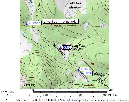
- HP08 is a standard box, at about 8600 feet,
in the GPS route HOCKETT PLATEAU.
- Note: Southeast and Northwest Rock Camp boxes are about 100 yards apart.
Between them the trail goes over a log-and-plank footbridge. Waypoints
are hard to get here due to the tall trees.
- Directions from Steve Eckert, with GPS waypoint, June 2001:
One box just inside the tree line where the southeast branch of
a meadow (with a stream) meets a larger open space that defines
the main meadow here. Neither the good-sized campsite nor the box
is at all visible from the trail! Find Rock Camp's southern bear
box by looking for glimpses of meadow to the west as you walk
north along the trail: Soon after the meadow appears, but before
you cross the footbridge, you should seem some use trails head
over to the campsite. Boulders also become prominent as you
approach from the south, and the campsite is hidden from the
trail by these rocks.
- Directions from Mineral King ranger info sheet, dated 1991:
Two boxes, one at each of TWO camps between the trail and the meadow
about one fourth of a mile north of Hunter Creek.
- HP08 coordinates: (see GPX waypoint download links above)
  (lat,lon) = (36.3419400, -118.6395200) in decimal degrees, NAD83.
  (zone,east,north) = (11S, 352948.0, 4022927.0) in decimal meters, NAD27.
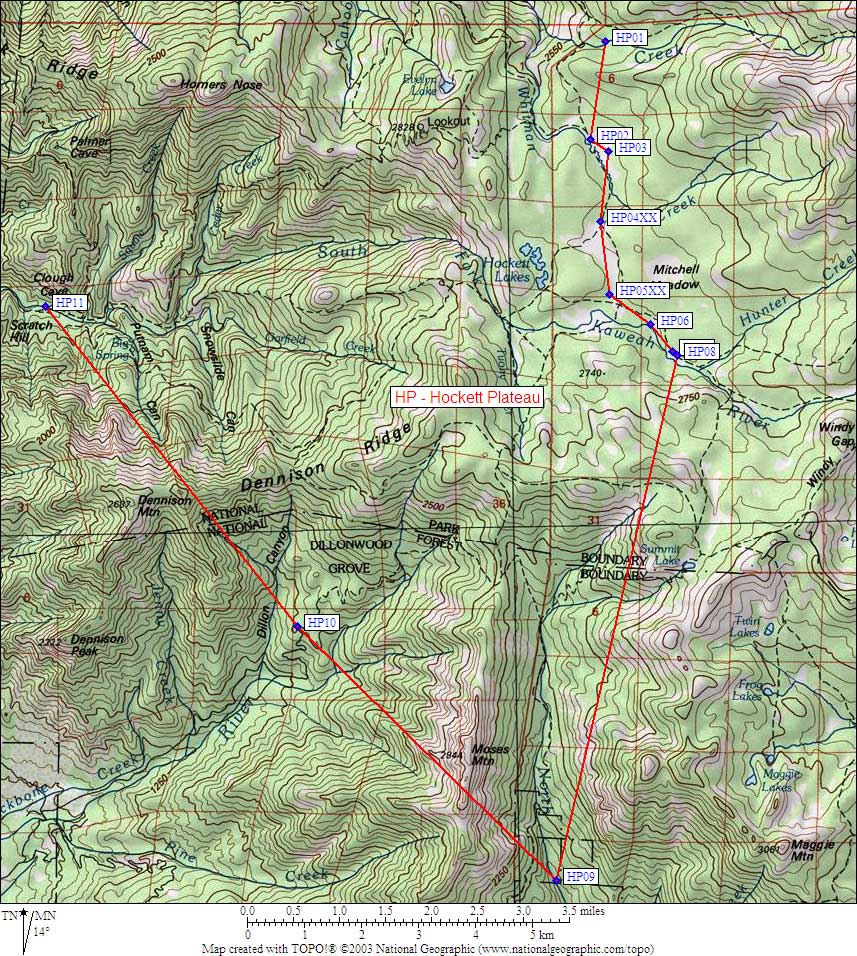
- Scroll down for a regional map of the entire Hockett Plateau region.
Map exported from TOPO! software, used with permission.
Useful Links: