If you don't like linear reading, here's an index:
Each time I hike up Bear Creek, I'm surprised how beautiful it is. The 2
miles of 4WD road between Lake Edison and the trailhead (waypoint
BEARCD) keeps out the riffraff, and most of the people there seem to be
families and fishermen who don't stray far from their SUVs. Miles of
swimming holes and small cascades lead you through pine forest into
slabs, and you're on both the John Muir and Pacific Crest Trail
(waypoint JNMUIR) before you know it.
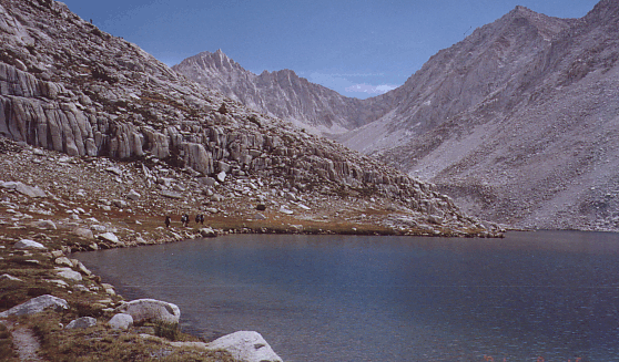
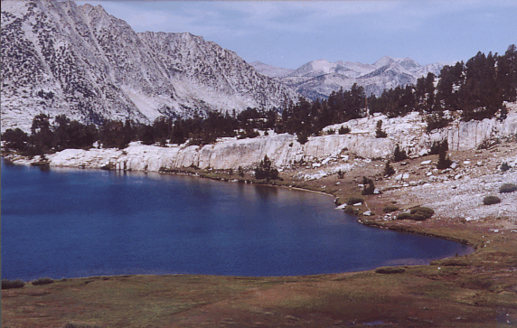
Bear Creek below 8000'
(Does anyone know why the PCT is 6
miles from the actual Crest here?) If you're meeting people here, make
sure you agree on exactly where and when to meet! The
trailheads page gives pretty clear
instructions,
but those who had to walk up the road didn't leave enough time and those who
expected to meet at the campsite down by the Bear Creek Dam didn't know
that everyone else thought they were "no shows".
After restating my previously announced plan of starting on time with or
without the group, a couple of us walked away from the cars shortly
after 7am. Others caught up at various points along the trail, with the
early starters having the longest breaks. We had lunch in the shade
beside a rushing stream, after staying pretty much together as a group
the entire morning. The pace was leisurely, the breaks long, and after
lunch the eager beavers started pulling ahead of the slower hikers.
Still, we all got to Sandpiper Lake (waypoint CAMP1) by 530pm, and there
was time aplenty for washing up and dinner before dark. [10.5 hours,
3800' gain, 14 miles, a long day with heavy packs]
No mosquitoes! Well, very few. The first day was the only day I used bug
repellent, as the dry summer exchange freedom from bites for wilted
wildflowers. The Roguls had hiked in on their own, and were waiting for
us at the lake. We worried some about the group of 20-somethings tossing
rocks off a cliff near camp for quite some time, but they turned out to
be some sort of training class clearing a place to practice with ropes.
(Lots of clean cliffs here, no need to teach bad trundling habits.)
Plans for the next day were made and changed as the sun set.
Sunday we ended up in roughly three groups: Chris, JimR, Linda and I
left for Turret Peak (not on "the SPS list", which is why I wanted to
climb it) at about 6am, the early group (Aaron, Carol, Joe, Ron) left at
6am to do both Hooper and Senger, and a later group (Charles, Jill,
JimC, Mike, Phil, Tony) planned to leave for Hooper around 8 or 9. (It
turns out this division was to become semi-permanent.) To go from
Sandpiper to Turret or Senger, go around the west shore of Three Island
Lake (the southern half looks cliffy on east side). Pay attention to
your map or you'll get hung up in the inlets of Medley Lake, but once
you get to Three Island proper you follow a grassy ramp up 100' then
down to great campsite mid-lake and another ramp leads up to Sharp Note
Lake and the saddle east of Senger. (We saw bear tracks in mud just
below Sharp Note, proving that our food canisters were a good idea, and
dead mouse on the bottom of Three Island Lake, proving that water
filters were a good idea.)
Joe reports that the early group "headed to Marie Lake via the
cross-country route (well ducked) and before the pass headed for Mt.
Hooper. Ron led the crack on Hooper (NOT the easy route!) and I
followed that on belay. Aaron and Carol wisely went up the good way
after Carol found it. We met [the later group] on the descent and gave
them the rope. We then did Senger via the Secor route except that
instead of getting to the easy side of Senger via the chute next to the
false summit, we climbed some class 3 ledges on the other side of a
gendarme and ended up on the class 1-2 backside that way... We went
down a loose chute on the northeast (the one [Steve] recommended) and
got back to camp via the beautiful 3 island lake, etc. drainage."
The Turret crowd had the best day, I think. We walked on tundra, slabs,
firm gravel, and hopped a few stable boulders now and again. The footing
was astonishing! JimR called it "A very pleasant ramble along rounded
ridges and grassy 'roadways,' over slabs and tundra, and past
interesting cliffs (remember that platform that looked like a Greek
stage?), and gorgeous isolated tarns." I can't add much to that, except
to say that Upper Turret Lake (waypoint TURLAK) and every puddle around
it is worth visiting. We thought they would be deserted honeymoon lakes
until we read the summit register: Turret is climbed a LOT by Outward
Bound and teenagers, the register is a small jar is full of paper
scraps, and none of the scraps is older than 1993.
From Turret (12091'), we traversed the 2nd class ridge directly to the
base of Gemini (12880'). This was not in our original plan, but getting
to our first summit at 10am forced us to reconsider! The ridgeline is
good walking, but has a couple of 100-200' notches that make you think.
Secor's description of Gemini doesn't mention the west face, but it's
all class 2 if you do it right. Attain the broad west "ridge" at the
saddle near the base of Gemini from any direction, then skirt south of a
prominent tower (what Secor calls the west spur of the northwest summit)
and then turn directly to the peak above the tower. Dropping into the
northwest bowl and heading almost directly toward Seven Gables Pass,
instead of going back to the tower, leaves you with 100' of low class 3
climbing (which another party in our group sneered at us for doing, but
which shortens the route a bit). The true north ridge might also be 3rd
class, but we stayed off it.
We topped out about 230pm, lazed around almost an hour, scouted the next
day's route between Sandpiper Lake and Seven Gables Pass, and reached
camp around 6pm. [12 hours, 3700' gain, 10 miles] Imagine our surprise
to find camp deserted! A neutron bomb? Hide and seek? Mutiny? An hour
went by while we kicked ideas around about who could be where and
whether we should go look for them.
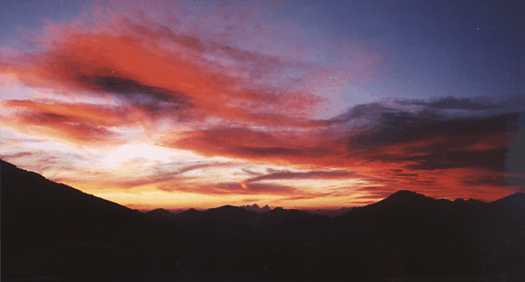
Sandpiper Lake at sunset
At 7pm, Tony and Phil wandered into camp from a direction we didn't
expect, asking where Jill was. Oops. They had left her at Marie Lake
after taking the direct cross-country route from Sandpiper. She planned
to fish while they climbed the peak with JimC, Mike and Charles, then
they were all going to return together. I'm not sure I'll ever know
EXACTLY what happened, but the best story I could piece together goes
like this: Phil said she wasn't where they expected her, that Mike and
Charles were out of sight, JimC had veered off-route and disappeared
(after Phil waved at him which JimC took as "go ahead" when Phil meant
"we're coming"), and when Jill wasn't at the lake they assumed she was
with the other three. Tony says they decided to take an easier route,
and didn't return to Marie the same way they left it when climbing
Hooper, so they might not have returned to the right end of the lake.
(Marie is a mile long, so a person at one end would not be able to see
someone at the other end.) Phil and Tony had no map with them, and when
they thought JimC veered off-route (which he didn't) they were
essentially lost. They took the trail down and around instead of
returning on the route they took that morning... so they didn't have any
idea whether the others were waiting somewhere along the original route
and we didn't know where to go looking.
About ANOTHER hour later, at 8pm, Jill/Mike/Charles/JimC showed up via
the cross-country route from Marie Lakes. They had been searching for
Phil and Tony for several hours, and were exhausted. JimC says they
stopped waiting for the others to catch up when the terrain became easy
to navigate, and all three guys returned to Marie Lake and found Jill
right where they expected her. After the failed SAR drill, they wisely
returned to camp before dark. Imagine their surprise to find the people
they had been looking for were now rested and considering going back to
look for THEM.
The four people in the early crowd were still missing, last seen handing
off the rope to the later Hooper crowd and heading for Senger. Joe and Ron
showed up about 830pm, having agreed with the others to split up about a
mile from camp. Just at dark, Aaron and Carol strolled around the end of
the lake, in fine spirits. (It seems the Medley Lake Maze almost got
them and Aaron's GPS came in handy.) We all swapped stories while the
Milky Way came alive. Even though we were camped at 10500', it was too
warm to zip up our sleeping bags overnight.
Day 3 (Monday) was when the group fell apart. We were supposed to get an
early start, because we had 5 miles of backpacking and one or two peaks
to bag. Yeah, right. The day before had taken its toll. JimC's knees
hurt, Charles had pulled a leg muscle somewhere, Tony seemed to have
altitude sickness, Jill was all done with cross country forever, and my
idea of hoisting packs at 6am was met with jeers and catcalls. The night
before the plan was for the less ambitious to go back down the trail and
take another use trail up to Lake Italy, where they would meet us in a
couple of days. When we left camp at 730am, the NEW plan was for JimC to
lead the less ambitious up a longer but easier route and still cross
Seven Gables Pass. (That guy's a team builder!) We talked at length
about how to meet up where the Vee Lake and Seven Gables Lakes drainages
intersect, camping there instead of continuing to our original
destination so people could climb Seven Gables and continue to the
better camp on Tuesday. Yeah, right. Details below!
My group went up the east shore of Sandpiper, crossed a trickle of
water, and angled up to Lake 11100 between alder thickets. (This is the
route we had scouted the day before, and it's super easy walking if you
keep your head up and avoid the brush.) From Lake 11100, climb toward
the south ridge and traverse east for the easiest (2nd class) way into
the Seven Gables Pass drainage. Stay to the north in this drainage, and
you'll find great grass-and-slab walking. The middle goes also, but you
might have to climb around some waterfalls. Linda, Chris, JimR, Ron, and
I dropped our packs at Lake 11600, filled up on water, and tried to
figure out the route. Aaron, Carol, and Joe continued to the tarn by the
pass, where they dropped their packs to climb Gemini.
Secor's south face Seven Gables route indicates you have to climb
through a third class chute on the face. This cliff band is clearly
visible on the 7.5' topo, between 11.8-12k, and tends to be smooth
friction slabs with just enough sand to make you nervous. You'd want to
do that if you were coming from the pass, but staying left of the cliffs
from Lake 11600 keeps you in second class and makes more sense coming
from the west. The footing is pretty good, but we still spread out to
avoid kicking rocks. Heading for the apparent high point, we were
completely confused by the guidebook: "Ascend the south slope to a knife
edge ridge just beneath the summit." OK, we did that - it's the skyline,
right? "Go left (west) over the ridge and into a chute" is just plain
impossible. Looking over the knife edge ridge, you're looking into the
EAST chute that forms the cleft between the north and south summits when
viewed from the east. It's a sheer cliff. After a bit of hunting around,
we discovered some ducks pointing out the correct route: Climb to just
BELOW the apparent high point (the knife edge ridge), going to the right
of a prominent tower. When it's clear that you're between the tower and
the ridge, go west (left) and cross the lesser ridge between the tower
and the knife edge (summit) ridge. We crossed about 40' below the
apparent high point, dropping 20' into a chute (southwest from the peak)
through some large boulders. Traverse the SW chute on good footing above
all the rubble, about 50 yards, then head directly for the summit and
pop over the ridge forming the W side of the SW chute. Now you are at
the low spot of the summit ridge, where the knife edge ridge turns
abruptly and rises 100' to the summit, but you're a hero if you got here
by following the knife edge!
Seven Gables reflected in Vee Lake, taken the next day
NOTE: Secor's Second Edition makes the same mistake as the first - his
picture of Seven Gables from the east marks north and south summits, but
the ACTUAL north summit is NOT in the picture. What he shows as the
south summit is just the east end of the knife edge ridge and not a
summit at all. The writeup says the south summit is the high point, and
the picture shows technical routes ascending to the actual south summit
(but labels it as the north summit). Point 12600 is the true north
summit and Point 13080 the true south summit. Secor's west ridge route
leads you to the bowl between them, then south to the high point. Many
east side climbers look at the big east chute and believe that it
separates the two summits, when in fact the north summit is almost half
a mile away!
That last bit to the summit is the real challenge: JimR had been here
before, in a snowstorm, and followed Suzuki directly up the ridge. This
time I insisted we find the described (chute) route. If we found it, it
stinks and you should climb Suzuki's route instead! We dropped about 50'
down a west talus chute from the low point of the knife edge summit
ridge, then turned up a narrow chute of noticeably gray rock. 20' up
this chute you hit a down-flaring stem section which stopped Linda and
Chris. Above that you climb over several house-of-cards rockpiles that
threaten to wipe out anyone below you if you're not careful. It's
possible that the correct route was even farther down the talus chute,
because we didn't duck under an overhang as described in the guidebook.
We decided to descend Suzuki's ridge route instead of braving that nasty
crack again. WAY BETTER! The holds are solid and plentiful, the moves
are easy, but the exposure is high. To climb this route, start at the
notch (low point in the knife edge) and use Hail-Mary holds to pop over
a 5' block that looks worse than it is. Stay slightly left of the
ridgeline above that, and go left around a diving board for the final
20' to the summit. The summit block is another diving board, low angle
but sort of like the top of North Guard. From here you can see the
notch, the knife edge, and friends who didn't like the crack. The most
colorful register entry called the climb "Sphinctor Factor Ten". (JimR
had an even better phrase, but it's even more colorful and my wife won't
even let me write it down!) The part I can quote him on is "the cool
thing was that we climbed up the summit crack described in Secor and
descended the ridge, and so were able to directly compare the two. I
thought the ridge, though airy, was much shorter, easier, and more fun."
I completely agree. Ignore the book, do the ridge.
We spent 5 hours doing the peak from our packs, longer than expected.
When we returned, each of our packs had a single medium-sized rock on
it. Hmmm. A sure sign of humans, but JimC's group was to go up another
(easier) drainage, and the Gemini group was far above us. We packed
slowly, knowing that all we had to do was pop over the saddle and
descend to camp. Soon there was yelling from above: The Gemini group was
waiting for us, concerned about the route and somewhat unhappy that we
were taking so long!
Seven Gables Pass is one of the easier passes I've been over... but
don't go to the low point unless there's lots of snow and you want an
exciting glissade. Go to waypoint 7GBPAS just under a tenth of a mile
north from the low point and about 150' higher. Then stay on the prow of
the ridge, aiming straight where the braided and brushy-looking drainage
from Vee Lake intersects with the Seven Gables Lakes stream. The ridge
steepens as you go, and Joe's steady stream of worried comments gnawed
at my confidence that the route worked. Stay on the prow and you'll drop
into the drainage almost entirely on good slabs, exiting between small
cliff bands. We found good sand-between-slabs camping right where we had
planned to meet JimC's group (waypoint CAMP2). [arrived at 630pm, 11
hours, only 4 miles, 3300' gain including 7Gables]
Washing up, talking, and dinner brought us to dusk, still with no sign
of JimC's group. We looked for signs of the others and worried, since
members of our group were sharing stoves (etc) with members of the other
group... and since several members of the other group had expressed
grave reservations about the cross-country pass. The plan, talked about
that morning at Sandpiper, was to meet within sight of the stream
confluence or to leave a bright piece of clothing there with a note
where good campsites were found. Just before dark, JimC and Mike
strolled into our camp saying they had known all along where we were,
had watched 3 of us descend the pass to Stub Lake (all 8 of us stayed
together and stayed on the ridge - must have been some other group), and
were camped several hundred feet down and about a third of a mile away
behind a stand of trees (waypoint CAMP2X). I have to admit losing my
temper, because the primary rule I had established when organizing the
trip was "splitting up is OK as long as everyone agrees where and when
to meet up again."
The splinter group showed no understanding of my worries about where
they were, even in light of the previous night's search-and-rescue
fiasco and the gear-sharing issues. They told us they had changed their
minds AGAIN, and would NOT be moving to Black Bear Lake the next night
as previously agreed. (Had we known this, I would have stayed on the
original itinerary and gone the extra two miles to Black Bear instead of
camping in the 7Gables drainage, but it was too late now.)
Change-O-Rama. Mike told me that they had noted the spot where we were
supposed to meet but didn't want to camp away from trees. JimC told me
he never agreed to any meeting spot or leaving a note. Climb-O-Drama.
Some said I spoke for the group, others were unaware there was a
problem, others said we should "just move on" (a phrase which I always
interpret as "learn nothing from this event").
Remembering the Taboose Climb-O-Rama where similar events resulted in
everyone except Eddie and I leaving the mountains days early, and both
the Milestone and Whitney Climb-O-Ramas where similar discussions split
the group permanently, I started for Black Bear Lake the following
morning with a heavy heart and serious thoughts of signing out to finish
the week solo. Who needs the hassle of planning things for those who
don't respect the effort?
The grassy ramps between slabs and the beauty
of Vee Lake weren't entirely wasted and my mood improved as we
approached the isthmus between Ursa and Bearpaw Lakes. At the isthmus (a
mere 2 hours into the day) JimR, Ron, and I dropped our packs for a
"quickie" climb of Feather Peak, while Linda and Chris packed on to
Black Bear Lake and an afternoon off.
Meanwhile, Aaron, Carol, and Joe climbed Seven Gables "the easy backside
way", going up the chute between the true north and south summits. They
met Mike, Charles, Phil, and JimC on the summit before packing over to
Black Bear Lake (demonstrating that the peak and the pack fit easily in
one day).
Can you spot Ron beside Bearpaw Lake?
The area between Vee, Ursa, and Bearpaw is the best scenery we
encountered. The pictures don't do it justice. Bearpaw, in particular,
has a shore that could be a Club Med ad: lush green grass, coarse bright
sand, turquoise-fading-to-blue crystal clear water, and the massive
flakes of Feather Peak as a backdrop. We strolled up to Feather Pass
(waypoint FTHPAS) and started sidehilling along the east side of the
southwest ridge. We went through a keyhole and stayed on the ridge for a
bit, but the ultimate options are staying low in sand or staying on the
class 4-5 ridge, with interesting and fun 3rd class in between. (For
example, we did a 30"x10' chimney with no exposure, just because it was
there.)
200' below the summit, we hit a rib we couldn't cross and climbed it to
the ridge... which was 5th class. We ended up downclimbing a brownish
crack 200', crossing a rib and a gully and another rib, ending up in a
shallow gully with rust colored slabs. THIS is the chute that leads to
the summit (one chute over from the chute next to the east ridge) with
the easiest class 3 climbing, as far as we could tell. JimR's memory of
the face is "After we climbed that chimney in the delusion that we were
near the summit, I remember counting five huge ribs between us and the
summit (including the one we were standing on). I think that this face
of Feather has about eight major ribs, though of course that depends on
how far up or down the face you are."
We topped out just before 2pm after a much tougher climb than we
expected. The SW ridge is not a class 3 route - staying with class 3
requires a face traverse, not a ridge climb, and is essentially the same
as the southeast face route described by Secor (with a different
approach angle). The east ridge also looked class 4, but the rubble
chute next to it might be class 2-3.
Feather Peak (13240) has a great summit block, with stunning cliffs
overlooking Royce Lakes. From here I tried to call my wife on Ron's cell
phone... shortly after which a freak gust of wind blew the paper with my
list of phone numbers and waypoints about 10' over the cliff, where it
hung suspended for almost a minute. Fluttering in the wind, but not
moving, there was time for me to joke about reaching out to grab it
before it started drifting up... which it did for the next 10 minutes,
slowly vanishing while rising vertically above us into the crisp blue
sky. Is that a message or what? "NO PHONE CALLS FROM HERE!"
We descended the way we came, crossing several ribs until we saw one
that was sandy all the way to the valley, and traversed back to Feather
Pass at around 12200'. We got our packs, and sprinted to camp at Black
Bear Lake around 5pm. [3200', 10 hours, including the peak] Chris and
Linda told stories about the family with an off-leash dog that had
previously occupied our campsite, and we looked for shade from the
evening sun after the obligatory (and refreshing) dip in the lake.
Black Bear Lake has limited camping and is kind of barren, but beautiful
in its own way. Joe was especially impressed with the "amazing light in
the late afternoon/early evening", and reportedly burned up a roll of
film there. The "High Route" goes from here to White Bear and Teddy Bear
Lake so there is a reasonable use trail heading directly over White Bear
Pass. We got a bit of a late start the next morning, partly because I
was fixing Linda's broken sunglasses with a bobby pin splint (trash
found in camp) and copper wire (from my first aid kit). We think the
fashion statement will catch on, so buy stock early! Tim Hult was camped
near White Bear Pass with some friends, but we blew on over the pass
without much of a visit.
Secor's description of White Bear Pass (waypoint WHITEB) is OK from
below, but from above it's kind of intimidating. We kept it down to
class 2 by starting near the middle of the saddle, working our way NE on
sandy ledges and then SW into the green area. It's tempting to stay
right on the greens, but better to cut left (SW) under cliffs and down
through a short section of boulders before getting back on grass to the
NE. (From below these cliffs appear as the dark stained area.) If you
stay on the NE side of the drainage, in the plants, you risk ending up
on steep friction slabs or in the willows. It's a wonderful walk around
the north shore of Brown Bear and the Teddy Bear lakes, and the footing
is better if you don't try to stay too high as you contour over to the
Hilgard Branch trail. If you expect a REAL trail to Lake Italy, you're
in for a surprise! It's one you can stay on, but it's also easy to cross
it in a slabby area so stay east of the stream. (On the way out, Chris
reported "The use trail from the PCT to Lake Italy fades in and out.
Stay on the north side of the Hilgard Branch of Bear Creek from the PCT
until around 10,800 ft elevation, then cross the creek to its south side
and pick up the trail again.")
Lake Italy's north shore, looking east
At the outlet of Lake Italy, Joe opted for the class 2 route on Julius
Caesar and went up the east shore. (He actually wound up doing both JC
and the 12600' bump next to it, which I call "Brutus" below." The rest
of us carted our packs 1.5 miles around Lake Italy, to our camp at the
outlet of Toe Lake (waypoint CAMP3). There are lots of improved sites
here, and room to spread out. We repacked and ate for about an hour,
and left for the east ridge of Julius Caesar just after noon. Cloud
bands were blowing over, alternately looking like a winter storm and a
bright summer day, but in the end the day cleared with no rain.
The east ridge of JC had stymied me once before, so this time I brought
reinforcements! We climbed to the outlet of Lake 12000 (the cirque
between Bear Creek and JC), then turned due south and climbed about 300'
where we angled east under a tower and entered the most western chute on
the south side of the cirque. Above the tower, the rock got increasingly
loose and dangerous. Two forks of the chute appeared, and the left
(gray) one looked better. At least the TOP appeared solid, even if there
was a single-file loose chute to climb first. Ron went first, and said
later that he would have turned back part way up if he knew how bad it
would be near the top... but backing down crumbly rock full is harder
than going up. Ron and Chris topped out first, and Ron scouted while
JimR and I climbed to the ridge. Aaron and Linda, hiding behind a
sheltering boulder to avoid the constant rockfall, decided it wasn't
worth it and turned back. With hardscrabble dirt and
hairline-fractured-crumbly granite, I can't recommend this chute to
anyone (except it might be great when covered with snow). The chute is
visible from the summit area as the most western gray chalky saddle.
Aaron at the base of the chute on Julius Caesar's east ridge
At the notch, waypoint JCNERD, we looked fearfully (east) down the ridge
to where I had topped out LAST TIME, confirming that it's not good. The
only beta on this route was one sentence in Secor's book about a trip in
1953. There's a reason for that! We were only a quarter mile from the
peak on the NE ridge, but it took us a couple of hours to get there. For
less than 50 yards, we stayed on the south side of the ridge near the
crest, until we reached the top of our original chute's right fork at
about 12800'. We then crossed to the north side and stayed there (or
briefly on the crest) all the way. We stayed on improbably ramps, above
the rubble-covered cliffs, and the climbing was not for the
meek-hearted. We stayed on the crest for a while around 13k. Above a
large rib that sticks out toward Toe Lake the difficulty decreased to
class 2-3 and the exposure dropped dramatically.
Ron, Chris, Jim, and Steve on Julius Caesar
We reached the summit of Julius Caesar after 4pm, with much relief and
celebration. Ron gets extra credit for scouting and leading the ridge, I
get demerits for making an easy mountain hard two times in a row. JimR
said "By far my favorite climb of the Climb-O-Rama. Perhaps the most
amazing thing about it was that there was no route description, no beta,
no trip reports, no ducks, no footprints -- nothing to go on but a
one-line statement in the guidebook that it was climbed 48 years ago.
The nature of the climb is a bit similar to Russell in that the ridge
often appears to be a knife-edge with big exposure on both sides and a
couple of steep towers on the crest. Yet just as on Russell, there are
always ledges and shelves along the right (north) side that let you
bypass the difficulties. The big difference is that on Russell, the
ledges tend to be narrow and solid on beautiful rock, while on Julius
Caesar they are wide, blocky, and often loose. Another cool thing about
the climb is that we got a relative newcomer (Chris) up it."
We walked off the easy west face, around Jumble Lake on a good use
trail, and hopped the huge boulders (less scary than I remember from a
prior trip) around Lake Italy's southeast shore just after JimC's group
arrived at camp. They had packed over Jumble Pass (from White Bear Lake
to Jumble Lake) instead of White Bear Pass, and they all agreed they
would never do it again. Many boulders and tedious footing meant they
spent the entire day backpacking instead of moving camp and bagging a
peak as we did. They camped just out of sight from our group, but I
headed up there for dinner and gossip. Phil and Jill camped 100 yards in
a different direction because, Jill said firmly, they were married and
wanted their privacy. Don't shoot the messenger! [back to camp at 630p,
8 miles half with full packs, 2600 gain including JC, another 11 hour day]
Ready for an easy day, I headed toward Bear Creek Spire with Aaron and
Joe around 8am on Thursday. Others were headed for Gabb, Hilgard, Dade,
and most people wanted to do Julius Caesar by the easy route. Joe had
discovered a register on "Brutus", the bump west of JC and so named by
Mike because it was Julius' next door neighbor, but others reported
finding only an empty jar. Chris reports "I can add that Peak 12,600+ is
Class 2 from the saddle with Mt Julius Cesar and its southern slope is
Class 2. Its middle summit is the high point."
Anyway, Bear Creek is a pretty simple climb from Toe Lake or Cox Col:
take either chute, but work into the right (west) one when the left one
ends at about 13400'. When the west chute ends at a gray granite bowl
several hundred feet higher, cut above the buttress which separates
them. Secor calls this a "diagonal crack", but it's more like a 10' wide
square-bottom chute filled with large boulders. Climb the boulders to
squarish slabs, where you can see the famous "squeeze crack" as a gash
on the skyline one short pitch away. Pull up over a flake, edge right
and then left in a true crack, and you'll end up on a downsloping ledge
from where you can belay others if they want a rope for this 20-30'
section. The exposure isn't bad, and the holds are good. I'd call it
class 3, but the others took a belay.
Above the squeeze crack it's mostly nerves that cause problems. The
holds are fine, the exposure is not, but the summit block doesn't have
much in the way of holds OR belay options. I blitzed it before cooling
off, then belayed Joe over to the base of the block where he called it a
day. Aaron took a belay on the summit after I dismantled the worst set
of rappel slings I've ever encountered. Someone with initials "HS" put 3
slings over a detached 2' boulder on the summit ridge (a boulder I could
shift with my hands) and then rapped off a girth hitched sling so poorly
tied that one end of the webbing had pulled completely into the knot.
Yikes. All gone now! While we were doing the lower belay, a young couple
camped near us came tearing up the mountain with fanny packs and no
rope. They climbed through our rope, jostling me as I held Aaron on
belay and saying they would also need a rope if they carried packs like
we did, and then complained about us crowding the summit when we
arrived. Fortunately they didn't stay long and we could savor the view
before descending.
We topped Bear Creek Spire around 1230pm, then split up around 330pm:
Aaron and Joe wanted to traverse over to Dade, where we had heard JimR
and Carol celebrating just before we reached BCS. I thought that would
take too long at our morning pace, and headed for Pipsqueak Spire
(waypoint PIPSQK, 13268') instead. The traverse from the west side of
Cox Col (at 12800') was easy, but the summit consists of twin flakes,
10-15' high with 18" spacing between the flake corners. You could belay
someone by tossing a rope over the top, and I had a rope, but didn't
feel safe belaying myself! I zoomed back to camp in about an hour,
arriving at 5pm. [an easy day, 3000' gain, 9.5 hours, 4 miles] Everyone
else was there or arrived soon after, except Aaron and Joe. They showed
up just after dark, having run out the clock in their determination to
get Dade.
10' high summit blocks on Pipsqueak Spire
After much evening and morning discussion, Change-O-Rama was in full
swing! At one point, no one wanted to continue with our planned route
over Gabbot Pass (waypoint GABBOT). When I announced I was going anyway,
Linda signed up immediately. When we were actually walking out of camp,
JimC and Mike changed their minds and decided to come with us. At this
point, 10 people had "left the trip"... 4 remaining, and counting.
Ron had done all the peaks he came for, and hiked out early. Here is his
end-of-trip tale: "I had an uneventful (but very scenic!) hike out and
made it to the trailhead by 1:30 on Friday. I met a couple of guys at
the trailhead who had been fishing in the lake and we got to talking
about bears in the wilderness (they saw my bear canister). While
discussing the possibility of bear attacks, one of the guys proudly
whipped out a LOADED .357 pistol from his fishing vest - he was hoping
that 'one of them critters tried to attack him'. Needless to say, I
quickly packed up and sped down the road - welcome back to
civilization....."
Phil and Jill hiked most of the way out Friday and finished the hike on
Saturday morning. Carol, Joe, Charles, Chris, and JimR did Hilgard via
the chute that goes to the summit from the Lake Italy outlet. (They did
better than I at finding good rock when I climbed this lump!) Joe says
"We avoided the loose crap and kept it class 2 by going over nice solid
rock just to the right (east) of the loose chute. We descended the
chute and did Gabb by traversing low (Carol and I dropped all the way to
the lake) and then going up a nice rock rib, 100 feet of easy class 3 to
get to a sandy plateau area, and then took the west ridge to the top.
We went back to camp by descending the southwest side via class 2
sand/talus, then traversed east, then down to camp through the nice
grassy, flat rocky stuff." They camped at Toe another night and hiking
out the next day. Aaron, worn out from the Bear-Dade Double Header,
skipped Gabb but otherwise stayed with what was left of the group.
OK, well, back at Upper Mills Lake, Linda I and I took in the view and
waited for JimC and Mike to catch up. We stayed together as we strolled
down the valley often on a use trail (which doesn't follow the High
Route description - just stay on the valley's central ridge prow and rim
all the lakes on the east). Our plan was originally to climb Gabb and/or
Abbot that day, and camp at the outlet of Lower Mills Lake (waypoint
CAMPX). JimC was right about that campsite! It was probably the most
perfect campsite of the trip, with sand/slabs/tundra/water all close
together and views from Mills to Gabb as a backdrop. Rinaldi called it
"five star camping", but on the new schedule all we had time for was an
hour lunch (people had decided they wanted to reach the cars early
Sunday morning, instead of Sunday night).
Lower Mills Lake, looking north
On we went down Mills Creek, to where we could finally see across the
Second Recess valley. I was elated, Mike and JimC were depressed. I saw
open terrain and easy climbing, they saw 2000' of gain with sore joints.
We waved goodbye around 2pm at 9400' (waypoint MILLCK), they headed for
Mono Creek and the Lake Edison Ferry, we headed for Upper First Recess
Lake. Above 9400, the stream cascades over slabs much like Dusy Basin.
Below that the trees are large and the slope is low, making for
excellent walking. Our trajectory across the valley was a bit more
northerly than I expected, but I kept thinking we needed to go even
FARTHER north to avoid a dead-end drainage. Turns out the problem was my
compass! The declination setting had moved, and when we finally got high
enough to triangulate I realized we were just fine. We climbed through a
defect in some small cliffs just south of a large field of huge
boulders, with minimal brush to contend with. The climbing got less
steep the higher we got, all the way to the top! The footing went from
duff to heather around 9800', then from tundra to bare slabs around
10200', and our rate of climb doubled on the perfect footing. Increasing
clouds with rainbow colors were a concern, but again they blew away
without dropping anything.
Our camp at Upper First Recess Lake (waypoint CAMP5) was amazing. No
signs of humans since we left Mills Creek. No ducks, no footprints, no
use trails, no evidence of camping. It was a peaceful and refreshing
afternoon ending at our highest campsite of the trip (11300'). We
watched smoke from a forest fire drift in front of Ritter and Banner
(two peaks that were visible almost every day of our trip) and were
treated to the best sunset of the trip above the wide open view down
First Recess and across Mono Creek. [camp at 520pm, 7 miles, 3100' gain,
9+ hrs] The next morning we walked a couple hundred feet down to Lower
First Recess Lake, but I think the scenery high in the bowl is better.
sunset at Upper First Recess Lake, looking north
We packed out over 2nd class Mono Divide via Recess Pass (waypoint
MONDIV), starting at 830am (the latest start of the trip for me). Secor
says "take care to ensure that the easiest route is selected", but I'm
here to say that there is ONLY ONE easy route! You have sand and cliffs
to choose from, nothing in between. With no apparent traffic over the
pass, the sand and gravel is very loose for the top 100' on the east
side, but the west side is good rambling through boulders and dirt. Head
directly toward Volcanic Knob to avoid the scrub pine, and take the time
to visit Volcanic Knob if you're here. It feels like you've been
transported magically to Donner Summit, with geology and plants not
generally found in this area. Bright lichens and bear scat on the summit
made for good variety also!
A use trail appeared at about 10600' (waypoint RECVOL), which we weren't
looking for. It appears to lead from the 3-way junction of the PCT with
the Bear Ridge trail (waypoint PCTRID) to the basin west of Recess Peak.
We followed it down into a very dry sand-and-trees area where it
vanished, followed our WSW, and picked up the trail again near a
miniature version of Volcanic Knob where we dropped into a shallow
drainage that leads directly to the signed trail junction. The use trail
is the fourth trail out of the junction, but it has had logs and rocks
piled on it and no sign points that way.
A long slog down the silly switchbacks of the PCT led us to the Bear
Creek trail where we found a note from the main group. They were 90
minutes ahead of us, and planning to camp at the cars that night. Ugh.
We decided to cover all but the last 4 miles and camp someplace nice.
While hunting for campsites not already occupied by huge harem tents
(the disadvantage of being 4 miles from cars on a Saturday night), we
saw Joe's tripod standing by the trail. It led us to the group, who were
having a "beach day" on a sandbar of Bear Creek, but we wanted to make
camp before dropping our packs. JimR turned out to be 50 yards away,
eager to keep hiking, so the three of us hunted for a suitable place.
Finally, at about 8000', I spotted a place where we could jump the
stream and escape the crowds. Waypoint CAMP6 marks an amazing place,
where we could all gather for dinner on slabs, sit in jacuzzi-style
waterfalls, swim, hang out beneath shade trees, and generally marvel at
how nice the west side trails can be. It was only 5pm, and we could have
done the last 3 miles to the cars that night, but no one seemed unhappy
about our rock garden.
at our Bear Creek Campsite, about 8000'
Joe deserves special mention for his final dinner of the trip:
Triscuits, miscellaneous chips and animal crackers, nuts, instant baked
beans, leftover spice packets, and water boiled into the most horrid
looking porridge you can imagine! Remember that we had food stolen (by
humans, two nights in a row, from metal lockers) on last year's
Climb-O-Rama... and Joe was the ONLY ONE left untouched. In his words,
that's because he had "nothin but crap" with him. Whatever works!
Sunday we were up and out early, covering the 3 miles to the cars in
about 90 minutes. Aaron, Tony, and I found a fisherman who would give us
a ride down to Tony's car, and Charles was parked a bit below that. JimC
and Mike were the drivers for everyone else, and they weren't at the
trailhead! We had made plans for how to hook up, which required one of
JimC's passengers to drive over to the ferry if he and Mike weren't at
the trailhead. Bad plan. No one in Mike's car had a key, and JimC's car
was missing. Four of us piled into the back of the stranger's pickup and
bounced away from a forlorn looking group - only to meet JimC and Mike
as they drove back to the trailhead after a big resort breakfast.
Most people had breakfast at the Mono Springs Resort, everyone got home
sooner than expected, and we escaped more or less without serious
problems. Mike reports "My casualties include a sore back, achilles
tendons, dead right toe nail :) and a broken strut on my Subaru (from
the ride out... bummer)! I should've charged $1.00/mile." JimC was
popping Vioxx and wading into streams to ice down his knees, Charles
pulled a leg muscle early on but was basically recovered by the end, I
broke a hiking pole by falling on it, and there were Linda's broken
sunglasses (fourth time I've seen someone need spares, and no one
carries them).
Linda's homecoming wasn't ideal: "Going to work this morning was a bit
abrupt, like a slap in the face, my gear in a heap on the floor and not
having time to shop for food yet. Still eating almonds." Did I mention
she stored her almonds in a dry bag floating on Sandpiper lake because
they wouldn't fit in her bear box? Well, dry bags don't keep lake water
out all day, and she spent part of the next day washing them in filtered
water and spreading them to dry! On the other hand, the Gabbot/Mono loop
was worth it: "The best moment for me was standing at the top of the
Mono Divide, looking eastward toward Mills and Gabbot Pass. Way cool.
Lunch at Lower Mills was probably the most beautiful spot, and another
favorite day was at Black Bear Lake, when I took the day off and did
absolutely nothing but enjoy being there."
By the end of the trip people were already discussing where to reconvene
next year! That, more than the positive comments, lets me know the trip
was a success. Carol set herself up for an SPS Merit Badge, while I got
4 non-SPS-list peaks. Everyone got something they wanted. Below is a
list of who climbed what, to the best of my knowledge, a list of
participants, Ramaker's trip report, and GPS waypoints. I promise never
again to write a trip report this long... blame it on my miniature voice
recorder, for which no detail is too small!
-- Steve Eckert
*PEAK* | Aaron | Carol | Chris | JimR | Joe | Linda | Mike | Phil | Ron | Steve
Mt Hooper | X | X | | | X | | X | X | X |
Mt Senger | X | X | | | X | | - | | X |
Turret Peak | | | X | X | | X | | | | X
Gemini | X | X | X | X | X | X | | | | X
Seven Gables | X | X | - | X | X | - | X | X | X | X
Feather Peak | | | | X | | | | | X | X
Mt Julius Caesar | - | | X | X | X | X | X | X | X | X
Brutus (12600) | | | X | | X | | X | X | |
Bear Creek Spire | X | | | | X | | | | | X
Pipsqueak Spire | | | | | | | | | | X
Mt Dade | X | X | | X | X | | | | |
Mt Hilgard | X | X | X | X | X | | | | X |
Mt Gabb | | X | X | X | X | | | | X |
Volcanic Knob | | | | | | X | | | | X
(total=62) | 7 | 7 | 6 | 8 | 10 | 4 | 4 | 4 | 6 | 8
"-" entries: Honorable Mention for almost making it, searching for others, etc.
Here are some parts of the Climb-O-Rama that are not included in Steve's
report because he was off doing other climbs:
On Thursday August 16, Carol Snyder and I set out to climb Mt. Dade
(13,600+) from our camp at Toe Lake. Dade's west face is complex and
impressive, but the easiest route is obvious -- a long, 2000' talus and
scree gully angling up from left to right, going from just below Gabbot
Pass to just short of the the summit. Instead of climbing the talus
blocks in the bottom half of this chute, we climbed the slightly less
tedious slabs and ledges to the right. We soon passed a small tower and
entered the main part of the gully -- a classic Sierra scree slog. The
guidebook says to climb the class-3 rib to the right of the gully, but
that doesn't really work -- the side of the rib is vertical in places,
with sharp towers and flakes on its spine. We did climb ledges on the
edge of the rib at times, and used handholds on it while toiling up the
right edge of the scree gully.
The top of the gully merges into rubble-covered class-3 ledges and then
ends in a headwall. From below, I spotted a hidden ledge on the
headwall, and we climbed up onto it from the top left edge of the gully.
We crossed the loose, blocky ledge from left to right, climbed a short
section of easy stuff, and emerged onto the Sierra crest just 30' south
of the summit. The climb took about three hours from Toe Lake -- a good
thing, because we were ready for an easier day after several consecutive
hard ones.
We rested and admired the views for a long time. Particularly striking
were the high lakes below us to the east -- one of the Dade lakes was
still half frozen, and a tiny lake below Pip Squeak Spire was a mosaic
of icebergs and green glacial water. A mile to the southeast, Bear Creek
Spire was impressive, especially the northeast buttress, which Dave Ress
led Carol and me up in 1999. After awhile, we heard a distant yell from
that direction -- presumably from Steve, Aaron, and Joe summiting.
Later, while Carol and I were talking, a distant rumble grew into a
roar, and we saw an impressive rockfall sweep down down the east side of
Pip Squeak Spire. Thankfully it wasn't near any common climbing routes,
but on top of two big rockfalls we'd heard in the middle of the night
from our camp at Toe Lake, it was a sobering reminder that large,
spontaneous rockfalls are more common than we'd like to think,
especially in this part of the Sierra. About a month before our visit, a
climber was killed by rockfall on the hourglass on Mt. Dade, an easy
class-2 climb. As if to drive the point home, when Carol and I were
descending the scree gully back to camp, I stepped on a Maytag-sized
block that released, sending a huge, dusty, 30-second cascade of rubble
at least 1000' down the gully. There was no danger, since Carol and I
were descending side-by-side. But parties climbing this route should be
familiar with the discipline of climbing side-by-side, and I'd never
start up this route if another party were climbing above me.
Two tedious hours descending the gully and ledges brought us back to the
slabs and sky gardens below Gabbot Pass, and then to our camp at 3:30.
We washed, relaxed, and talked with Chris and Steve, who was back early
from Bear Creek Spire. Soon, a large group from our team returned from a
successful climb of Julius Caesar from Italy Pass. The early evening
provided a bit of "climbodrama" -- Aaron and Joe had elected to traverse
from Bear Creek Spire to Dade, and were nowhere to be seen. When they'd
parted from Steve, they weren't sure what route they'd take, and we all
anxiously scanned the vast mountainside between the two peaks with Jim
Clement's excellent Pentax 8-power binoculars. Finally, about 7:30, I
was relieved to spot two tiny figures descending the Dade Scree gully,
where Carol and I had been. It's amazing how tiny and hard to see they
were against the 2000-foot high, mile-wide expanse of cliffs, slabs, and
scree between Bear Creek Spire and Dade. They rolled into camp about an
hour later, exhausted but happy after their big "double-header."
Friday morning the group split up, with Steve, Linda, Mike, and Jim
Clement heading over Gabbot Pass and down Mono Creek, with plans to meet
us at the cars on Sunday morning. Ron, Jill, and Phil headed for home,
and the other seven of us stayed at Toe Lake for more climbing and one
more night at our beautiful camp. I volunteered to lead a climb of
Hilgard and Gabb, the two 13'ers just north of Lake Italy, and Aaron,
Carol, Charles, Chris, and Joe joined in. Both of these peaks can be
real rubble heaps, but we managed to find routes that were reasonably
solid and enjoyable.
Tackling Hilgard first, we hiked down the trail to about 1/4 mile above
the outlet of Lake Italy. From there we headed up grassy ramps and
gained the huge southeast scree rib of Hilgard. We climbed that until it
was blocked by a huge tower with a 100' wide flat face, then moved left
into the 500' wide, 1000' high scree chute that is prominent on the
upper half of the southeast face. The guidebook description of this side
of Hilgard is unnecessarily confusing, making no mention of either the
easy scree rib or the scree chute, and referring instead to a "broad
east ridge" that does not exist, neither on the map nor in the field
(the ridge connecting Hilgard to Gabb veers far to the northeast and
north, and is class-4 with gendarmes).
To avoid the loose morass in the scree chute, we climbed blocks and
ledges on its right edge, then traversed leftward across its broken
headwall via an easy class 2-3 ledge system. From the upper left area of
the chute, and easy gully leads to the summit.
After a long break from 11 to noon, we took advantage of the gravel in
the scree chute for our descent, intending to traverse over to Gabb at
the 11,600' level as the guidebook recommends. Joe and Carol elected to
descend all the way to the lake at 11,200' and take advantage of a short
stretch of trail, while the rest of us did the traverse, which was
pretty easy across slabs, solid boulders, and minor brush. We met up in
the green valley about 1/2 mile along the north shore of Lake Italy,
which has a seasonal creek marked on the 7.5 minute map (actually, the
creek was flowing strongly in mid-August of this dry year). We headed up
the green valley and then up onto the gently-angled slabby rib just to
its right (east).
At the head of this rib is a large talus fan, and at the head of the
talus is a broken gully that appears to offer the easiest way through
the cliffs on the southwest side of Mt. Gabb. The talus provided solid
boulder hopping, while the gully gave us 100' of enjoyable class-3.
Above the gully, we walked across the vast sandy bowl at about 13,000'.
From here, a sandy use trail threads up to the right through the
boulders on the southwest slope of Gabb. It's a good descent route, but
we figured the climbing would be more solid and sporting if we walked up
the center of the bowl to the west ridge of Gabb, and then followed that
to the summit. This ridge consisted of huge blocks, many car-sized or
larger, with occasional big air on the left, and was enjoyable class
2-3. We finally topped out pretty tired at 4:30 -- we'd forgotten that
Gabb is 13,711', and was for most of us it was the highest peak on the
Climb-O-Rama, just two feet shorter than Bear Creek Spire.
Thankfully, the 2500' descent to Toe Lake was easy -- down the use
trail, down through the sandy bowl, then a jog to the left (east) for a
few hundred feet to catch a break between two cliff bands (obvious on
the map), and then finally down through some beautiful sky gardens to
Toe Lake. Sitting in camp that night, it was hard to believe that the
Climb-O-Rama, which had seemed so long when we left the Bay Area exactly
a week ago, was now done as far as the climbing was concerned.
Saturday was hike out day -- down the Hilgard Branch, John Muir, and
Bear Creek trails at a leisurely pace. On the way down the beautiful
Hilgard Branch trail, we ran into two woman trying to get to Lake Italy
on horseback. Thankfully, this unmaintained trail has a rough bouldery
section perched on a steep slope above a canyon, so it's unlikely they
made it. Lake Italy is far too fragile and beautiful a place for idiots
on horseback anyway. In the late afternoon on the Bear Creek trail, we
ran into Steve and Linda, and our last camp was at a beautiful spot next
to the creek at 7600' -- probably an all-time-record low elevation for a
camp on a Climb-O-Rama. It was so warm there in the late afternoon that
most of us took long refreshing swims in the creek and then sat around
cooking in short sleeves.
Early Sunday morning, we hiked out the last few miles to Bear Diversion
Dam, then drove the torturous three-mile jeep trail out to the main
road. Seven of us then went to breakfast at the Mono Hot Springs
"resort," -- one of those rustic, backwater mountain oddities that time
forgot, a collection of dusty buildings and cabins looking like a cross
between Curry Village circa 1920 and the hillbilly farmhouse in the
movie "Deliverance." A motley collection of 1960s and 1990s hippies
drifted about like shadows, along with some lost European tourists in a
new Audi. Breakfast was a tad expensive but quite tasty, though our
24-year-old carbo-loading climbing machine Joe Budman was heard to
remark that he could've eaten three more breakfasts like the one he got.
We finally hit the road around 11 and got back to the Bay Area at 3 --
love those west side trailheads.
For anyone who's never gone on a Climb-O-Rama or similar eight to nine
day climbing trip in the Sierras, I highly recommend it. I always go in
feeling like I've been consigned to a prison work gang, and come out
feeling like it was the best week of my life, so far.
-- Jim Ramaker
And if you don't like reading at all, here are the pictures:
SHORT FORM TRIP REPORT:
We entered at the Bear Creek Diversion Dam just south of Lake Edison
(both of which now have greatly improved climber.org/DrivingDirections
pages), hiked east up Bear Creek to the John Muir Trail and south to
Sandpiper Lake. Climbed a bunch of peaks, lost a few people, found them
again, headed over Seven Gables Pass. Climbed more peaks, split the
group, moved camp to Black Bear Lake (or not, depending on which group
you were in). Climbed Feather Peak, moved camp to Lake Italy via White
Bear Pass (the good way) or Jumble Pass (the splinter group). Climbed
a bunch of peaks for 3 days from Lake Italy, some of us went over
Gabbot Pass, across Second and First Recess, over the Mono Divide,
and magically met up (4 miles from the cars) with those who had trekked
down the Hilgard Branch from Lake Italy... except those who didn't do
First Recess because they hiked out Mono Creek and took the Lake Edison
Ferry. Sound like a busy enough trip? It was!
(back to index)
(back to index)
(back to index)
(back to index)
(true north summit on the far right, true south summit right of the cleft)
(back to index)
(back to index)
(back to index)
(Bear Creek Spire on the left, Julius Caesar on the right)
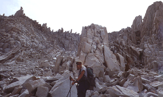
(take your sturdy boots, it's gonna be a bumpy ride!)
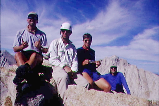
(note the big smile on everyone's face except the guy whose camera took this shot!)
(back to index)
(back to index)
(back to index)
(back to index)
(back to index)
PEAKS CLIMBED: (for those who sent me a list)
(back to index)
GPS Waypoints - (back to index)
NOTE: These routes are not organized cronologically!
They represent campsites, passes, and peaks, rather than the route we walked.
![]() Download the Waypoint+ data below as a GPX file for your GPS.
Download the Waypoint+ data below as a GPX file for your GPS.
Datum,North America 1983,GRS 80,0,-1.6E-7,0,0,0
RouteName,1 ,CAMPS
RoutePoint,D,CAMP1, 37.3104489652,-118.8522450278,07/24/2001,02:41:03,SANDPIPER LAKE OUTLET
RoutePoint,D,CAMP2X, 37.3198171305,-118.8235291688,08/29/2001,03:10:28,SPLINTER GROUP IN TREES
RoutePoint,D,CAMP2, 37.3170899885,-118.8179299701,08/10/2001,08:21:07,VEE LK - 7 GABLES LK
RoutePoint,D,CAMP3, 37.3368759185,-118.7959599804,07/24/2001,02:40:28,BLACK BEAR LK OUTLET
RoutePoint,D,CAMP4, 37.3624986505,-118.7930142208,07/24/2001,02:41:39,TOE-ITALY LAKES LOTS OF SITES
RoutePoint,D,CAMPX, 37.3993556748,-118.8122616795,07/24/2001,02:41:47,LOWER MILLS - NOT USED
RoutePoint,D,CAMP5, 37.3925729078,-118.8592576203,07/24/2001,02:42:05,UPPER FIRST RECESS LAKE
RoutePoint,D,CAMP6, 37.3601797410,-118.9373255033,08/24/2001,00:25:02,LAST NIGHT BY WATERFALL
RouteName,2 ,JUNCTIONS
RoutePoint,D,BEARCD, 37.3359299887,-118.9766999698,08/10/2001,08:14:00,CAR - BEAR CREEK DAM
RoutePoint,D,JNMUIR, 37.3682499898,-118.8880599695,08/10/2001,08:14:51,PCT - JOHN MUIR - BEAR CK
RoutePoint,D,PCTALY, 37.3457199892,-118.8761099698,08/10/2001,08:15:28,PCT - LAKE ITALY
RoutePoint,D,UPPERB, 37.3303799888,-118.8669399699,08/10/2001,08:16:12,PCT - UPPER BEAR CK
RoutePoint,D,PCTSND, 37.3191999885,-118.8694199700,08/10/2001,08:16:43,PCT - SANDPIPER LK
RoutePoint,D,PCTROS, 37.3169599884,-118.8716799701,08/10/2001,08:17:03,PCT - ROSE LAKE
RoutePoint,D,SELDEN, 37.2897799876,-118.8728399703,08/10/2001,08:17:28,SELDEN PASS - 10900
RoutePoint,D,TURLAK, 37.2766357111,-118.8347119158,08/10/2001,08:19:26,UPPER TURRET LAKE
RoutePoint,D,3ISLND, 37.2956999878,-118.8515499703,08/10/2001,08:20:07,THREE ISLAND LAKE
RoutePoint,D,7GBPAS, 37.3054327113,-118.8220445924,09/01/2001,00:03:15,7 GABLES PASS
RoutePoint,D,FTHPAS, 37.3211057359,-118.7817625231,09/02/2001,16:05:48,FEATHER PASS
RoutePoint,D,WHITEB, 37.3395625291,-118.8015680988,09/01/2001,00:01:32,WHITE BEAR PASS
RoutePoint,D,TEDDYB, 37.3464472626,-118.8154440615,08/10/2001,08:22:00,TEDDY BEAR - ITALY
RoutePoint,D,LITALY, 37.3548796701,-118.8151775816,09/02/2001,22:31:46,LAKE ITALY OUTLET
RoutePoint,D,JCNERD, 37.3587968934,-118.7773107408,09/02/2001,18:37:18,JULIUS CAESAR NE RIDGE
RoutePoint,D,GABBOT, 37.3795899903,-118.7917699695,08/10/2001,08:23:10,GABBOT PASS
RoutePoint,D,MILLCK, 37.4040631851,-118.8335835555,08/10/2001,08:24:13,MILLS CREEK
RoutePoint,D,MONDIV, 37.3884444118,-118.8630064420,09/01/2001,00:12:58,MONO DIVIDE
RoutePoint,D,RECVOL, 37.3872183696,-118.8892834944,08/10/2001,08:25:11,RECESS - VOLCANO
RoutePoint,D,PCTRID, 37.3824699901,-118.9103599694,08/10/2001,08:25:35,PCT - BEAR RIDGE
RouteName,3 ,PEAKS
RoutePoint,D,HOOPER, 37.2924599877,-118.8946699703,03/27/2001,22:53:13,HOOPER MT
RoutePoint,D,SENGER, 37.2777599873,-118.8584799705,03/27/2001,22:53:13,SENGER MT
RoutePoint,D,TURRET, 37.2635352551,-118.8425805319,09/01/2001,00:05:35,TURRET PEAK 12091
RoutePoint,D,GEMINI, 37.2975690209,-118.8179710744,03/27/2001,22:53:13,GEMINI
RoutePoint,D,7GABLS, 37.3114799883,-118.8338999701,03/27/2001,22:53:13,SEVEN GABLES
RoutePoint,D,MERIAM, 37.3090499884,-118.7652999702,03/27/2001,22:53:13,MERRIAM PEAK
RoutePoint,D,ROYCE, 37.3182199886,-118.7708699701,03/27/2001,22:53:13,ROYCE PEAK
RoutePoint,D,FEATHR, 37.3259265214,-118.7779688277,03/27/2001,22:53:13,FEATHER PEAK
RoutePoint,D,BRUTUS, 37.3552209809,-118.7915199569,09/02/2001,22:29:41,12600 NEAR JULIUS CAESAR
RoutePoint,D,CAESAR, 37.3567983680,-118.7816358178,03/27/2001,22:53:13,JULIUS CAESAR MT
RoutePoint,D,BEARCS, 37.3680376041,-118.7675013286,03/27/2001,22:53:13,BEAR CREEK SPIRE
RoutePoint,D,PIPSQK, 37.3752765961,-118.7734083912,08/29/2001,03:35:08,PIPSQUEAK SPIRE 13268
RoutePoint,D,MTDADE, 37.3819383056,-118.7793255507,03/27/2001,22:53:13,DADE MT
RoutePoint,D,MTABOT, 37.3863617782,-118.7848292154,03/27/2001,22:53:13,ABBOT MT
RoutePoint,D,MTMILL, 37.3939991585,-118.7899581982,03/27/2001,22:53:13,MT MILLS
RoutePoint,D,MTGABB, 37.3766658712,-118.8025560029,03/27/2001,22:53:13,MT GABB
RoutePoint,D,HILGRD, 37.3605799897,-118.8267299697,03/27/2001,22:53:13,HILGARD MT
RoutePoint,D,MISTPK, 37.3778098849,-118.8481760693,03/27/2001,22:53:13,MIST PEAK
RoutePoint,D,RECESS, 37.3823999902,-118.8557099694,03/27/2001,22:53:13,RECESS PEAK
RoutePoint,D,VOLNOB, 37.3973348600,-118.8895946198,09/01/2001,00:13:56,VOLCANIC KNOB 11140
| The 10-year history of Climb-O-Rama's: | ||
| 1996 | Great Western Divide | first trip named 'Climborama', over Shepard Pass to Milestone Basin |
| 1997 | Climborama 97 | a decentralized affair in the Evolution region |
| 1998 | Duke Newcomb and the 16 Peaks | the most prolific Climb-O-Rama ever, in the Whitney area |
| 1999 | Mosquito March '99 | subgroups forming and dissolving from Taboose Pass to Cartridge Pass |
| 2000 | Climborama V | rain and hail ended this Kearsarge Pass and Center Basin trip early |
| 2001 | Climb-O-Rama 2001 | Crowd-O-Rama had a very large group, from Bear Creek to Lake Italy |
| 2002 | Lawd Have Merced | a one-way congenial trip from Yosemite Valley to Tuolumne Meadows |
| 2003 | From Roaring to Lion (The Triple Trip) | our exit was blocked by a forest fire on this Colby Pass area trip |
| 2004 | WESTERN Great Western Divide | unrelenting bad weather on the seldom-visited side of the Milestone Basin |
| 2005 | Climb-O-Rama X (Black and White) | horses made the approach to Blackcap Basin and White Divide easier |