Chris took all the photos in this report, except for Steve's Whaleback Blowhole photo.
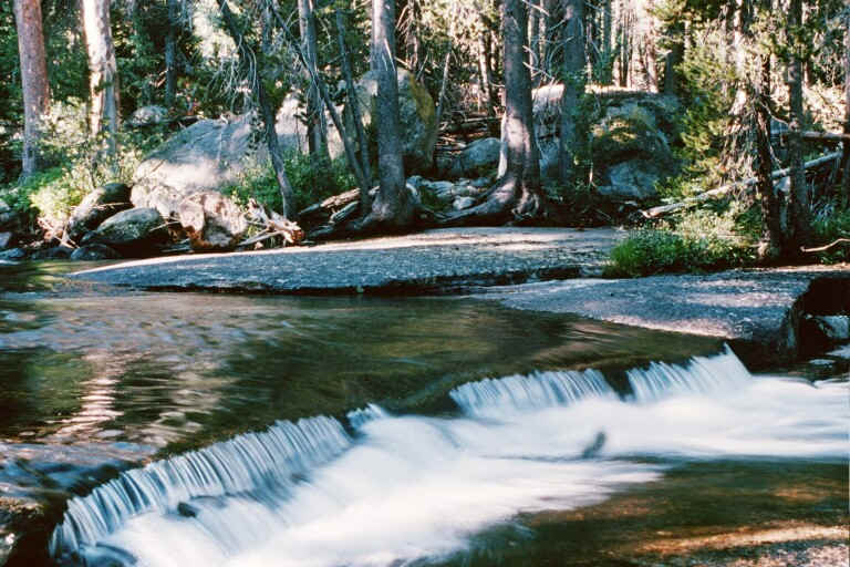
Saturday, August 16. We entered the wilderness at Rowell Meadow. Off the road to Lodgepole, beyond the fork of the road to Kings Canyon, there is a one lane road marked for a horse camp. Beyond the end of the asphalt there is a corral and a trailhead. (If you're following our path, find complete instructions in http://www.climber.org/DrivingDirections/.) A well kept trail with only a modest amount of horse manure enters the Jenny Lakes Wilderness, rising steeply for 2000 feet over an unnamed pass. Near the crest we whiffed wood smoke and ignored a rangergram tacked to a tree advising us about a controlled burn. We entered Kings Canyon National Park. The trail dropped down to Sugarloaf Meadow, named for a bald granite dome that reminded an early explorer of the Sugarloaf at Rio de Janeiro. We humped our packs, heavy with nine days supply of food, over another rise into the canyon of the Roaring River and camped near the cabin of a backcountry ranger and an impressive steel footbridge.
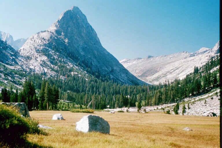
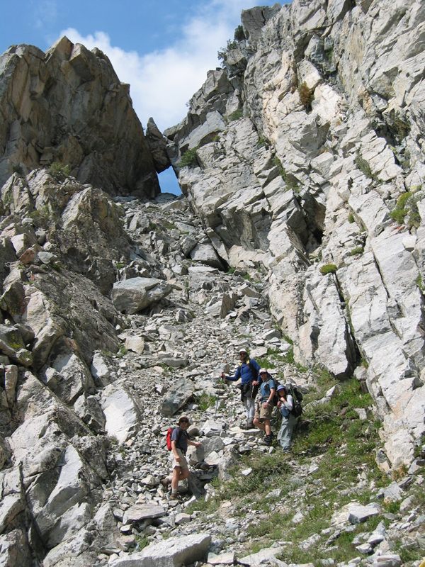
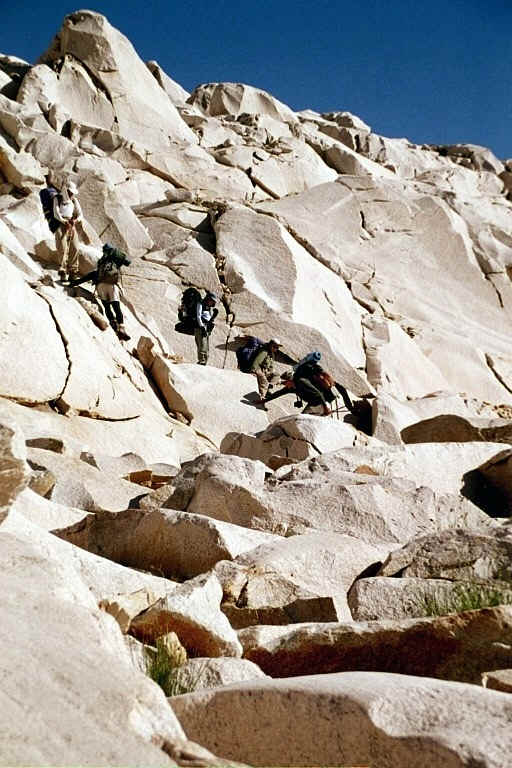
Sunday, August 17. We walked the trail up the Roaring River to the confluence of Colby Creek and Cloud Creek. The trail went left to Colby, but we took the right fork, stepping over boulders in and around the creek bed. We found a flat spot and set up camp early in the day. To the east, the glacially carved face of the Whaleback (11717') towered over us. The mountain intimidates. It is steep, smooth, and featureless, offering little opportunity to the climber. But Steve had made a solo first ascent of the west face four years before, and he promised a way up. We walked over slabs, into an implausible bowl. Though we were tempted to escape to the right flank of the bowl and gain the summit ridge, Steve warned us that the north ridge is obstructed by cliffs. At the top of the bowl, there is a broad ramp inclined to the left, which crosses several buttresses and gullies. The ramp route passes through a large tunnel of rock with a small piece of sky showing on the other side. We named this passage the "Blowhole", in keeping with the cetacean theme of the mountain. When we exhausted the ramp, we overcame a brief but exhilarating boulder scramble to the ridge, and then climbed easy rocks to the summit. Based on what we read in the register, we believe that our party made only the second ascent of this route.
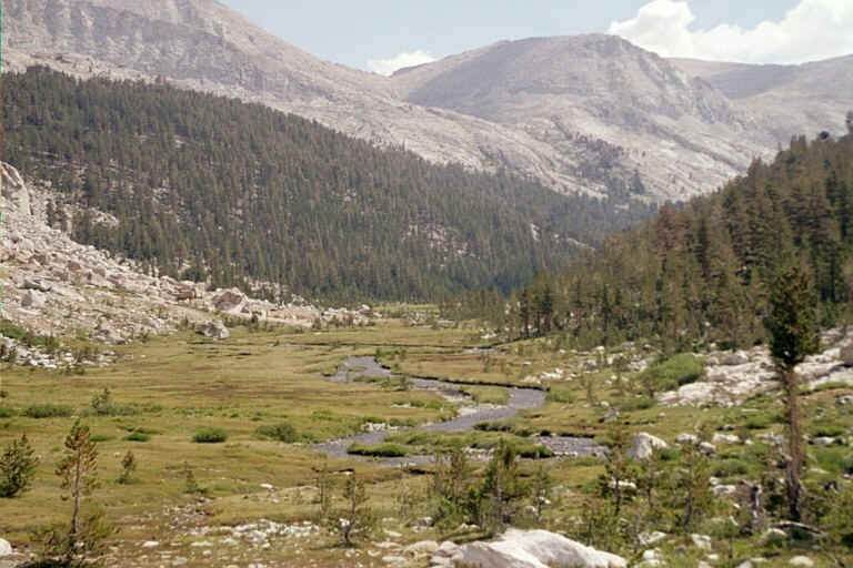
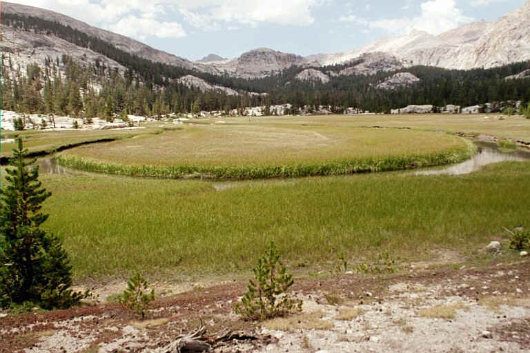
Monday, August 18. While we were breaking camp, a young male bear strolled by. He found plenty of bushes loaded with ripe berries along the creek. As we moved up Cloud Canyon, we learned that Tony had not been able to eat supper the night before or breakfast this morning. His old problem with nausea had returned, and he lacked the strength for the roadless road ahead. He decided to return alone to Roaring River, camp there for the week, make dayhikes in the surrounding country, and await our return. The remainder of the party headed east, up the canyon wall opposite to the Whaleback, to climb Glacier Ridge (12360'). A long, stable talus slope took us to the ridge, just north of the summit. A few class 3 moves brought us to the summit monolith. The final block is about 15' high, nearly vertical but rough in texture, bearing nubs the size of a climber's toes in exactly the places where nubs are needed. We tossed our rope over the block and took turns belaying each other up to the top. We descended the way we came, and recovered our backpacks by the stream. We debated staying in the green bottomland, but decided instead to keep to our itinerary and grunt up the head of Cloud Canyon to Glacier Lake. We passed an interesting test hole dug into the mountainside long ago by a miner during the age of prospecting in the Sierra Nevada. Shiny rocks were scattered around. I suppose the ore samples were worthless, or else there would be a road up there today. Glacier Lake itself is walled in by a precipice dropping down from the side of Triple Divide Peak. In mid-August, there was still ice in the lake. Imagine our surprise when, in this remote setting, we heard voices. A friendly party of young Outward Bound mountaineers settled in nearby.
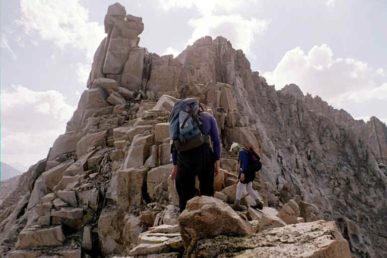
Tuesday, August 19. Steve, Ron, Jim, Patty and Chris climbed Triple Divide Peak (12634') via a long looping traverse, ascending the west ridge and descending the east ridge. They forced themselves to stay right on the ridge crest, even though there were easier alternatives, just to keep things interesting (hard class-3 with a class-4 move or two). After they were off the mountain, they experienced a small earthquake. Chris looked it up later on the USGS web site, and learned that it was 3.6 on the Richter scale, centered 1 mile west of Siberian Pass on the Sierra Crest. Jim continued on to climb the unnamed peak to the southwest that we called the Big Red Mountain. The quake most likely was the trigger for a large rockfall several hours later on the north face of Triple Divide Peak.
Darin, Sue and I, meanwhile, climbed Lion Rock (12360'). The only unroped route up Lion Rock is on the south side, facing Mt Stewart, but we were coming from the north. So our trek was long and complex: we crossed Triple Divide Pass, then down to Lion Lakes, then up a snow chute to the east ridge, then down into the southeast bowl, then up to the south ridge, and up an intricate maze of chutes and buttresses that went class 2 to the top. We returned essentially the same way, with down and up and down and up. We separated back at Triple Divide Pass. Darin and Sue headed back to Glacier Lake, and I headed for the summit of Triple Divide Peak. Darin advised me not to follow the ridge, but instead to stay on the face, below the upper cliffs and above the lower cliffs, and when I get to the last buttress, to climb it to the summit. My bright red day pack was easily seen from Glacier Lake, and the group there tracked my progress. They had a betting pool going on what time I would complete the climb. Even though I am not known for being the speediest guy on the mountain, I was hoofing it this time, being highly motivated to finish the climb in the daylight. After just an hour, I yodeled from the summit. Steve, who has seen me before with fire in my boots, won the bet with the most accurate guess of my summit time. That night, under a crystal sky, we saw the near approach of Mars.
Wednesday, August 20. We backpacked cross country over the unnamed pass east of Triple Divide Peak (between it and Big Red Mountain), into the Kern-Kaweah River, above Gallats Lake. With cliffs everywhere, it is hard to believe that the route could work, but Steve followed the instructions in Secor's guide, and led us through a complicated crossing with a minimum of difficulty. We camped just above a splendid meadow a mile above Gallats, in a place that rarely sees human visitors.
We set out for Kern Point (12730'), with its famous overlook of the Kern River gorge. We took a the Colby Pass Trail down to Gallats, and then traversed and inclined across sand and shattered stone toward Kern Point. Clouds that we had been observing for days finally became threatening. A wind kicked up, and a few drops fell on our faces. There was lightning over the Kaweahs and heavy rain in the Kern. We worried that the storm would catch us and put an end to our summit bid. We hustled like mad to the summit, and in our haste, failed to keep our party together. Sue waited for me on the descent, and the two of us did stay in touch by walkie talkie with Scott and Patty, who were far ahead. The storm broke up around nightfall, after we had made it safely back to camp.
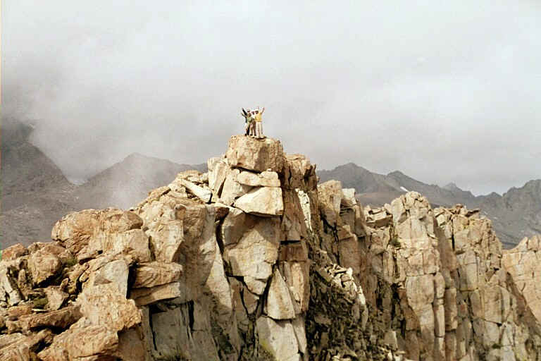
Thursday, August 21. We headed for Picket Guard Peak (12303'). Though this peak is little known because of its remote location, it was an enjoyable class 2 climb, with solid and rough textured rock all the way. It deserves more attention from mountaineers. As we climbed, we watched the clouds build again, preparing themselves for a repeat of yesterday's excitement. Steve didn't want to backpack over Colby Pass in a storm, so he decided to break off from the group and cross the pass while it was still morning and just cloudy. The rest of us climbed on. We couldn't tell which of the towers was the tallest, so we climbed several of them trying to see which one appeared to look down on the others. We still don't know for sure. We didn't find a summit register or a benchmark.
We returned to our camp, rolled up our gear, and hiked up the Colby Pass Trail. The rain began in earnest. By the time we all met up on the other side, at Colby Lake, we were a soggy crew. The southern Californians (Ron, Patty and Scott) decided to forge on ahead, for an early exit the next day. The six northern Californians continued down the trail as far as the confluence of Colby and Cloud Creeks, closing our loop where we had split off cross country last Sunday. The name of the place is Big Wet Meadow, and on a washed out evening like Thursday, you can imagine how unattractive it sounded as a campsite. We hiked until 8 p.m., yet still managed to cook hot meals and fashion comfortable beds. Jim thought it was a pretty nice evening, though with very wet grass and heavy dew.
Friday, August 22. As the sun rose, the sky was clear from horizon to horizon. The day before, we had abandoned our plans for a Friday climb of the back side of Milestone Mountain because of the foul weather. We had continued several miles beyond the starting point of that climb. Our change in plans turned out to be unnecessary, but who knew? We walked to Roaring River. There we found another rangergram, this one warning us that the controlled burn between Sugarloaf and Rowell wasn't quite so controlled any more, that the trail was closed, and that Avalanche Pass or Elizabeth Pass were recommended as alternate routes. Either of those alternate routes would have taken us many miles out of our way, and forced us to hitchhike up a little used one lane road to a closed trailhead to recover our cars. Tony was gone and hadn't left a note. We decided to go to Sugarloaf and see if there was a way around the fire. We passed Sugarloaf and hiked up to the edge of the fire. There, an impatient fire fighter crew boss ordered us to return to Sugarloaf Meadow, and offered that he *might* be able to provide us with an escort through the fire at ten the next morning, but no promises. Back at our camp, we tormented ourselves with regrets about not having selected Avalanche Pass and fears of being turned back again in the morning, or even getting cited for being in the fire zone. (Jim remarks, "Some of us never took the Avalanche Pass option seriously and did not torment ourselves, though all of us were uncertain about how and when we'd get out.") Confronted with anxiety, I sing. I revised the old Bobby McFarrin tune: "The ranger says you crossed the fire line, you might get a great big fine, don't worry, be happy." I composed a few other verses and we laughed it off.
Saturday, August 23. We were back at the fire line at 10 a.m., accompanied by a party of horse riders who also needed help getting through the blaze. Two men in fire suits, equipped with axes, walked us through a mile of smoldering woods. A lodgepole pine four feet in diameter, fallen alongside the trail, burned so hotly that it was hard to walk past it. Smaller burning trees lay across our path, as obstacles for horses and hikers to step over. The duff on the forest floor was blackened, and the air was heavy with smoke. But in twenty minutes, we were through. We thanked our fire guides, and then we finished the hike back to the cars. We were delighted to discover that Tony was waiting for us. He had taken the ranger's advice to hike out via Avalanche Pass, and hitched back to the trailhead in a single lucky ride. Tony's driver was going nowhere in particular, and was thrilled to have Tony show him such an out of the way trailhead. We had a farewell lunch at Grant Grove, and then drove home, yakking for hours about our adventures from Roaring to Lion and back.
John Wakabayashi comments on the summit of Picket Guard:
What a fantastic trip you and your group took. The block on which you folks posed for the summit photo appears to be the one we felt was the summit (also matches where the summit is shown on the topos). We looked high and low for a register and couldn't find one either, which is too bad because this peak certainly doesn't see too many visitors. Our guess is that because the top of that summit block tilts a bit off to the north someone might have accidentally let the register roll off the block and down the north face.
| The 10-year history of Climb-O-Rama's: | ||
| 1996 | Great Western Divide | first trip named 'Climborama', over Shepard Pass to Milestone Basin |
| 1997 | Climborama 97 | a decentralized affair in the Evolution region |
| 1998 | Duke Newcomb and the 16 Peaks | the most prolific Climb-O-Rama ever, in the Whitney area |
| 1999 | Mosquito March '99 | subgroups forming and dissolving from Taboose Pass to Cartridge Pass |
| 2000 | Climborama V | rain and hail ended this Kearsarge Pass and Center Basin trip early |
| 2001 | Climb-O-Rama 2001 | Crowd-O-Rama had a very large group, from Bear Creek to Lake Italy |
| 2002 | Lawd Have Merced | a one-way congenial trip from Yosemite Valley to Tuolumne Meadows |
| 2003 | From Roaring to Lion (The Triple Trip) | our exit was blocked by a forest fire on this Colby Pass area trip |
| 2004 | WESTERN Great Western Divide | unrelenting bad weather on the seldom-visited side of the Milestone Basin |
| 2005 | Climb-O-Rama X (Black and White) | horses made the approach to Blackcap Basin and White Divide easier |