Bear Boxes in Cedar Grove Area (CG)
Generated on 2 Aug 2022 - see revision history - please send updates to the webmaster
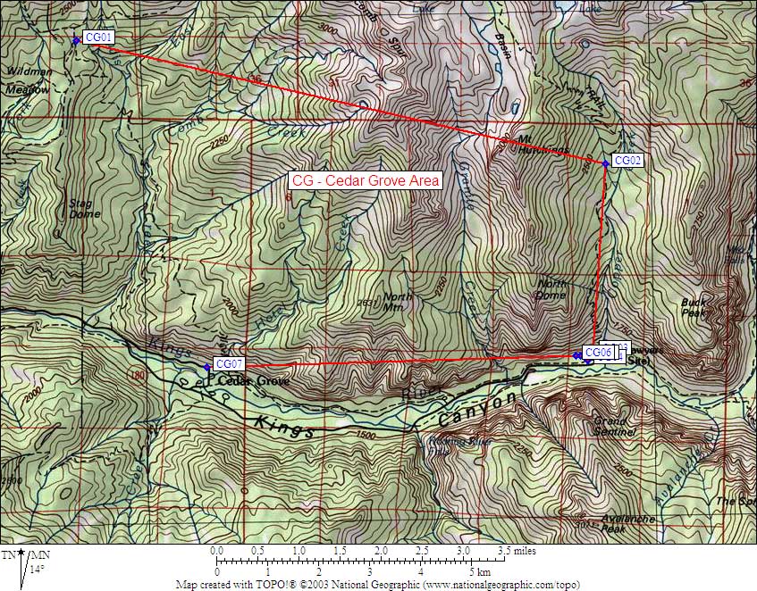
| 7 Bear Boxes in Cedar Grove Area - GPS route CEDAR GROVE | |||
|---|---|---|---|
| click on name for details and directions | elevation | waypoint | food locker type |
| Frypan Meadow | 7800 | CG01 | a standard box |
| Tent Meadow | 7840 | CG02 | a standard box |
| Copper Ck Jct Road's End | 5000 | CG03 | four large boxes |
| Day Use Lot, Road's End | 5000 | CG04 | two large boxes |
| East Horse Lot at Road's End | 5000 | CG05 | one large box |
| West Horse Lot at Road's End | 5000 | CG06 | two large boxes |
| Hotel Creek Trailhead | 4700 | CG07 | one large box |
Useful Links: