Bear Box at Hockett Meadow Ranger Station (HP02)
Generated on 20 Oct 2025 - see revision history - please send updates to the webmaster
Detail Map of waypoint HP02
in Hockett Plateau:
(scroll down for directions, waypoints, and area map)
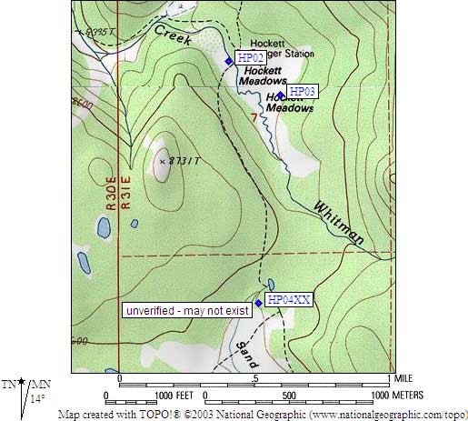
- HP02 is a standard box, at about 8500 feet,
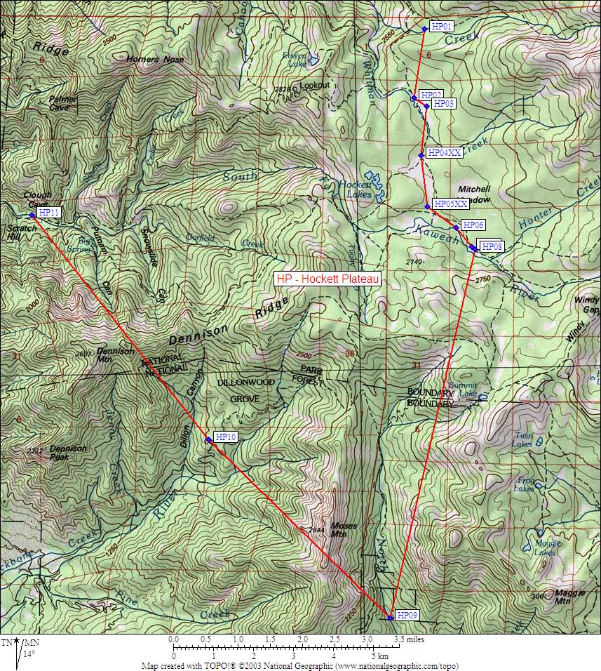
in the GPS route HOCKETT PLATEAU.
- Directions from Steve Eckert, with GPS waypoint, June 2001:
There is a log-and-plank footbridge where trail from the south crosses
the drainage from Hockett Meadow. One standard box about a third of the way
from the bridge to the ranger station, about 30 yds north of the trail
in a well used campsite. This trail is right along stream which drains
the meadow, bear box is very visible from trail but not mentioned by
the ranger's text. If this box is full, see BBHP03 across the meadow.
Go due north from bear box, hit trail to Evelyn Lakes, find sign
100 yards away for toilets: Two metal stools on plank bases with
privacy walls! Keep going toward Evelyn and you find a wonderful
campsite, too far to hike from bear box for most people, but
away from the meadow and near a great stream. Tall trees
would have been a good place to put the Hockett bear cable, but I
couldn't find it if it's still here. Spent a lot of time in the area
and found nothing. Backpacker's campsite is poorly defined, may be
any of several sites along trail to Evelyn Lake.
- Directions from Mineral King ranger info sheet, dated 1991:
One storage cable 100 yards north of the backpacker camp
immediately west of the Ranger Station.
- HP02 coordinates: (see GPX waypoint download links above)
  (lat,lon) = (36.3763100, -118.6566100) in decimal degrees, NAD83.
  (zone,east,north) = (11S, 351480.0, 4026765.0) in decimal meters, NAD27.
- Scroll down for a regional map of the entire Hockett Plateau region.
Map exported from TOPO! software, used with permission.
Useful Links: