Bear Boxes in Yosemite Park West (YW)
Generated on 20 Oct 2025 - see revision history - please send updates to the webmaster
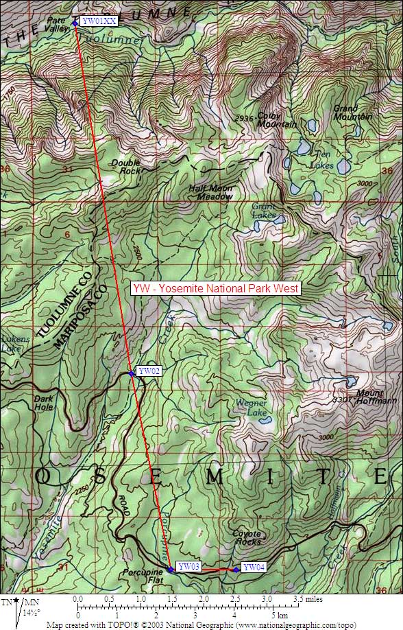
| 4 Bear Boxes in Yosemite Park West - GPS route YOSEMITE WEST | |||||
|---|---|---|---|---|---|
Please let the webmaster know if you can help verify that these boxes exist and precisely locate them. | |||||
| click on name for details and directions | elevation | waypoint | food locker type | ||
| Pate Valley Cable | 4400 | YW01XX | a steel cable, may not exist | ||
| Yosemite Creek, Ten Lakes Parking | 7500 | YW02 | 10 large boxes south of 120, 4 large boxes north of 120 | ||
| Porcupine Flat | 8100 | YW03 | 4 large boxes | ||
| Porcupine Creek | 8100 | YW04 | 8 large boxes | ||
Useful Links: