Bear Boxes in Ansel Adams Wilderness
(formerly Minaret Wilderness) (AA)
Generated on 20 Oct 2025 - see revision history - please send updates to the webmaster
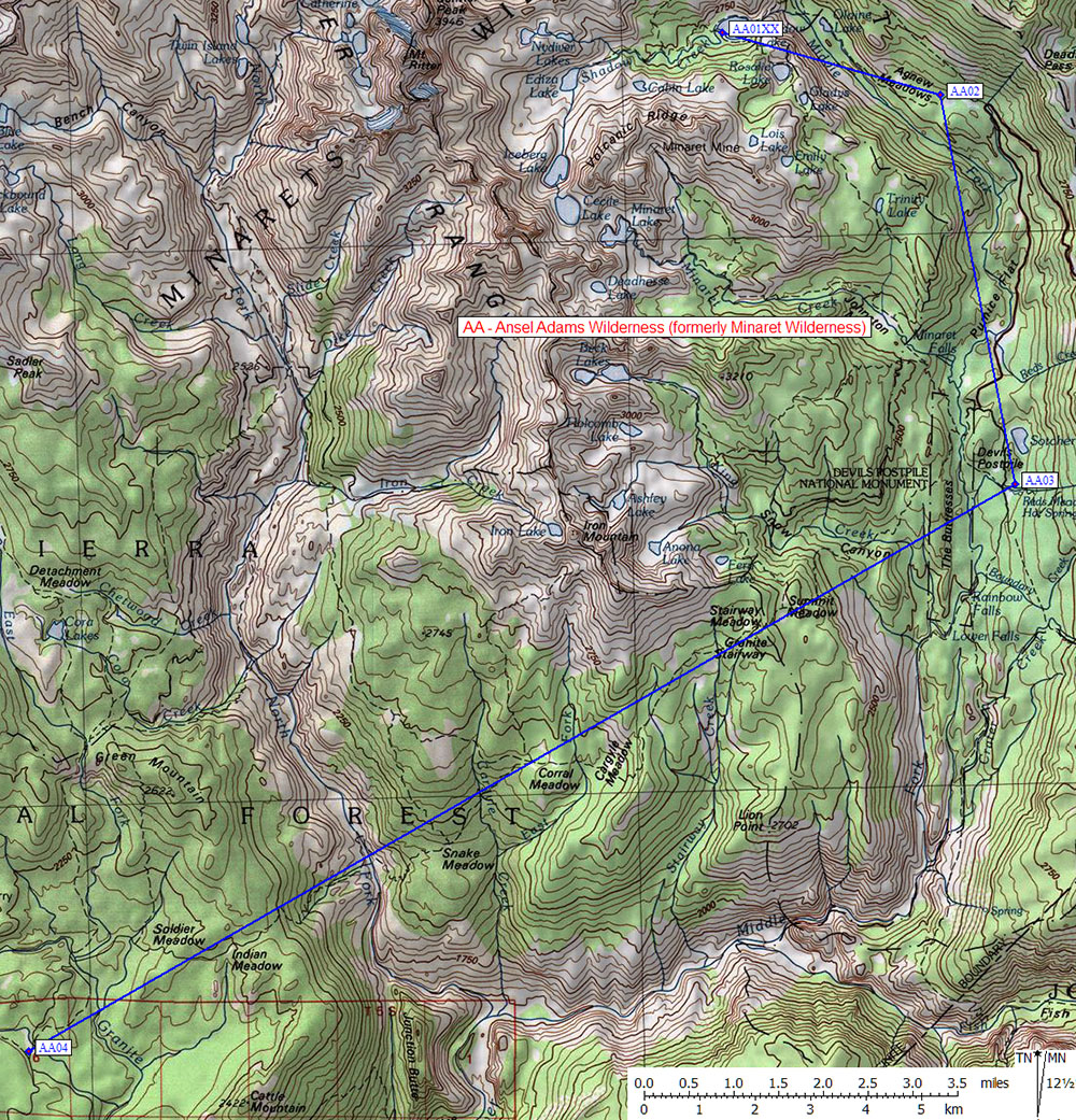
| 4 Bear Boxes in Ansel Adams Wilderness (formerly Minaret Wilderness) - GPS route ANSEL ADAMS | |||||
|---|---|---|---|---|---|
Please let the webmaster know if you can help verify that these boxes exist and precisely locate them. | |||||
| click on name for details and directions | elevation | waypoint | food locker type | ||
| Shadow Lake | 8800 | AA01XX | a steel cable, may not exist | ||
| Agnew Meadows Campground | 8300 | AA02 | over 20 large boxes | ||
| Reds Meadow Campground | 7700 | AA03 | 3 standard boxes | ||
| Clover Meadow Ranger Station | 7014 | AA04 | 6 standard boxes | ||
Useful Links: