Bear Boxes in Yosemite Park East (YE)
Generated on 2 Aug 2022 - see revision history - please send updates to the webmaster
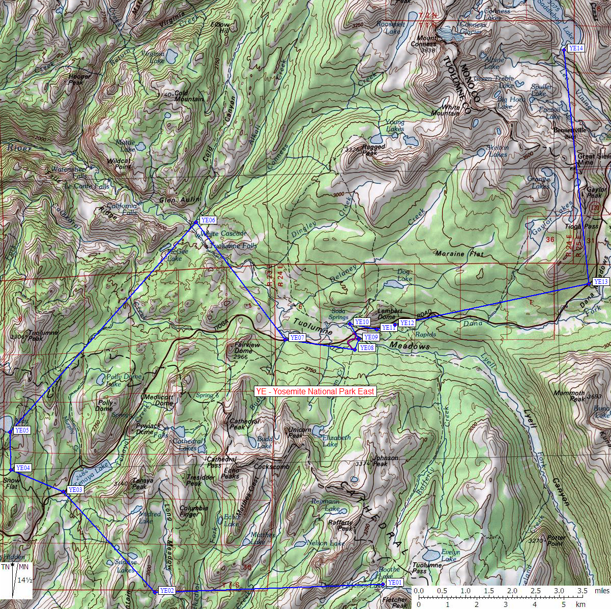
| 14 Bear Boxes in Yosemite Park East - GPS route YOSEMITE EAST | |||
|---|---|---|---|
| click on name for details and directions | elevation | waypoint | food locker type |
| Vogelsang High Sierra Camp | 10200 | YE01 | 4 large boxes |
| Sunrise High Sierra Camp | 9300 | YE02 | 2 large boxes |
| Tenaya Lake Sunrise Creek | 8200 | YE03 | 10 large boxes |
| Snow Flat Trailhead | 8200 | YE04 | 10 large boxes |
| May Lake High Sierra Camp | 8200 | YE05 | 2 large boxes |
| Glen Aulin High Sierra Camp | 7900 | YE06 | 2 standard boxes |
| Cathedral Lakes Trailhead | 8600 | YE07 | 10 large boxes |
| Elizabeth Lake Trailhead | 8600 | YE08 | 5 or more large boxes |
| Tuolumne Meadows Backpack Camp | 8600 | YE09 | 5 or more large boxes |
| Lembert Dome Trailhead | 8600 | YE10 | 5 large boxes |
| Tuolumne Meadows Permit Kiosk | 8700 | YE11 | 18 large boxes |
| Dog Lake Trail Backpacker Lot | 8700 | YE12 | 20 large boxes |
| Mono Pass Trailhead | 9700 | YE13 | 6 large boxes |
| Saddlebag Lk TH near Group Camp | 9700 | YE14 | 6 large boxes |
Useful Links: