Bear Box at Upper Kearsarge Lake #2 (KA05)
Generated on 20 Oct 2025 - see revision history - please send updates to the webmaster
Detail Map of waypoint KA05
in Kearsarge Area Eastern Rae Lakes Loop:
(scroll down for directions, waypoints, and area map)
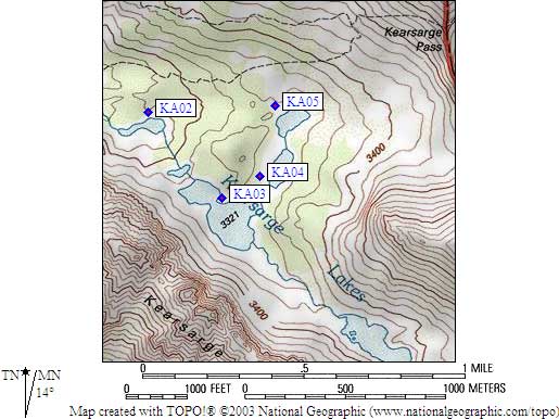
- KA05 is a large box, at about 10900 feet,
in the GPS route KEARSARGE AREA.
- Directions from Nate Kimbler, July 2025 (coordinates confirmed):
Bear box KA05ZZ is not out of service.
I visited it multiple times this summer,
most recently on June 28, 2025.
- Directions from Steve Milam, Sep 2021:
I was at Upper Kearsarge Lakes on 9/4/21 and the bear box was there.
The left half was padlocked but the right half was open and had one package in it.
- Directions from Alison Steiner, NPS Wilderness Coordinator, June 2012:
The park is closing the Kearsarge Lakes food-storage lockers for the 2012
season in response to a noted increase in food caching at Kearsarge Lakes.
Caching of materials in wilderness is problematic to park management and
disruptive to park visitors and, as such, is prohibited.
- Directions from Gary Craig, July 2002:
This box was present in the described location but padlocked.
Perhaps it is only for use by horse packers?
This is the second time that I've been to Kearsarge Lakes in
the past few years and this box has been padlocked both times.
- Directions from Steve Eckert, with GPS waypoint, Aug 2000:
One large box northwest of the Kearsarge Lake nearest to Kearsarge Pass,
between the use trail and the lake (close to shore).
- KA05 coordinates: (see GPX waypoint download links above)
  (lat,lon) = (36.7697700, -118.3860199) in decimal degrees, NAD83.
  (zone,east,north) = (11S, 376383.0, 4070030.0) in decimal meters, NAD27.
- Scroll down for a regional map of the entire Kearsarge Area Eastern Rae Lakes Loop region.
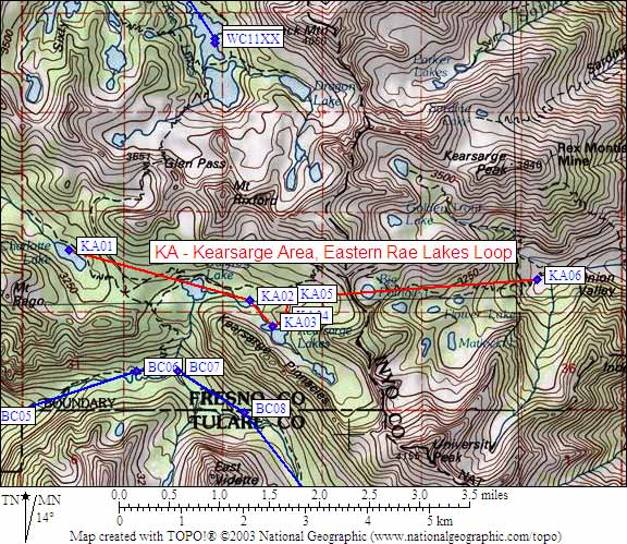
Map exported from TOPO! software, used with permission.
Useful Links: