Bear Box at Main Kearsarge Lake (KA03ZZ)
Generated on 20 Oct 2025 - see revision history - please send updates to the webmaster
WARNING!
"ZZ" in this waypoint name means this box has been taken out of service!
Refer to the notes and directions below for details, and please contact the webmaster if the box is back.
Detail Map of waypoint KA03ZZ
in Kearsarge Area Eastern Rae Lakes Loop:
(scroll down for directions, waypoints, and area map)
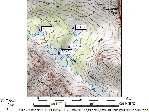
- KA03ZZ is a standard box, at about 10900 feet,
in the GPS route KEARSARGE AREA.
- Note: The Main Kearsarge Lake is the lake where two
drainages meet, the only lake with two inlets. A small
cliff/waterfall goes down from this lake to the lower lake,
easily bypassed on the north side.
- Directions from Alison Steiner, NPS Wilderness Coordinator, June 2012:
The park is closing the Kearsarge Lakes food-storage lockers for the 2012
season in response to a noted increase in food caching at Kearsarge Lakes.
Caching of materials in wilderness is problematic to park management and
disruptive to park visitors and, as such, is prohibited.
- Directions from Gary Craig, with GPS waypoint, July 2002:
One standard box on the promontory that extends into the 'main'
Kearsarge Lake from the NE, about 30 feet above the waterline.
I believe this box has been moved recently. It was in the location
described by Eckert when I was previously there.
- Directions from Steve Eckert, with GPS waypoint, Aug 2000:
OBSOLETE: One regular box just 20 feet from the northeast shore
of the eastern lobe of the main Kearsarge Lake.
- Directions from Mineral King ranger info sheet, dated 1991:
One box on the north side of the main Kearsarge Lake.
- KA03ZZ coordinates: (see GPX waypoint download links above)
  OUT OF SERVICE  (lat,lon) = (36.7655600, -118.3889800) in decimal degrees, NAD83.
  OUT OF SERVICE  (zone,east,north) = (11S, 376110.0, 4069570.0) in decimal meters, NAD27.
- Scroll down for a regional map of the entire Kearsarge Area Eastern Rae Lakes Loop region.
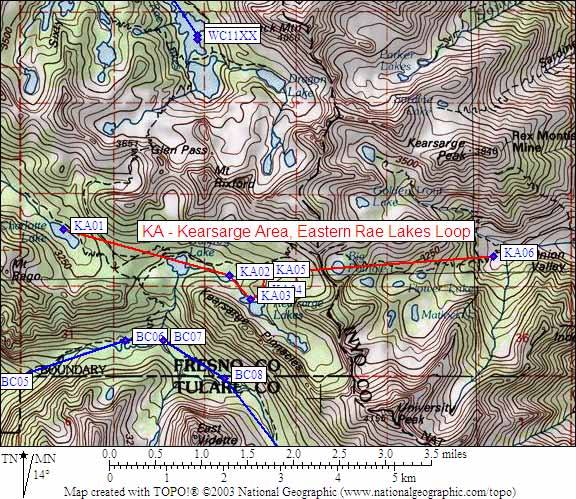
Map exported from TOPO! software, used with permission.
Useful Links: