Sierra Peaks - Region 19, Peak 10
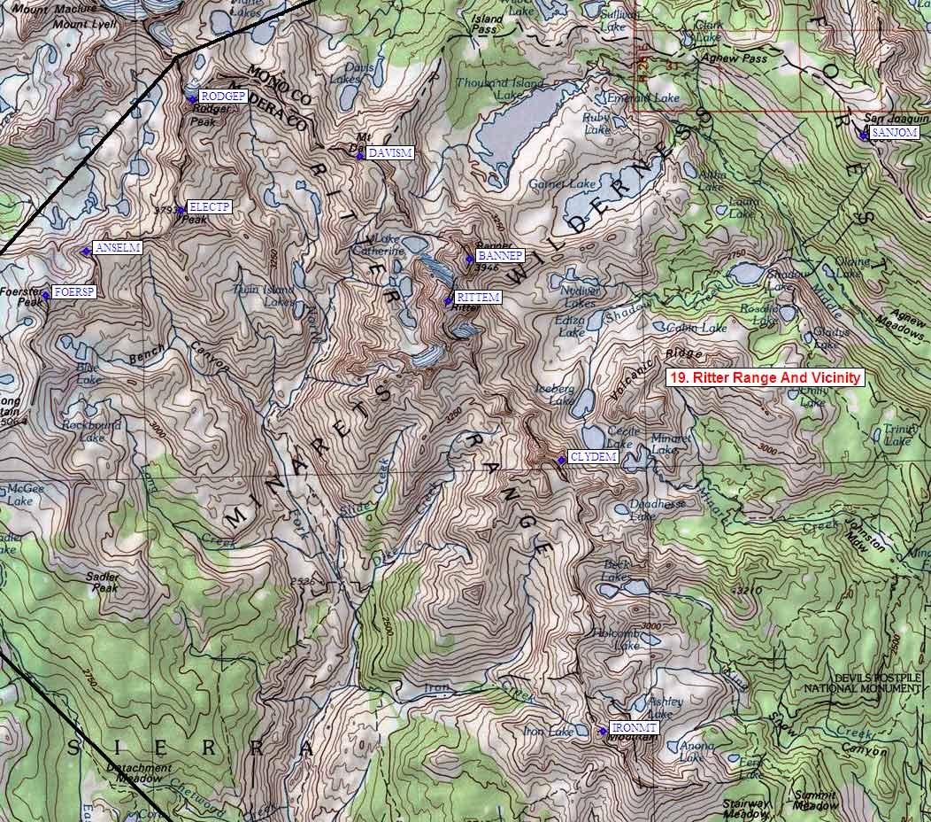
Ritter Range And Vicinity
Generated on 10 Aug 2024 - see revision history - please send updates to the webmaster
| Ansel Adams Mt in Ritter Range And Vicinity Region | |||||||||
| Num | Peak Name (more links) | Waypoint | Elev | SPS | Class | Pics and Reports | UTM hint (map) | 7.5' USGS topo quad | Register |
| 19.10 | Ansel Adams Mt | ANSELM | 11760 | X | 3 | 2 pics of AnselAdamsMt 4 reports on anseladams | 989745 | Mt Lyell | |
NOTE: M = Mountaineers Peak, E = Emblem Peak, X = not on SPS List (in 'SPS' column)
      ^ = metric contours and elevations on 7.5' maps (in 7.5' map columns)
      Name Mt  => 'Mt' is before peak 'Name' (ex: Rose Mt is Mount Rose, but sorted on 'Rose')
      Name Mtn => 'Mtn' is after peak 'Name' as listed (ex: Muah Mtn is Muah Mountain)
The "UTM Hint" in the table above approximates the peak location to the nearest 100 meters.
Click here for info on Universal Transverse Mercator coordinates.
Useful Links: