Bear Box at Kern Hot Springs west of trail (KC04)
Generated on 2 Aug 2022 - see revision history - please send updates to the webmaster
Detail Map of waypoint KC04
in Kern Canyon:
(scroll down for directions, waypoints, and area map)
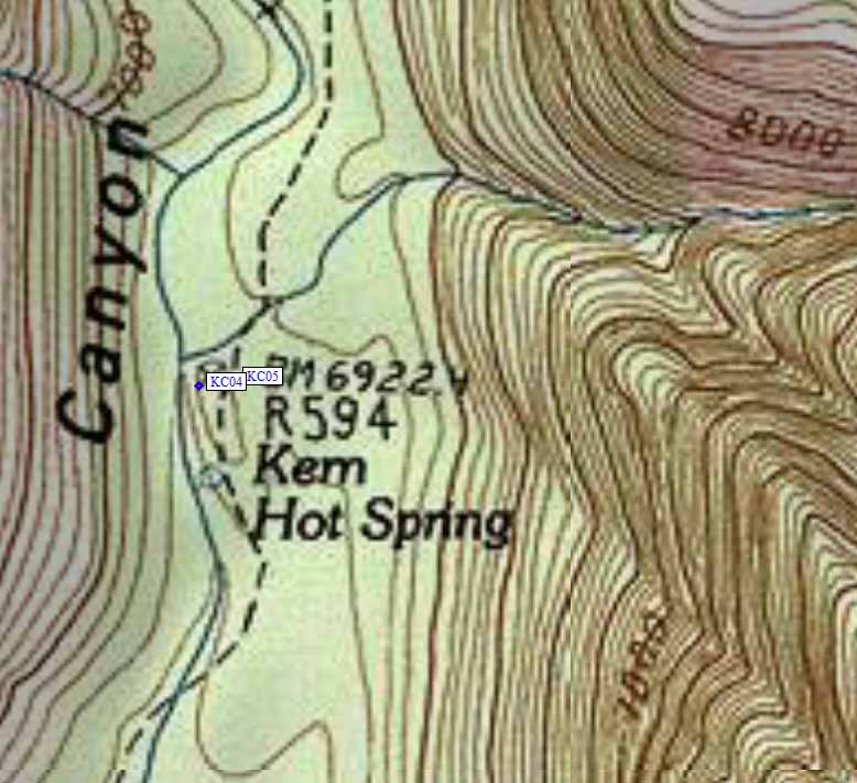
- KC04 is a standard box, at about 6900 feet,
in the GPS route KERN CANYON.
- Note: Kern Hot Springs is where Rock Creek joins the Kern River,
but the Rock Creek bearbox is far upstream and there is no direct
trail between them. There is a concrete tub with wooden privacy
screen at the hot springs, and the campsites are just up-canyon
in the trees.
- Directions from M F Miller, Sep 2020:
2 large brown bear boxes immediately to left of trail
about 80 yds past the hot springs.
KC04 and KC05) are essentially a lower and upper
campground in the same area.
- Directions from Jeffrey Zimmerman, with GPS waypoint, Sep 2007:
A single box, located just west (i.e., to the left if proceeding
upstream) of the Kern Canyon trail, about 50 or 60 yards from the Springs
themselves, and about 30 yards downstream from the adjacent box KC05.
It is immediately visible from the trail.
- Directions from Michael Golden, Sep 2000:
I saw two boxes in the established camp site along the
trail north of the hot springs. Supposedly there is
a third box. I did not see it, nor did I look for it.
- Directions from Mineral King ranger info sheet, dated 1991:
One bear box is at the campsite just north of the Hot Springs
meadow, between the trail and the river, 80 yards north of
the Hot Springs bulletin board, serving two campsites.
- KC04 coordinates: (see GPX waypoint download links above)
  (lat,lon) = (36.4792200, -118.4060300) in decimal degrees, NAD83.
  (zone,east,north) = (11S, 374125.0, 4037826.0) in decimal meters, NAD27.
- Scroll down for a regional map of the entire Kern Canyon region.
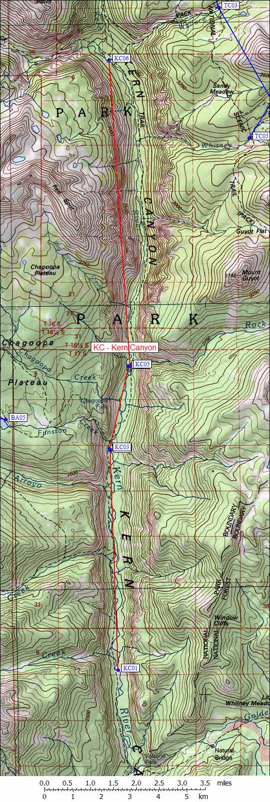
Map exported from TOPO! software, used with permission.
Useful Links: