Bear Box at Center Basin Junction (BC09)
Generated on 2 Aug 2022 - see revision history - please send updates to the webmaster
Detail Map of waypoint BC09
in Bubbs Creek Southern Rae Lakes Loop:
(scroll down for directions, waypoints, and area map)
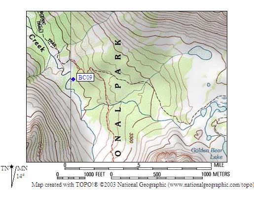
- BC09 is a standard box, at about 10500 feet,
in the GPS route BUBBS CREEK.
- Directions from Steve Eckert, with GPS waypoint, Aug 2000:
One box in a well-developed sand-and-slab campsite between the trail
and Bubbs Creek, perhaps 50 yards southeast of the unmarked junction to
Center Basin. The trail alignment does not match any USGS topo map,
on which the trail junction seems to be far from the creek. This box
is near Bubbs Creek at the point where the JMT pulls away as you
climb toward Forester Pass. There is NO bear box at the next developed
campsite at around 11300 feet.
- Directions from Mineral King ranger info sheet, dated 1991:
One box north of the trail at John Muir Trail junction from
Center Basin, about 10000 feet.
- BC09 coordinates: (see GPX waypoint download links above)
  (lat,lon) = (36.7337401, -118.3756183) in decimal degrees, NAD83.
  (zone,east,north) = (11S, 377251.0, 4066023.0) in decimal meters, NAD27.
- Scroll down for a regional map of the entire Bubbs Creek Southern Rae Lakes Loop region.
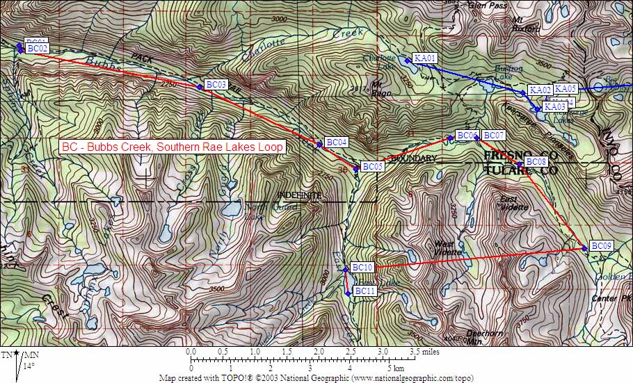
Map exported from TOPO! software, used with permission.
Useful Links: