In 2009 there was loose gravel in the wash between STIR01 and STIR02, which engaged the traction control on my car. If I had not been moving fairly quickly I think I would have gotten stuck. Beware! Passenger cars may want to stop at STIR01. A short rise out of the wash (waypoint STIR02) gets you back on good road again.
STIR2W was as far as I wanted to take my passenger car, so we camped there rather than shuffle all my stuff into Daryn's Jeep. It is entirely feasible to climb Stirling from the 2WD trailhead, since it's only 3 miles to the 4WD trailhead and 1.1 more miles to the summit, but why bother when your friend is grinning from behind the wheel of a Jeep?
We saw one other vehicle the day before we climbed, and they turned out to be climbing the same peak on the same day. They camped higher than we did, in the nice trees, after bumping and swaying up the road with a 4WD pickup camper. Since we were all starting about the same time, leaving the vehicles around 630am, we stuck together for a while. At some point they slowed down and we never saw them again.
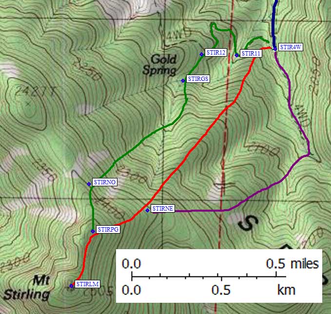
9.9 miles from the pavement is an intersection at 6.4k which I'm calling the 4WD trailhead (waypoint STIR4W). We didn't climb from there, but it's where we came out after making a loop. I believe this is the best place to get on the northeast ridge of Stirling (waypoint STIRNE) and follow the red line on the map, but there are several alternatives.
One alternative is to walk/drive on up the road before turning west to the peak. Daryn and I did this, and ended up with mostly good footing but heavy brush around 7.2k (see the purple line).
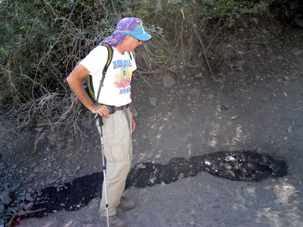
The other alternative is the way we descended, following the green line off the north ridge and down to Gold Spring. There are boulders and talus up high and some brush lower, but you get to see the gushing fountain of joy that is Gold Spring (see picture). If you're planning to do the Gold Spring route, you should drive up the road from STIR4W to STIR12.
Gold Spring. Really. That was there. We didn't do it.
Oh, yeah, here's the whole report: We were on the top of 8218' Mt Stirling at 8am. Then we drove home for dinner.
The red line on the map below, which I think is the best route, is only 1.1 miles each way. We spent about 1.5 hours going up the purple line, and about 1.5 hours coming down the green line. I think that means the Gold Spring route really stinks, because going down should be faster than going up. We did spend a little time looking at petroglyphs near the summit, but for the most part this peak is just a very short walk in the pinons.