Mid-May is usually a little late in the year to attempt the east-side desert approach to Cartago peak. But with lots of snow this year, we were expecting to at least have snow up on Cartago Peak to use for drinking water. I was starting with 4 quarts of water, including a large bottle of Crystal Geyser water. Crystal Geyser water is apparently bottled from aquifers at the base of Olancha and Cartago peaks, so I was going to be returning some of this water in one form or another to its source. Felt like wasted effort somehow.
There are already good reports posted for this particular route, one of which is Richard Carey's climber.org report from 1998. Another good one can be located on Summitpost.org, written by Matthew Holliman.
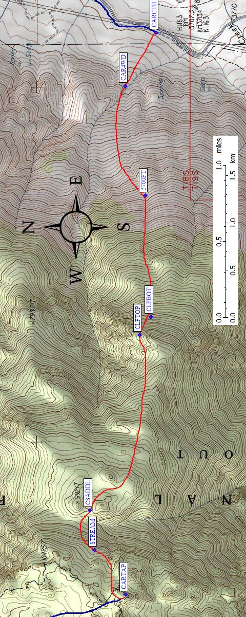
For our trip, we followed the trailhead description on Climber.Org, which now contains an updated map and waypoints and description of our route to the summit. (Actually we did better coming down than going up, and we did better than when Steve was here before, so it's worth checking that trailhead page for hints and waypoints!) We went over the aqueduct on the outskirts of the town of Cartago. I had my 4WD jeep, so we found the vague, unsigned 4WD jeep trail that connects with the main dirt road that runs alongside the aqueduct and followed it up about 0.3 mi. with a gain of 200 ft. This jeep trail had not been used recently and one of the posts that apparently marks the wilderness boundary was busted.
Our route: (click to enlarge - will be rotated so it's not so wide!)
Go to the trailhead page
for an interactive scalable map and downloadable waypoints.
The hike began on the old motorcycle trail, which can be seen from the town of Cartago. Even though we had an early start of about 6:30 am, it was pretty warm already. The long sand climb in the heat is what I'm describing as the first 'eco-zone' we entered. We aimed for the obvious rock band above us at an elevation of about 6900 ft and passed through it on its left side. This went well, involving mostly class 2 scrambling over big boulders. Leaving the first so-called eco-zone of heat behind, we then entered the second 'eco-zone', the one containing annoying flying gnats. These gnats insisted on flying around our faces as close as possible. I thought they were attracted to sweat. Steve was convinced it was movement that attracted them. We agreed to disagree on this, but we both agreed that they were hugely annoying.
After crossing the first rock band, another one comes into view above at an elevation of about 8200 ft. We attempted to go around it on its left side but got entangled in some really nasty brush. [We tried the other side on the way back down, and though steeper, was mostly free of brush - see the trailhead page for more details and waypoints.] We entered the third eco-zone at this second rock band, which I like to call the allergy zone. Steve developed upper respiratory system allergy attacks due to some flowering desert scrub. Steve was the primary indicator for this eco-zone, as I was essentially free from its effects. It got so bad at times, that Steve could not breath through his nose.
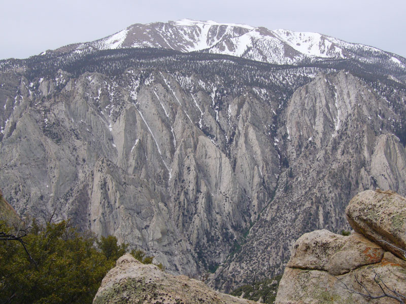
Looking south to Olancha.
We followed the ridge above the second rock band first on its north side, then mostly on top until we got near Point 9921. We hit some significant snowbanks at about 9200 ft. We reach the obvious gorge separating us from the Cartago massif a little too far south of Point 9921, so contoured around the east side of a small rocky point until we were at a just south of Point 9921. This made for easy crossing over the top of the gorge towards the rocky pillars that guarded the summit area. We then followed a drainage up towards the summit area that is WSW of Point 9921, which to our surprise had running water in it. However, it appeared that this small stream is only in existence for brief period in early spring, as it is fed by snow banks leading down from the Sierra crest just above us. As such, the stream probably cannot be counted on as an easy source of drinking water for more than a few weeks per year. It was here we entered the fourth and final eco-zone, known as high altitude awareness zone. Again, Steve was the primary beneficiary of this eco-zone change, resulting in slight feeling of nausea.
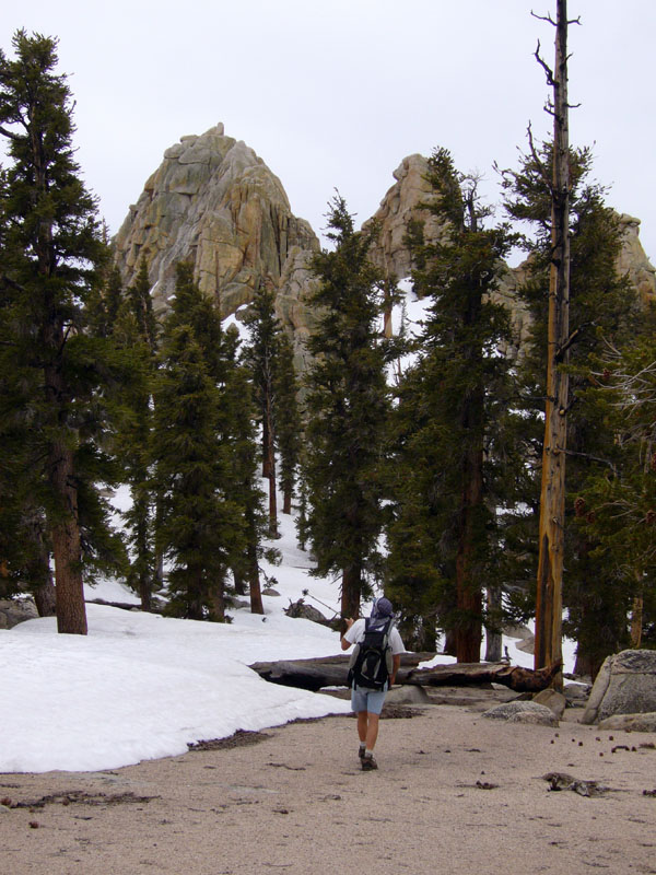
Daryn pointing in more or less the right direction, but walking towards the wrong summit!
Up to this point, I was leading using only a map and insisting that a GPS was not needed so Steve kept his GPS unit to himself. I now played the game he played with another climbing buddy some years back attempting to find the Cartago highpoint without use of the GPS. I knew the highpoint was the most southern pinnacle of rock on this poorly defined plateau. And that's the direction I headed. I spotted what I thought was the most southern pinnacle and when Steve did his GPS coordinating, he refused to confirm. A bad sign. He finally conceded after much whining by me that the high point was actually still SE of us 0.17 miles away. Sure enough, after pushing past some trees that blocked my view, there it was: the high point on Cartago.
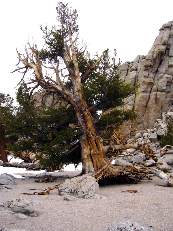
Interesting tree just below the right summit area.
After all the fuss in trying to find the high point, the final scramble up the class 3 summit blocks was relatively uneventful. According to the register, we were the first up here this year. The maze of rock outcroppings and trees on Cartago was probably the most interesting sight from the summit. The snowy summit of Olancha Peak was also quite spectacular. Getting back down through the maze of rocks to the running stream for drinking water was not trivial. We needed to pull out the GPS once to make sure we were on the right track. The descent was fun and fast once we got past the major band of rock at 8200 ft. We plunged-stepped through the sand, occasionally descending at a rate of 8000+ ft per hour. My jeep came into view long before we got near it and we steered toward the car on the decent. For the record, the hike took 11 hrs 45 min, with 6200 ft of gain and was nearly 10 miles round trip.