Bear Box at Pate Valley Cable (YW01XX)
Generated on 20 Oct 2025 - see revision history - please send updates to the webmaster
WARNING!
"XX" in this waypoint name means the coordinates and elevation are approximate!
Please contact the webmaster if you can help verify this box.
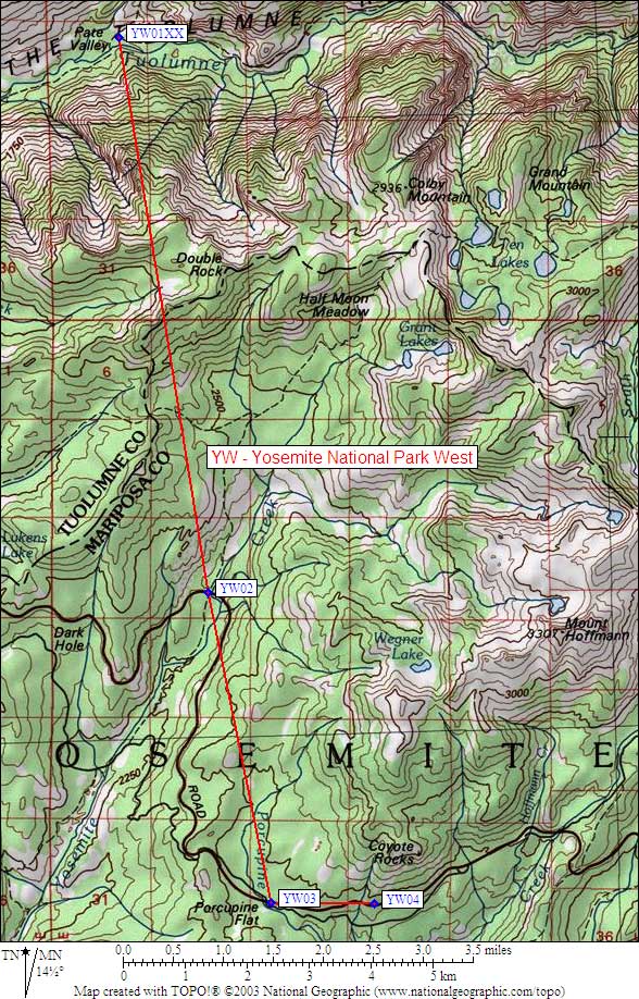
Detail Map of waypoint YW01XX
in Yosemite Park West:
(scroll down for directions, waypoints, and area map)
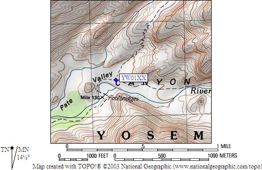
- YW01XX is a steel cable, may not exist, at about 4400 feet,
in the GPS route YOSEMITE WEST.
- Note: This cable may no longer exist!
- Directions from Kim Fishburn, July 2003:
I noticed that you show cables in the backcountry of Yosemite.
I read about a year ago that they were going to take them down.
The bears are injuring themselves by chewing on the cables.
I don't know if they are still up. I've heard stories about the
cables such as bears standing on them and bouncing the try to get
the food to slide toward them I was a Hetch Hetchy about 5 years
ago and the ranger told me that the bears had gotten the cables
down at Rancheria Creek and that they wouldn't be replaced.
- Directions from Debbie Bulger, July 2000:
One storage cable between two trees at the junction of the Grand Canyon
of the Tuolumne trail (to Muir Gorge) and the trail to Rodgers Canyon.
There are established campsites at this junction.
- YW01XX coordinates: (see GPX waypoint download links above)
  APPROXIMATE  (lat,lon) = (37.9332800, -119.5923200) in decimal degrees, NAD83.
  APPROXIMATE  (zone,east,north) = (11S, 272255.0, 4201383.0) in decimal meters, NAD27.
- Scroll down for a regional map of the entire Yosemite Park West region.
Map exported from TOPO! software, used with permission.
Useful Links: