Bear Box at Twin Lakes West (SC03)
Generated on 20 Oct 2025 - see revision history - please send updates to the webmaster
Detail Map of waypoint SC03
in Silliman Crest:
(scroll down for directions, waypoints, and area map)
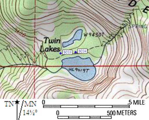
- SC03 is a standard box, at about 9400 feet,
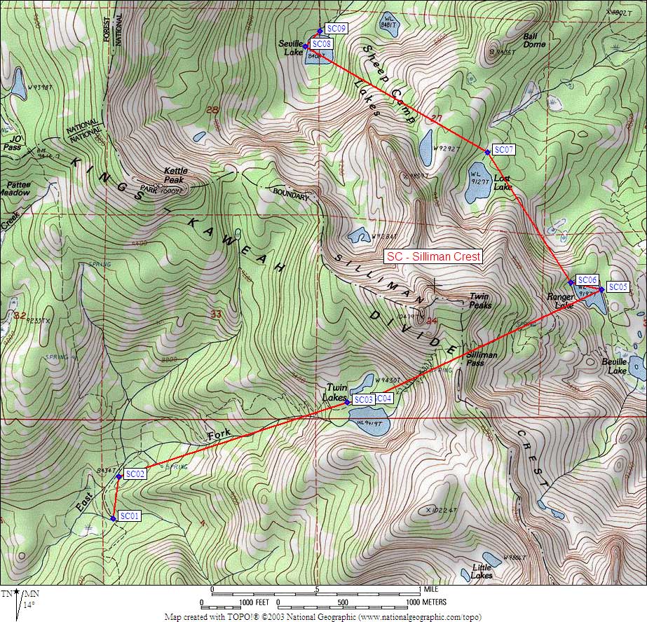
in the GPS route SILLIMAN CREST.
- Note: These are NOT the Twin Lakes between Maggie and Sheep Mtns,
these are the Twin Lakes by Mt Silliman!
As you approach Twin Lakes from Silliman Pass or Lodgepole / JO Pass,
there are signs with small and incorrect maps of where the two
bear boxes are. Unless the sign maps improve, don't trust them!
The old text descriptions from the rangers is also useless.
Both boxes are right beside the trail, both boxes are BETWEEN
the two lakes, and the two boxes are only about 0.1 miles apart.
- Directions from Steve Eckert, with GPS waypoint, June 2002:
The western box is about halfway between the westernmost tips of
the two lakes, 30' north of the trail. Leave the trail right at
the metal 'toilet' sign which points north, which is just west
of where the trail crosses the outlet stream from the
smaller/higher/northern lake. (There is an outlet stream, at least
in June, even though the topo maps don't show it.)
- Directions from Mineral King ranger info sheet, dated 1991:
Two boxes at Twin Lakes (no description of where).
- SC03 coordinates: (see GPX waypoint download links above)
  (lat,lon) = (36.6583900, -118.7168000) in decimal degrees, NAD83.
  (zone,east,north) = (11S, 346636.0, 4058154.0) in decimal meters, NAD27.
- Scroll down for a regional map of the entire Silliman Crest region.
Map exported from TOPO! software, used with permission.
Useful Links: