Bear Box at Lower Rock Ck / Pacific Crest Tr (RS01)
Generated on 20 Oct 2025 - see revision history - please send updates to the webmaster
Detail Map of waypoint RS01
in Rock Creek South:
(scroll down for directions, waypoints, and area map)
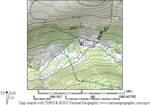
- RS01 is a standard box, at about 9600 feet,
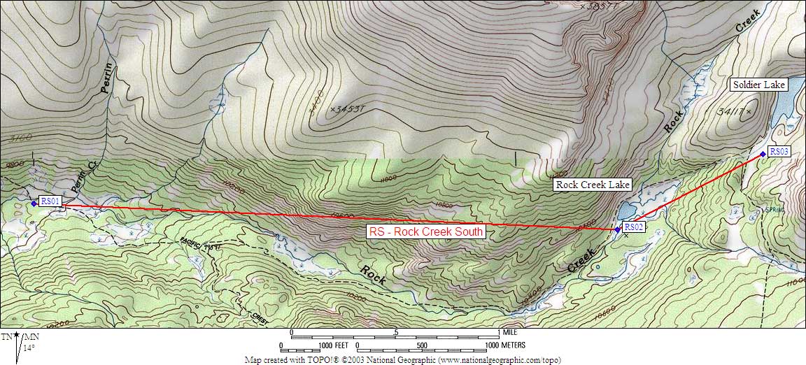
in the GPS route ROCK CREEK SOUTH.
- Notes:
This is 'Rock Creek South', by New Army Pass. See also
'Rock Creek North', by Hilton Lakes and Little Lakes Valley.
This is the same Rock Creek that joins the Kern River near
Kern Hot Springs, but there is no trail down Rock Creek.
- Directions from Scott Sullivan, with GPS waypoint, Sep 2001:
One box on the south side of Rock Creek and on the west side of the trail,
perhaps 50 yards south from where the trail crosses Rock Creek.
The bear box is about 10 feet from the trail and clearly visible.
- Directions from Mineral King ranger info sheet, dated 1991:
One box about 50 feet southwest of the Pacific Crest Trail
on the south side of the Lower Rock Creek crossing.
- RS01 coordinates: (see GPX waypoint download links above)
  (lat,lon) = (36.4967800, -118.3342200) in decimal degrees, NAD83.
  (zone,east,north) = (11S, 380585.0, 4039682.0) in decimal meters, NAD27.
- Scroll down for a regional map of the entire Rock Creek South region.
Map exported from TOPO! software, used with permission.
Useful Links: