Bear Box at Charlotte Lake (KA01)
Generated on 20 Oct 2025 - see revision history - please send updates to the webmaster
Detail Map of waypoint KA01
in Kearsarge Area Eastern Rae Lakes Loop:
(scroll down for directions, waypoints, and area map)
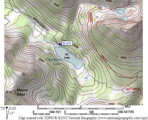
- KA01 is a standard box, at about 10400 feet,
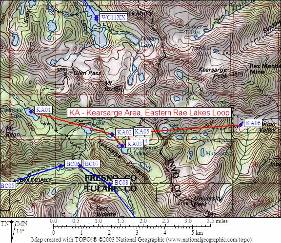
in the GPS route KEARSARGE AREA.
- Note: No camping is allowed at Bullfrog Lake - the second box is
apparently the one that used to be at the Bull Frog Lake Junction.
- Directions from Steve Eckert, with GPS waypoint, May 2014:
I saw only one box in 2014, chained to a tree right beside the trail near the lake.
It is near the outlet end of the lake, 200 yards west of the ranger station.
The ranger station is roughly in the middle of the lake, on the north side, about 100 yards
northwest from where the USGS 7.5' map shows a structure.
- Directions from Dave Johnson, Aug 1999:
There are now 2 bear boxes there, approximately 100 yards west of the ranger station.
- Directions from Mineral King ranger info sheet, dated 1991:
One box near the Ranger Station at Charlotte Lake.
- KA01 coordinates: (see GPX waypoint download links above)
  (lat,lon) = (36.7782000, -118.4283800) in decimal degrees, NAD83.
  (zone,east,north) = (11S, 372617.0, 4071022.0) in decimal meters, NAD27.
- Scroll down for a regional map of the entire Kearsarge Area Eastern Rae Lakes Loop region.
Map exported from TOPO! software, used with permission.
Useful Links: