Bear Box at Upper Backpacker Parking Lot (BP02)

Generated on 2 Aug 2022 - see revision history - please send updates to the webmaster

home Go to the main Bear Box Page or a clickable Bear Boxes Map or a complete list of 150 Bear Boxes
west Prev box is BP01: North and South Fork Trailhead.
south Next box is BP03: Lower Backpacker Parking Lot.
info GPS Waypoints in Region BP: download GPX file.

Detail Map of waypoint BP02 in Big Pine Creek Drainage:
(scroll down for directions, waypoints, and area map)

  1. BP02 is 2 standard boxes, at about 7700 feet, in the GPS route BIG PINE AREA.

  2. Directions from Steve Eckert, with GPS waypoint, July 2003:
    Two standard boxes on the upper loop of the backpacker parking lot, behind the sign by the toilet.

  3. BP02 coordinates: (see GPX waypoint download links above)
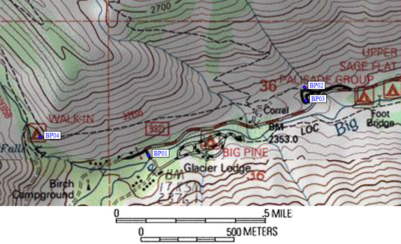
      (lat,lon) = (37.1284600, -118.4274700) in decimal degrees, NAD83.
      (zone,east,north) = (11S, 373280.0, 4109879.0) in decimal meters, NAD27.

  4. Scroll down for a regional map of the entire Big Pine Creek Drainage region.


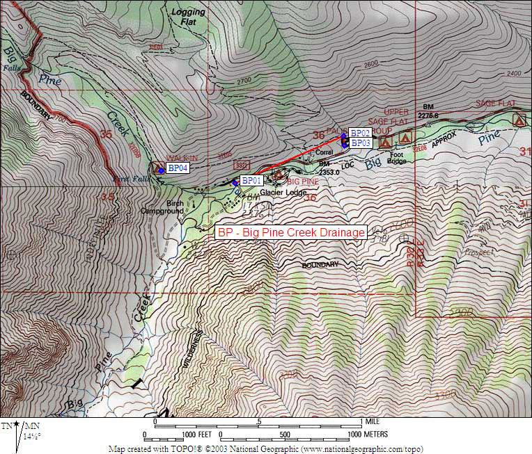
Map exported from TOPO! software, used with permission.


Useful Links: