Bear Box at Upper Vidette Meadow (BC08)

Generated on 2 Aug 2022 - see revision history - please send updates to the webmaster

home Go to the main Bear Box Page or a clickable Bear Boxes Map or a complete list of 150 Bear Boxes
west Prev box is BC07: Middle Vidette Meadow.
south Next box is BC09: Center Basin Junction.
info GPS Waypoints in Region BC: download GPX file.

Detail Map of waypoint BC08 
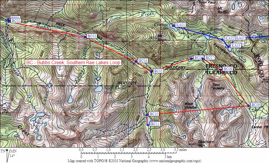
in Bubbs Creek Southern Rae Lakes Loop:
(scroll down for directions, waypoints, and area map)

  1. BC08 is a standard box, at about 10000 feet, in the GPS route BUBBS CREEK.

  2. Directions from Steve Eckert, with GPS waypoint, Aug 2000:
    Just south of the trail in tall trees west of where the trail approaches Bubbs Creek.

  3. Directions from Mineral King ranger info sheet, dated 1991:
    One box north of the trail in Upper Vidette.

  4. BC08 coordinates: (see GPX waypoint download links above)
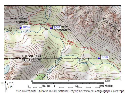
      (lat,lon) = (36.7530855, -118.3941669) in decimal degrees, NAD83.
      (zone,east,north) = (11S, 375626.0, 4068193.0) in decimal meters, NAD27.

  5. Scroll down for a regional map of the entire Bubbs Creek Southern Rae Lakes Loop region.


Map exported from TOPO! software, used with permission.


Useful Links: