Bear Box at Sphinx Creek at Bubbs Creek (BC02)
Generated on 20 Oct 2025 - see revision history - please send updates to the webmaster
Detail Map of waypoint BC02
in Bubbs Creek Southern Rae Lakes Loop:
(scroll down for directions, waypoints, and area map)
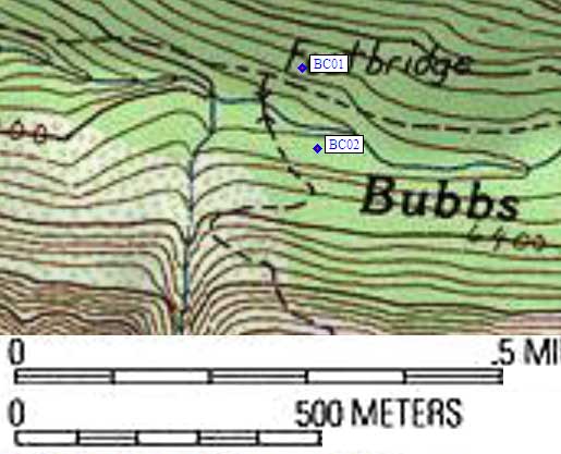
- BC02 is a standard box, at about 6200 feet,
in the GPS route BUBBS CREEK.
- Directions from Steve Eckert, with GPS waypoint, June 1999:
One standard box at the far east edge of the camp area 100 yards up the
Avalanche/Sphinx trail from the bridge at the Bubbs/Sphinx
trail junction, south of Bubbs Creek, east of the trail.
This camp area is harder to find that BBBC01, and is behind a huge
flat boulder (30' wide, chest high). Leave the trail just where it
gets steep and starts to switchback (the second, larger, clearing
as you head uphill from the bridge). It's closer to the river than
it is to the trail, in a stand of trees near some large boulders
behind the big flat boulder.
- Directions from Mineral King ranger info sheet, dated 1991:
One bear box across the creek [west of where the Bubbs Creek trail
crosses Sphinx Creek] on the Avalanche Pass trail.
- BC02 coordinates: (see GPX waypoint download links above)
  (lat,lon) = (36.7790000, -118.5361100) in decimal degrees, NAD83.
  (zone,east,north) = (11S, 363003.9, 4071258.1) in decimal meters, NAD27.
- Scroll down for a regional map of the entire Bubbs Creek Southern Rae Lakes Loop region.
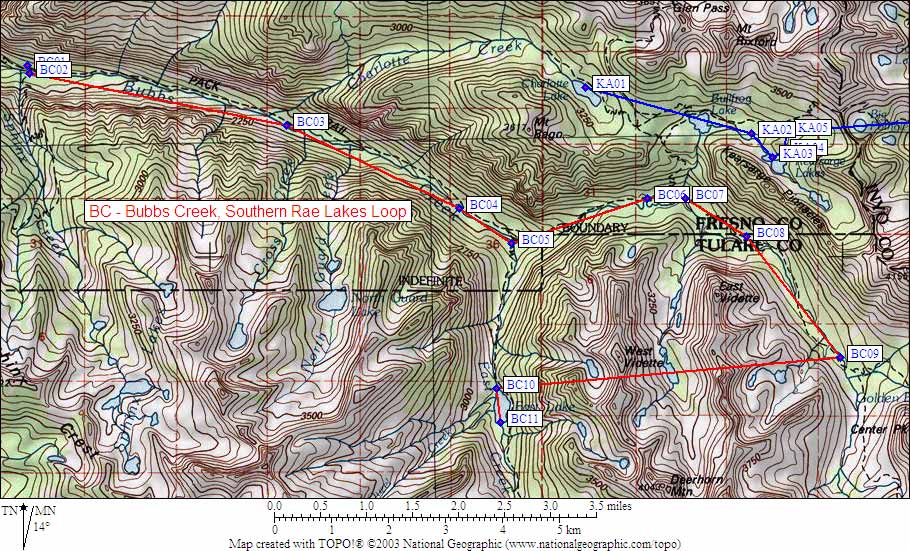
Map exported from TOPO! software, used with permission.
Useful Links: