Bear Box at Shadow Lake (AA01XX)
Generated on 20 Oct 2025 - see revision history - please send updates to the webmaster
WARNING!
"XX" in this waypoint name means the coordinates and elevation are approximate!
Please contact the webmaster if you can help verify this box.
Detail Map of waypoint AA01XX
in Ansel Adams Wilderness (formerly Minaret Wilderness):
(scroll down for directions, waypoints, and area map)
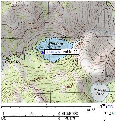
- AA01XX is a steel cable, may not exist, at about 8800 feet,
in the GPS route ANSEL ADAMS.
- Directions from Kit Groves, Jul 2002:
On a hike through the Minaret Wilderness area in mid-July we found
that there is no camping allowed around Shadow Lake and up the
north side of the river and around Ediza Lake. I did not take the
time to look for the cable because this changed our camping plans!
- Directions from Alan Ritter, with GPS waypoint, Nov 1999:
We were on our way back down from Mt. Ritter, and decided to camp
near/above Shadow Lake. As we came down (east) along the stretch of the
Shadow Creek and John Muir Trail (where they run together for a mile or
so), we got to the bridge where the JMT crosses Shadow Creek and takes
off south, just above the inlet (west) end of Shadow Lake. We crossed
the bridge, and to the left (east), there is a big granite hummock.
Perhaps 100 yards south on the JMT, we walked up over the top of the
hummock (off-trail) and found some flat spots with enough soil in them
to make for nice tent spots, but still well up on the rock outcrop,
above Shadow Lake. (The hummock is tall enough that you can see its
contour on that bulge that sticks out into the west end of Shadow
Lake.) From our campsite, we could see down toward Shadow Lake, and the
cable was strung between two trees, down in the relatively flat area
closer to the lake. Say looking southeast from the hummock.
Although we didn't walk through that area, I would imagine there are use
trails and well-trodden campsites around that end of Shadow Lake, since
I often have seen people around there as we passed by on the way to Mt.
Ritter. Might come in handy for someone hiking the JMT...
- AA01XX coordinates: (see GPX waypoint download links above)
  APPROXIMATE  (lat,lon) = (37.6931900, -119.1346300) in decimal degrees, NAD83.
  APPROXIMATE  (zone,east,north) = (11N, 311874.0, 4173720.0) in decimal meters, NAD27.
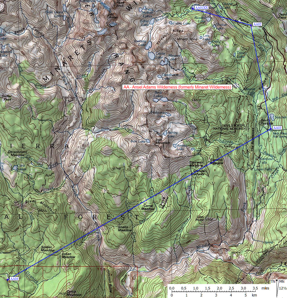
- Scroll down for a regional map of the entire Ansel Adams Wilderness (formerly Minaret Wilderness) region.
Map exported from TOPO! software, used with permission.
Useful Links: