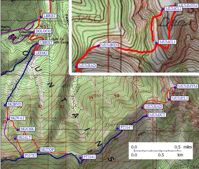
I parked near the ski area entrance, wondering if it was really OK to go through the ski area's gate. No signs said I shouldn't, so I did. Going southwest between the buildings and keeping right on the grassy slopes led me to the ski lift which my GPS said would be there. It's oddly hard to see from the entrance, and being there when it's empty feels a bit like trespassing, but I guess it's be OK. I ignored the gravel maintenance roads and just walked on the rocky grass. The rest of my route description may or may not match the DPS Guide - I just climbed where I thought was the best footing.
The top of the ski lift (waypoint SKIBND) is at 9.3k, and there is a small ski patrol hut here. Drift toward the gorge on your left (when climbing) and pick up a maintenance road near the hut. This road goes to a water intake grate (waypoint SKIWAT). I crossed the stream here at 9.5k and went left up into a pine forest to avoid the brush. Soon I was able to drop back into the drainage I was following (probably NOT the DPS Guide drainage). This was very scenic but a chockstone at 9.9k (waypoint SKICHK) forced me left again onto a rib (waypoint SKIRIB) which I followed from 10k to the main ridgeline at 10.9k (waypoint SKITOP). This is NOT the place where the DPS Guide suggests hitting the ridge, but I think it's better. I went down their way (from waypoint PT10875) and I didn't like the footing at all! The rib is far easier terrain and well worth the extra 100' of climbing (compared to hitting the saddle).
It took me about 2 hours to get to the ridge (at 9am), and at this point I was above the ridge trail. I headed east along the ridge, picking up the trail at the saddle west of Point 3341. A large group of local high school kids was straggling by in clumps, and they were quite curious about how I got up there before them. It never occurred to them that anyone might climb without being on a trail!
Eastern half of the day - Mummy Mountain
The trail to Mummy does not
always follow the line shown on the map. It traverses the south side of
the ridge far below Point 3341 and Point 3347, dropping to the switchbacks
of the north Loop Trail.
I followed the trail down through stands of bright yellow aspens to about 10.4k (waypoint MUMJCT), then turned north and scrambled up loose scree to the 10.7k saddle west of Mummy (waypoint MUMSAD). It's tempting to stay on the ridge or traverse above the trail, but the footing is terrible and the chute to the saddle goes faster. From the saddle, the ridge was easy to follow to the east. I found a use trail that hugs the north side of the ridgeline toward the peak.
At 10.3k the trail and I drifted north of the ridgeline and I noticed a notch with a big dead tree in it at waypoint MUMCL3. This is not the chute described in the DPS Guide, but it's the cool way to the summit. The other way, which I came down, is ugly class 2 (waypoint MUMCL2) about 0.1 miles north of the class 3 chute on the use trail. This class 2 DPS chute is directly between Charleston and Mummy, making it easy to find on the way down.
It took another 2 hours to reach the 11528' summit of Mummy Mtn (waypoint MUMMYM), 4 hours from the car and only a third of the mileage I had planned for the day. I spent only a half hour on top, where I had lots of cell phone bars but couldn't place a call. Back to the trail at noon, having lost 1100' from the summit, I started the long mindless trudge to Charleston.
Cool trees along the traverse below Charleston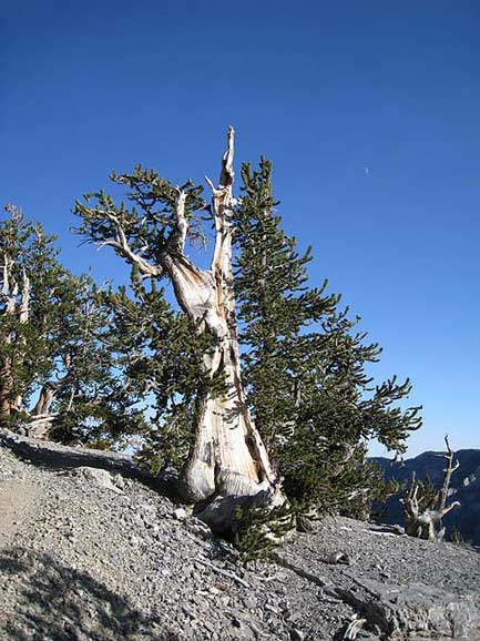
|
Western half of the day - Charleston Peak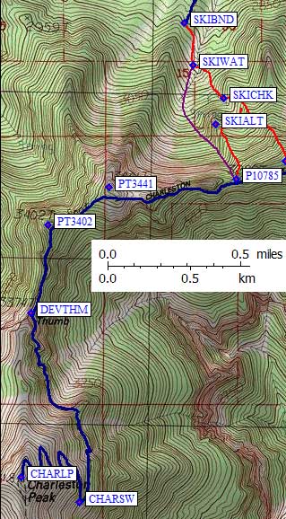
|
It took 4 hours to get from Mummy to the 11915' summit of Charleston Pk, while all the students were going the other way. The only surprising thing about this trail (other than the trash and toilet paper they left) was the amazing trees in the cliffs at the base of Charleston. Nothing like them over at Mummy, but then again Mummy's summit is pristine with some gnarled small trees while Charleston has buildings, antennas, and no plant life at all. I much preferred Mummy.
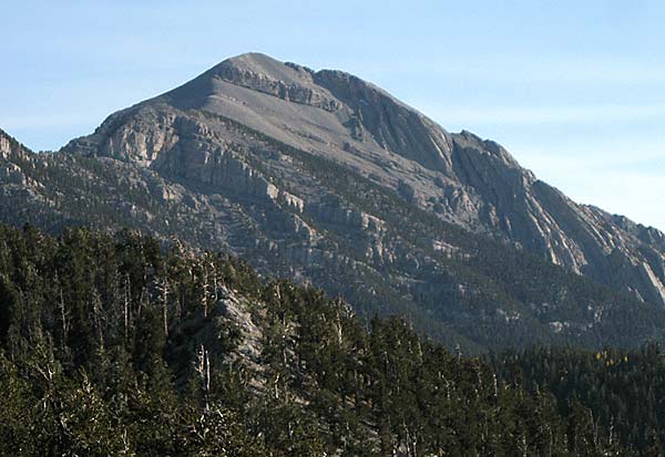
Charleston from the McFarland ridge, showing Devil's Thumb cliffs
Alone on Charleston in the late afternoon, I considered bypassing the long switchbacked trail (waypoint CHARSW) by following the ridge directly down to Devil's Thumb (waypoint DEVTHM). Good thing I didn't. The trail goes down a talus face and then traverses through ledges and cliffs, and while the ridge stays above all those cliffs and ends abruptly where the 200' contours on the USGS map all touch (south of DEVTHM). If anyone has followed this ridge down, I'd appreciate details on how to get around the cliffs at the Thumb.
I tried going down the DPS Guide route from the saddle at waypoint P10785. It's steep hardscrabble, much less fun than the way I came up, so I got on the rib just east of their route. It worked OK down to 10.2k, where it started to cliff out (waypoint SKIALT), so I traversed further east to the rib I came up on and which I still prefer (the one between SKIRIB and SKITOP). If, on the other hand, you're looking for a cool promontory for solitary camping or watching sunrise then SKIALT is the place for you.
This ended up being a 12 hour day, partly because the altitude bothered me. The total gain is hard to nail down because the trail along the ridge between Charleston and Mummy has many ups and downs, and it does not match the line on the map. It was about 2300' of gain in 3 miles from the trailhead to the ridge, about 3500' of gain in 9 miles round-trip on the trail, and another 1100' in the 2 mile round trip up to Mummy. That's a 6900' day, so I don't feel too bad about taking 12 hours to do 14 miles!
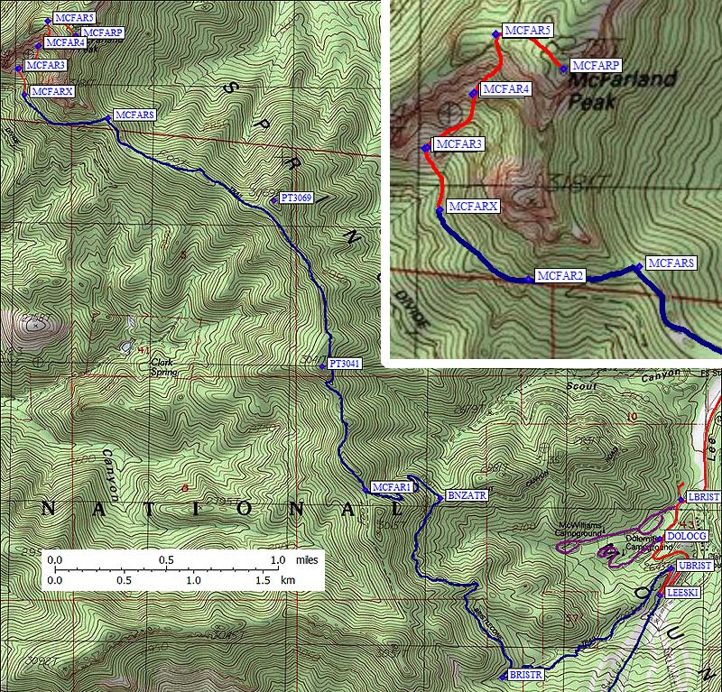
The DPS group assembled at the Upper Bristlecone Trailhead (waypoint UBRIST) We followed the cool canyon trail west up a drainage to about 9.1k (waypoint BRISTR) where the trail crosses the stream and climbs to the north. We turned left (northwest) at a 9.2k saddle with a sign for the Bonanza Trail (waypoint BNZATR). I believe a right turn here would take you down the dirt Scout Canyon Road to the Lower Bristlecone Trailhead. The trail switchbacks west to the 9.7k saddle just north of Point 3015 (waypoint MCFAR1), where the roller-coaster ridge run to the north begins. Save some energy for the hike out, because there's 900' of gain in that direction.
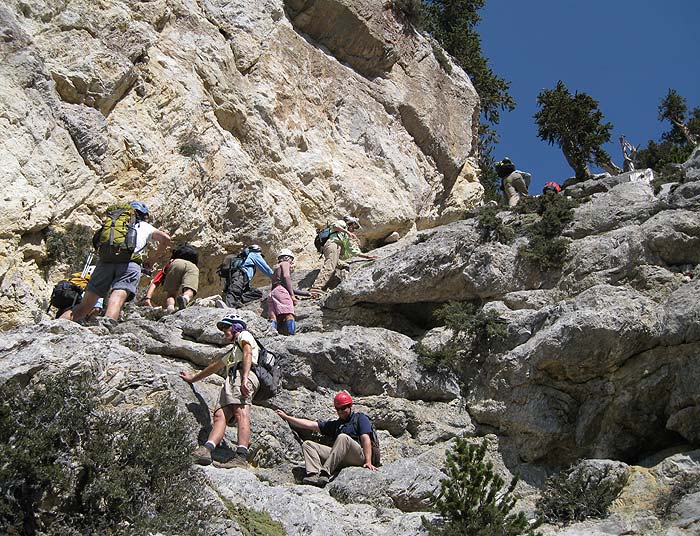
The trail goes near, but not directly over, Point 3041 and Point 3069 on its way to the main saddle south of McFarland (waypoint MCFARS). After this saddle, the trail traverses and switchbacks south, but apparently does NOT match the line on the map. We followed the trail west and northwest to the first big switchback (waypoint MCFARX) at 9.5k, then went XC into and up the drainage west of the peak. The climbing isn't hard but was loose at times. There is a 10-15 foot section of class 2-3 at 10.1k (waypoint MCFAR4) and some fun route-finding above that. The chute tops out at 10.5k (waypoint MCFAR5) a tenth of a mile west of the peak. From here to the summit is easy forest duff.
The McFarland Crux
We reached the 10742' summit of McFarland Peak (waypoint MCFARP) in good spirits, with most of the group agreeing that it should be added to the DPS Peaks List. (This was, after all, an official exploratory trip!) Those that weren't so enthusiastic pointed out that it was very close to two other peaks, and there are already 5 peaks in the Spring Mountain Range on the list. There is 11 miles round trip on the trail that gets you within half a mile of the peak with a total of 4600' of gain. The real climbing part seems too short compared to the approach.
At 9.6k on the way down, start edging left so you can catch the trail above where it crosses the drainage. Some of us were enjoying the downhill too much and had to climb back up on the trail. The group spread out more during the return hike, but we were back to the cars around 6pm.