Bear Box at Crabtree Ranger Station (TC04)
Generated on 2 Aug 2022 - see revision history - please send updates to the webmaster
Detail Map of waypoint TC04
in Tyndall and Crabtree Area:
(scroll down for directions, waypoints, and area map)
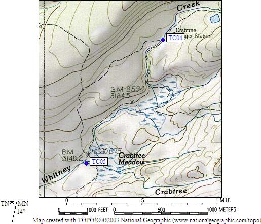
- TC04 is a large box, at about 10700 feet,
in the GPS route TYNDALL CRABTREE.
- Note: Descriptions of this box vary, and TC05 is nearby!
This one is TC04, at the Crabtree Ranger Station,
a mile north of Lower Crabtree Meadow where Whitney Creek and Crabtree Creek join.
- Directions from M F Miller, Sep 2020:
Large brown bear box directly on trail
immediately after stream crossing as come into large meadow and with ranger
station towards the left. Pit toilet is at far end of meadow.
- Directions from Dan Anderson, July 2011:
Due to changes in the trail this bear box (and JMT/HST trail section) were
confusing. The JMT has been rerouted from the South to North side of
Whitney Creek, apparently to avoid wetlands. There are now 2
junctions--one north and one south of Whitney Creek.
To reach the bearbox from the JMT, head to a signed trail 'T' junction on
the north side of Whitney Creek (about 100 yards northwest of TC04). Take
the trail junction southeast, cross Whitney Creek, head up the riverbank
and bearbox TC04 is at another 'T' trail junction south of Whitney Creek,
in meadow area. A short trail heads ~100 yards east to Crabtree Ranger
Station, in the trees. The other (main) trail heads southwest to Crabtree Meadow.
- Directions from Michael Golden, Sep 2000:
There's a box just on the south/east side of Whitney
creek. There's a trail junction on the JMT that points
to Lower Crabtree Meadow and the Crabtree Ranger Station.
Follow that trail through an established campsite and
across Whitney Creek. The box is next to the creek,
at the trail junction for the trail that leads northeast
to the ranger station and southeast to lower crabtree meadow.
- Directions from Kit Groves, with GPS waypoint, July 2000:
One box at the trail junction 100 yards southwest of the Crabtree Ranger Station.
- Directions from Mineral King ranger info sheet, dated 1991:
One box at the Crabtree Ranger Station.
- TC04 coordinates: (see GPX waypoint download links above)
  (lat,lon) = (36.5639200, -118.3493500) in decimal degrees, NAD83.
  (zone,east,north) = (11S, 379335.0, 4047149.0) in decimal meters, NAD27.
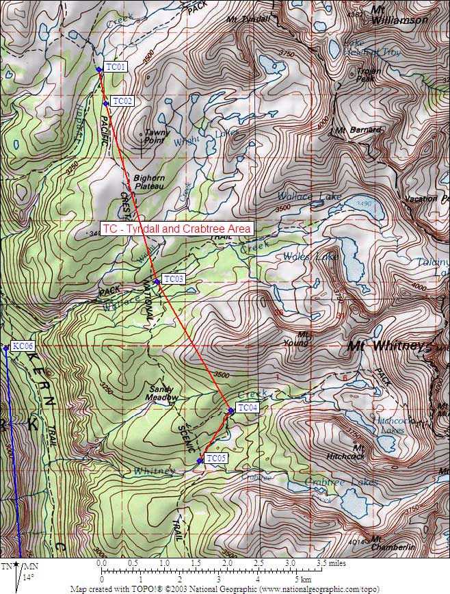
- Scroll down for a regional map of the entire Tyndall and Crabtree Area region.
Map exported from TOPO! software, used with permission.
Useful Links: