Bear Box at Hocket Meadow Trailhead (MK02)
Generated on 2 Aug 2022 - see revision history - please send updates to the webmaster
Detail Map of waypoint MK02
in Mineral King Area:
(scroll down for directions, waypoints, and area map)
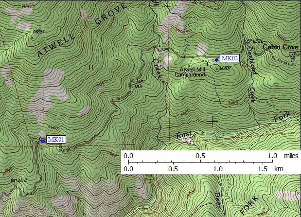
- MK02 is a standard box, at about 6600 feet,
in the GPS route MINERAL KING.
- Directions from Steve Eckert, with GPS waypoint, Oct 2001:
One public box at the Hocket Meadow trailhead parking area just south of
(and visible from) the Mineral King Road. This is the upper or
eastern (unmarked) entrance to the Atwell Mill campground, roughly
a tenth of a mile east of the marked entrance. Other boxes are for
campsites, this one is for backcountry users.
- MK02 coordinates: (see GPX waypoint download links above)
  (lat,lon) = (36.4644500, -118.6670000) in decimal degrees, NAD83.
  (zone,east,north) = (11S, 350717.0, 4036559.0) in decimal meters, NAD27.
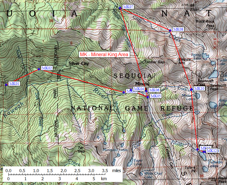
- Scroll down for a regional map of the entire Mineral King Area region.
Map exported from TOPO! software, used with permission.
Useful Links: