Bear Box at Junction Meadow East Creek (BC05)
Generated on 20 Oct 2025 - see revision history - please send updates to the webmaster
Detail Map of waypoint BC05
in Bubbs Creek Southern Rae Lakes Loop:
(scroll down for directions, waypoints, and area map)
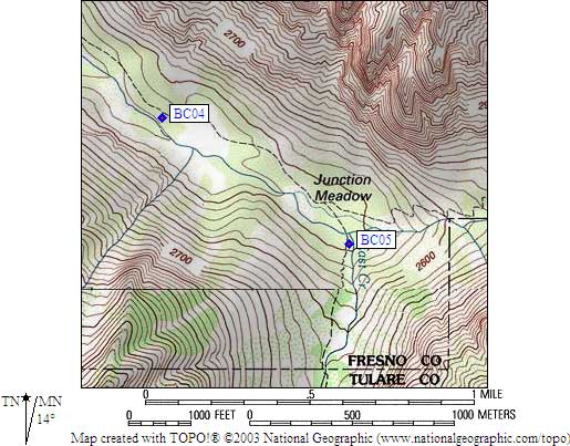
- BC05 is a standard box, at about 8200 feet,
in the GPS route BUBBS CREEK.
- Directions from Gary Craig, July 2002:
The distance from the trail to this box is more like 20 or 30
yards, not 50 yards as estimated earlier. It is a standard
box on the west side of the East Lake trail.... BUT.... if
you use the giant log crossing a couple hundred yards west
(downstream) of the 'main' Bubbs Creek crossing, you will
likely walk right next to this box on your way back to the
East Lake trail after crossing Bubbs! This is a bad stream
crossing and if I could vote for one place in the Sierra
that needs a footbridge, it would be here.
- Directions from Scott Sullivan, with GPS waypoint, Sep 1999:
From the intersection of the [Bubbs Creek] trail from Road's End,
and the East Creek trail to East Lake, go south toward East Lake
and cross Bubbs Creek (may be difficult). The bear box is located
perhaps 50 yards south along the trail after crossing the creek
and is visible from the trail.
- Directions from Mineral King ranger info sheet, dated 1991:
One box across the creek from Lower Junction Meadow on the trail to East Lake.
- BC05 coordinates: (see GPX waypoint download links above)
  (lat,lon) = (36.7518900, -118.4406300) in decimal degrees, NAD83.
  (zone,east,north) = (11S, 371479.0, 4068120.0) in decimal meters, NAD27.
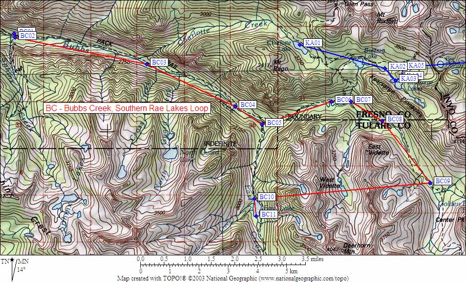
- Scroll down for a regional map of the entire Bubbs Creek Southern Rae Lakes Loop region.
Map exported from TOPO! software, used with permission.
Useful Links: