Bunny Flat and Panther Meadow
(Avalanche, Casaval, Sargents routes on Mt Shasta)
Revised 24 Jun 2012 - please send updates to the webmaster
These two trailheads are the start of the most commonly used routes on Mt Shasta. It's a short drive from the village of Mt Shasta, and the road is plowed to Bunny Flat all winter. It's crowded with sledding families in the winter and day hikers in the summer, but there is an all-year rest room at Bunny Flat.
More Mountain Info:
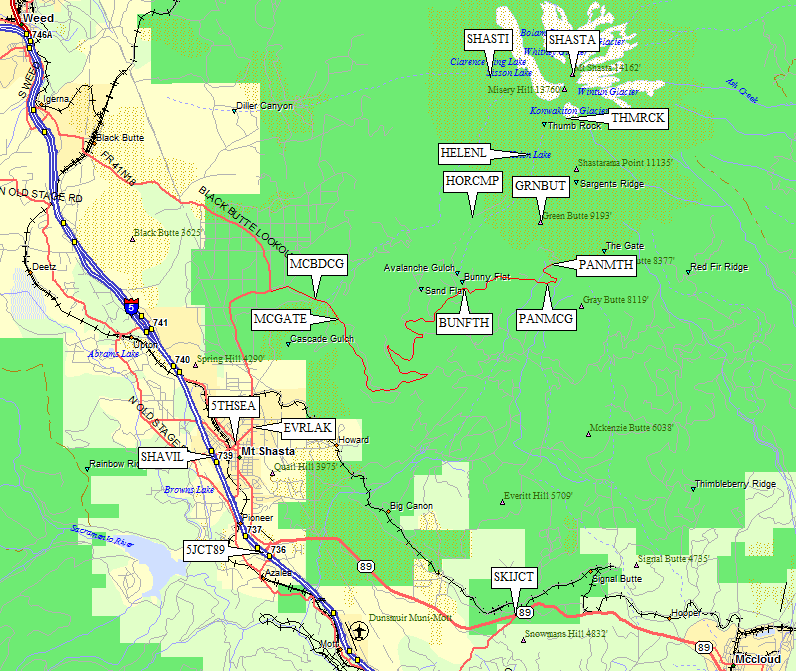
Two miles north of Hwy 89, leave I-5 at Lake Street, the central exit for the village of Mount Shasta (waypoint SHAVIL). Lake Street crosses some railroad tracks and continues northeast to the Everitt Memorial Highway (waypoint EVRLAK). The Fifth Season climbing store (waypoint 5THSEA, on the corner of N Mt Shasta and Lake two blocks NE of the tracks) can supply any last-minute climbing needs (including free mandatory human waste disposal bags), and will sell you a summit pass ($20 each in 2012).
Go north out of town on Everitt Hwy, which turns east and then southeast as it goes past McBride Campground (waypoint MCBDCG) and a gate (waypoint MCGATE). The road steepens in switchbacks to the famous Bunny Flat all-season parking area at 6900' (waypoint BUNFTH). In the winter, the road is gated here. In summer you can continue to the Panther Meadow campground (waypoint PANMCG) and 7700' trailhead (waypoint PANMTH).
Useful Links: