We stopped at the Fifth Season to get human waste bags and summit passes, and for Matt to buy better snow-climbing boots. We easily followed really bad directions and really good signs to the Brewer Creek trailhead on the far (east) side of the mountain. (See the trailhead page link above for accurate driving directions and GPS waypoints for the road.) We hit some snow drifts that I didn't want to scrape my car over, and camped just off the road around 7k. This trailhead would work well even if you could only drive to 5k or 6k, because the vegetation is sparse and the mileage is minimal. See below for maps and waypoints!
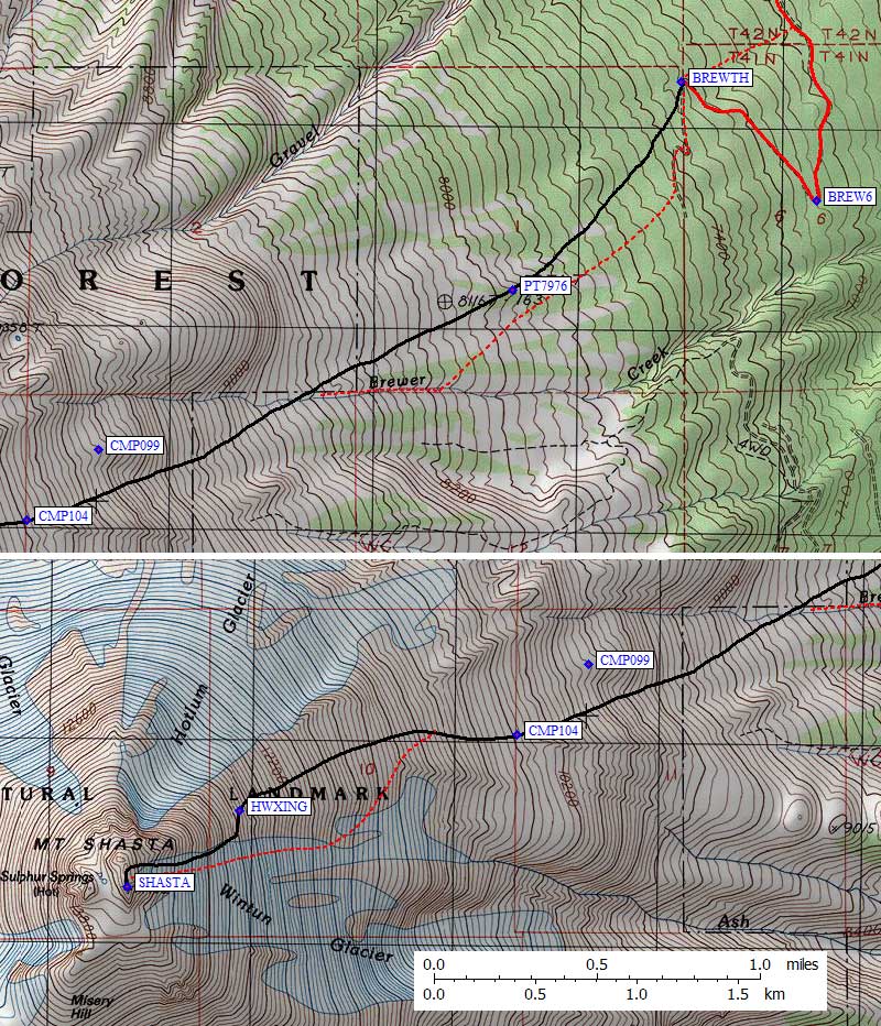
Shasta from the east, with the entire route in view
Day 1 was short. No other way to say it. We walked up the road to the official trailhead (waypoint BREWTH), filled out self-issue permits, and quickly lost the trail in patches of snow. Since you can see the peak the whole time, navigation is trivial unless you lose visibility. Go up. Go straight up. Don't worry about the trail, no one else is following it either. The lowest snow tongues are in the Brewer Creek cut, so go there if that's what you want. Otherwise, aim for Point 7976 and then drift south into the drainage.
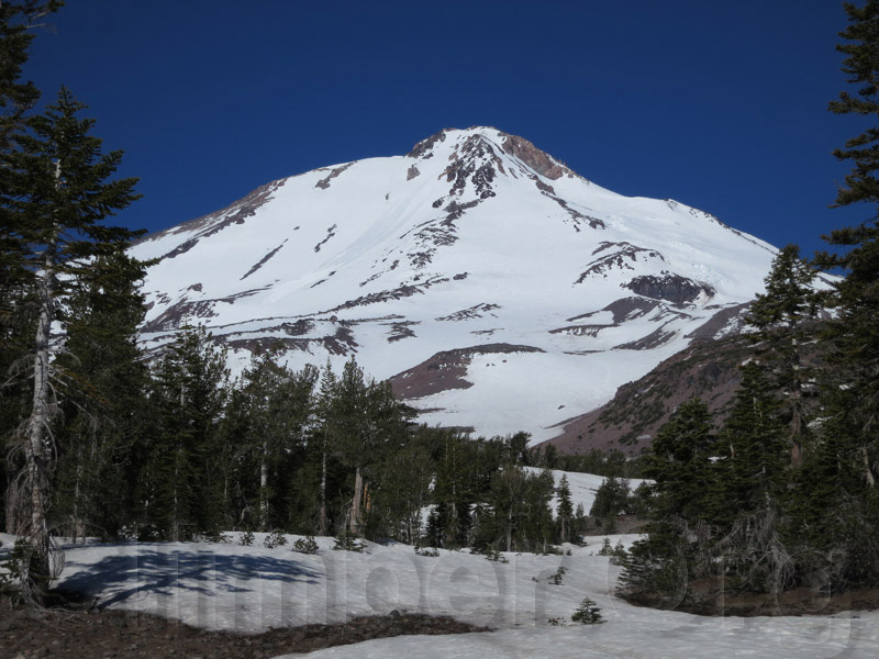
The "normal" camp is a 9.6-9.9k gravel shoulder that melts out quickly. We noted the dense cluster of tents there (later finding out it was a Boy Scout group) and went on. I wanted to get higher and intended to camp on snow if needed, but we stumbled on some stone walls enclosing level campsites at 10.4k and decided that was high enough (waypoint CMP104). We didn't see anything higher, and when the afternoon wind kicked up we were happy to have some rocks around us. We thought about doing some ice axe practise, but ended up just napping and wondering what the groups above us were doing. One guy sat in the snow like a rock literally for hours, while his group climbed at a rate of roughly 200 feet per hour. We don't think they made the summit, but they didn't come down until 6pm.
Climbers on the route as it appeared from our campsite
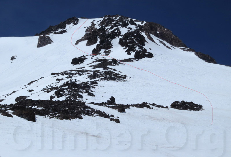
The next morning we stair-mastered the snowfield above camp to the place where everyone seemed to be crossing the ridge. This is called the Hotlum-Wintun Ridge, but really it's a snowfield from which you cross a rib into a chute. At the crossing (waypoint HWXING) I finally switched from ski poles to an ice axe as the slope steepened dramatically. This slope catches the full morning sun, so the snow softened quickly from 9-10am. A week-old minor avalanche had cleared fresh snow from the Wintun Glacier but we saw nothing that looked unstable. (One week earlier it was snowing with 70mph wind, but we really hit the perfect weather window.)
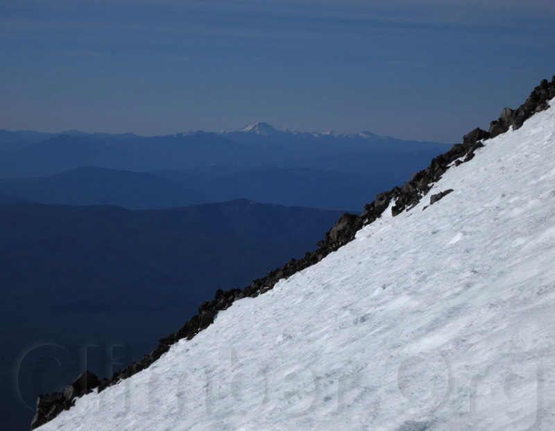
The classic volcano view
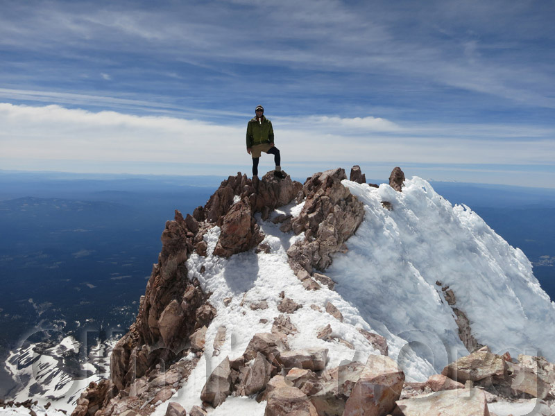
The cool thing about this route is it keeps getting steeper all the way to the top. And then you're done! We exited the upper bowl on the right to keep the angle down a bit, with a 100 yard traverse south to the summit. On top at 1030am, we took hero shots and scrapped the third day of our planned schedule. There is Verizon (but not AT&T) cell service from at or near the trailhead, and I think everyone had a signal at the summit.
Steve on the summit of Mt Shasta
We split up for the descent back to camp, with Matt in crampons and me on my roll-up plastic sled. I had to traverse a bit to get a clear fall line, then straight down the summit chute and into the avalanche-cleared section of the Wintun Glacier. Don't even think about glissading the top section unless you have a completely bombproof technique and are sure you can stop to rest often. When it got less steep I let myself speed up, and noted a 27000 ft/hr descent rate acording to my altimeter. There was nasty ice just below the now-soft snow, but in the cleared part a 3-point standing glissade worked well and allowed my frozen hand to thaw out. I crossed the ridge much lower than we had on the way up, angling down between 11.6k and 11.2k, which was a bit more mileage but did not require a high-angle traverse and completely avoided the rock ribs.
I got to camp almost an hour before Matt, and lounged in the hot sun while drying out. Then it was time to plop back on the sled (with a full pack) and ride down Brewer Creek to below 8.2k. Too flat to glissade very far below camp unless you have a sled or tarp. We met our only ranger of the trip, who politely asked us for permits and said he was trying to find a shady spot to watch climbers descend. (Good luck!) Having a GPS waypoint for the trailhead and the car really helped because the tracks come and go and only the last quarter mile to the trailhead is really a trail.
We dumped our bags in the bin by the outhouse, walked another cross-country line to the car, and headed back to Mt Shasta village for dinner and a boring drive home. We left camp and 630am, were on top at 1030am, back to camp at noon, drove away at 3pm, and I pulled into my driveway at 930pm. The whole trip went surprisingly smoothly, greatly disappointing Matt (who really needs to be hurting to have fun).
Datum,North America 1983,GRS 80,0,-1.6E-7,0,0,0
RouteName,1 ,HOTLUM WINTUN RIDGE
RoutePoint,D,BREWTH, 41.4350999594,-122.1332600117,06/04/2012,20:15:00,BREWER CK TH 7300
RoutePoint,D,PT7976, 41.4258493185,-122.1431753635,06/25/2012,18:02:32,POINT 7976
RoutePoint,D,CMP099, 41.4187500477,-122.1676299572,06/04/2012,20:16:46,APPROX CAMPSITES AT 9900
RoutePoint,D,CMP104, 41.4156252146,-122.1718257666,06/20/2012,05:28:45,CAMPSITES AT 10400
RoutePoint,D,HWXING, 41.4122699499,-122.1881999969,06/25/2012,18:03:12,RIDGE CROSSING 12700
RoutePoint,D,SHASTA, 41.4089000225,-122.1948499680,06/04/2012,20:17:07,MT SHASTA 14162