Had been looking at this peak for a while, and the best route seemed to be a 23 mile RT backpack over Taboose Pass, with about 9,000 feet total gain. This did not sit well with me, so I feverishly searched for alternates. Then I found it - on page 132 of 'The High Sierra' by R.J. Secor: Mt. Wynne [close to Pinchot] ... East Ridge first ascent 8-15-1972 by ..., ... and Gordon MacLeod. This was done in one day round trip from the end of the road in Armstrong Canyon ...
Bingo ! - I'd hiked with Gordon in 2002, and assuming he had not slowed much in 30 years, and my car could go anywhere he would willingly travel in a vehicle, this shortcut to Pinchot was just the ticket.
Further investigation turned up good route + road info
given in the references above. To further grease the
skids I planned to backpack in to 10,000' on the 10th,
and hike the peak on the 11th. Unfortunately the drive
in took longer than expected (gory details below),
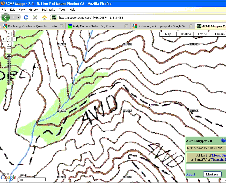
and I camped here on the 10th:
http://mapper.acme.com/?ll=36.94574,-118.34958+z=15+t=T
NOTE: ACME links may not work in MSIE, but seem to work in Firefox.
Set out by headlamp a bit after 4 AM the next day, with 4.5 quarts water. Made good progress on climbers 'trail' to a wide talus chute through cliffs at http://mapper.acme.com/?ll=36.93202,-118.37404+z=15+t=T (note bad map overlap on Acme)
This is a real grind to climb - the talus is small and loose, so you need to stick close to the sides for decent footing. Descending this wide chute is easy if you can rock-glissade. This type of descent would be too dangerous for large parties.
I found a decent sized snow bank just north of the '3600' meter mark on the contour, and put some snow in water bottles to melt.
Not much further, about 10AM, at this location,
http://mapper.acme.com/?ll=36.94245,-118.37696+z=15+t=T
I lost heart when looking at the rising talus traverse to the pass. Dropped it into low gear and plodded on, but felt pretty cruddy all the way to the summit - perhaps the altitude ? perhaps the poor physique ?
The small lake mapped at: http://mapper.acme.com/?ll=36.94790,-118.38923+z=15+t=T was dried up, but I found a dinky patch of snow nearby to melt some more water. The lake 3672 to the NW had plenty of water, but is a bit off the route.
Headed up the east ridge of Pinchot, keeping to the south of the crest until about 3940 meters. There is a faint use route to follow. After this you can keep on the ridge, or go a bit to the north.
Reached the summit about 1PM, used Cell Phone to alert home base that I should be off this sucker before midnight.
Register had entries from SPS folks. Think Doug Mantle had been up for the 7th time in March a year or two prior, but said his was not a winter ascent. March would be more than wintry enough for my tastes.
The long trudge back to the car was brightened by arrivals at caches (all 3 of them). Made it back a bit after 6 PM, ate dinner, pitched tent, hit the hay.
See map on http://www.climber.org/DrivingDirections/sawmill.html
This effort was inspired by http://www.summitpost.org/mountain/rock/154288/mount-pinchot.html which states: A competent and confident driver could probably drive it in a normal passenger car that had reasonable clearance, though the drive would be less stressful in a high clearance 4WD. The most negative aspect of the road is its almost unrelenting narrowness.
I not only possessed the competent + confident adjectives, but others like 'foolhardy', 'oil pan bashing', and 'seemingly insane' that might come in handy.
Plan 'A' was to drive the road, and backpack in to 10,000' in Armstrong Canyon.
Shortly before noon I reached the Division Creek power House, and de-pressurized the front tires to 30 PSI. I then passed some bush campers at Scotty Spring (ARMS04) and launched up the narrow mining road. The road surface was a nice granitic weathered sand (good), with a narrow sagebrush lined road (bad) plus grapefruit + larger rocks seen from time to time (worse). The grade was pretty constant, and steep enough that it was tough to get moving uphill if you stopped.
All went well till the first switchback (ARMS05) where I failed on two tries on loose volcanic cinders, backed into the switchback, and cleared the road ahead for a final try. At this point a vehicle came down, said the road got worse ahead, and suggested I beg a ride from the bush campers back at Scotty Spring.
After some soul searching I decided this made sense, but when I tried to drive out of the switchback, the front wheels spun - I was stuck in level volcanic rocks - a new and unwelcome experience.
Started cranking the jack in the blazing Owens Valley sun, but the jack just sunk into the loose, light rocks. About this time a second vehicle came down, and offered a tow, which was gratefully accepted.
Retreated to the bush camp, and ate lunch with the friendly residents. They had 2 vehicles, and one would soon get towed off to Ridgecrest, to repair a U joint that had gone bad the day before, somewhere up the hill. Decided not to request a taxi ride up the road with their last means of locomotion. This lead me to plan 'B' - goof around for several hours until the switchback was in shade, camp there at 6400', and backpack in to 10,000' the next day.
Enjoyed several hours with the bush campers. They gave me a good tip on how great the Division Creek water was - I later filled all my containers at the fenced Power House outlet pond.
Once the hill fell into shade the campers reminded me several times about plan 'B', and I reluctantly departed.
On reaching the switchback I decided to take the 3rd run before camping. With tires spinning and rocks flying the aged car just made it past the loose cinder stretch, and back to firm granitic sand. Decided to launch Plan 'C', and check out the road ahead, which was rumored to be infested with rocks too high to straddle, too wide to drive around, and buried to deep to dig out.
Turned out I could drive around them, though some
sagebrush did come in through the open windows.
Made it all the way to
http://mapper.acme.com/?ll=36.94574,-118.34958+z=15+t=T
NOTE: ACME links may not work in MSIE, but seem to work in Firefox - here's the map:
where a 2 ton rock makes a tight and rough squeeze that was not to my liking. At this point the road was just wide enough to turn the car around, pull it off to one side, and clear out a tent spot on the other side.
The next night I decided that no one would be coming up the road in the dark, and pitched the tent right in the road, with the car blocking the road behind and some rock piles doing the job ahead.