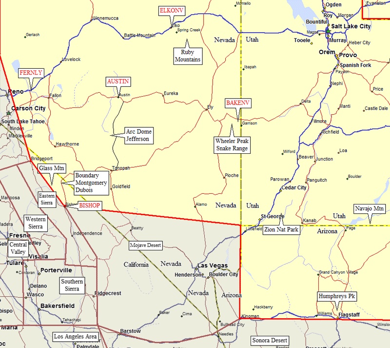
Great Basin Trailheads
(Mono Lake Area, southern Utah,
northern Arizona, northern Nevada)
Revised May 2010 - please send updates to the webmaster
|
Great Basin Trailheads (click on any black label) and Towns (in red)
| ||
| waypoint | trailhead | comments |
| GLASTH | Glass Mountain | between Lee Vining and Benton |
| QUEENM KENSAD | Boundary and Montgomery Peaks | on the California-Nevada border, north of White and Dubois |
| DUB2WD DUB4WD | Mount Dubois western approach | south of Boundary, north of White, on the California-Nevada border |
| ARCDTH JEF2WD JEF4WD | Arc Dome and Mt Jefferson | between Austin and Tonopah |
| THOMTH ISLKTH LAMCTH HENNEN | Ruby Mountains | Thomas Canyon, Island Lake, Lamoille Canyon, Hennen Canyon, near Elko Nevada |
| LEHMAN WHELTH BAKETH SNAKTH | Wheeler Peak and the Snake Range | Lehman Caves, Wheeler Peak Campground, Baker Creek, Snake Creek in Great Basin National Park, near Ely Nevada and Baker Nevada |
| WILDTH | Zion National Park | Wildcat Canyon Trailhead for North Guardian Angel and South Guardian Angel |
| AZBOWL | Humphreys Peak | Arizona Snow Bowl trailhead for the high point of AZ |
| NAV2WD NAVAJM BETKIN | Navajo Mountain | drive to the top, but don't miss great nearby sightseeing |
Useful Links: