Bridge Mountain
Revised 1 Dec 2015 - please send updates to the webmaster
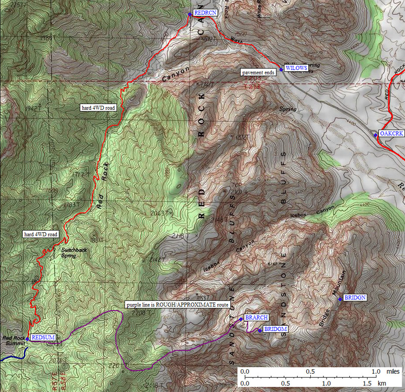
Bridge Mountain is a moderate dayhike from the closest trailhead (waypoint REDSUM). This trailhead is a place you might be able to spend the night without being tagged, because it is so far up a tough 4WD road, but my understanding is that you can't spend the night legally anywhere around here. You have to wait for the park to open in the morning before driving in. (See my trip report for some pictures and more details of the climb.)
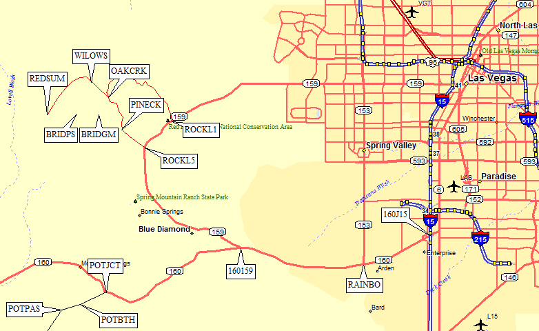
Here is an area-wide road map. See below for a detailed map of our
hiking route:
The passenger car 'trailhead' is waypoint WILLOW, where the pavement ends. It's 19 miles from here to the summit and back, according to the BLM. You'll need a good 4WD to get to what the map calls Red Rock Summit (and the BLM calls Rocky Gap). They say you need a permit to camp here, but I'm guessing they don't patrol very often and we wished we had done the 4WD part the night before.
The 4WD trailhead is at Red Rock Summit (waypoint REDSUM). We tried to go down the west side to Lovell Canyon, and found it was totally washed out, impassable even for a well-equipped Toyota 4Runner.
You approach this trailhead via the Red Rocks Scenic Drive, a loop that doesn't open until 7am. Follow Hwy 159 from Las Vegas, either from I-15 heading southwest or from Hwy 160 (Blue Diamond Rd) heading northwest. It's a one-way loop, starting near waypoint ROCKL1, and if you drive it in the early morning all the good photo ops will be in the shadows. Go over half way around the loop and take the right turn to the Willow Springs picnic area (waypoints OAKCRK and WILLOW). If you make it to Pine Creek you went too far!
I should mention that the map shows Bridge Mtn in a very different place than is on the DPS's Desert Peaks List. The DPS climbs to waypoint BRIDGM, which is the high point of what the map labels "Sandstone Bluffs", not Bridge Mtn. The USGS and the topo maps label waypoint BRIDGN as "Bridge Mountain", which is lower and to the east (the named feature, not the high point).
Here is a topo map with waypoints plotted. See above for a
area road map with GPS Waypoints>:
Useful Links: