Baxter Pass Trailhead
Revised 18 Apr 2013 - please send updates to the webmaster
Baxter Pass is short and steep, crossing the crest between Mt Baxter and Diamond Peak and descending to the northern end of Sixty Lakes Basin. It also provides access to Black Mtn and Mt Mary Austin.
Here's a overview of the road from Hwy 395 to the trailhead, details are below:
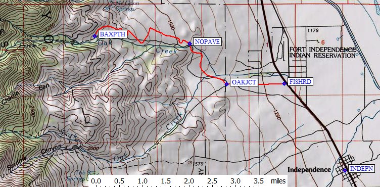
Start by getting yourself to US-395 and Fish Hatchery Road (waypoint FISHRD). This intersection is about 22 miles north of Lone Pine (waypoint LONPIN), 2 miles north of Independence (waypoint INDEPN), or 24 miles south of Big Pine (waypoint BIGPIN). You can find these and other towns on the Hwy 395 Waypoints page.
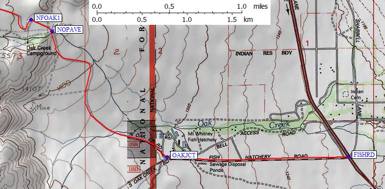
Turn west on Fish Hatchery Road from Hwy 395 (waypoint FISHRD) two and a quarter miles north of the traffic light in Independence. Go past the fish hatchery buildings and across a cattle grate (waypoint OAKJCT, 1.3 mi from Hwy 395) where Fish Hatchery Road splits into North Oak Creek Road and South Oak Creek Road. Turn right following the sign to North Oak Creek. A brown sign for Baxter Pass (with an arrow pointing to the right) was missing in 2011 but Charles Bechtel reported it was back in 2013.
NOTE: The South Oak Creek Road leads to Sardine Canyon and Little Onion Valley, for access to the north face of Kearsarge Peak, but I don't have waypoints or details on parking there. Please send details if you have them!
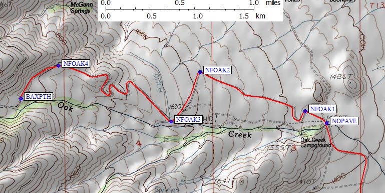
Continue on pavement to another cattle guard 2.6 miles from Hwy 395 (waypoint NOPAVE) where the pavement ends. The Oak Creek Campground might be here but I didn't see any signs in 2011. The road continues straight here, ignore the staked left turn even if your GPS tells you to take it. The dirt road is excellent, and suitable for any vehicle. Charles Bechtel said in 2013 The unpaved road was as smooth as I've seen a dirt road. And the trailhead signage appeared new.
After a few switchbacks you reach the Baxter Pass trailhead (waypoint BAXPTH) 5.6 miles from Hwy 395 at 6000 feet elevation.
Useful Links: