Bear Box at Glen Aulin High Sierra Camp (YE06)
Generated on 20 Oct 2025 - see revision history - please send updates to the webmaster
Detail Map of waypoint YE06
in Yosemite Park East:
(scroll down for directions, waypoints, and area map)
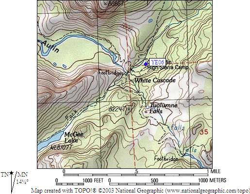
- YE06 is 2 standard boxes, at about 7900 feet,
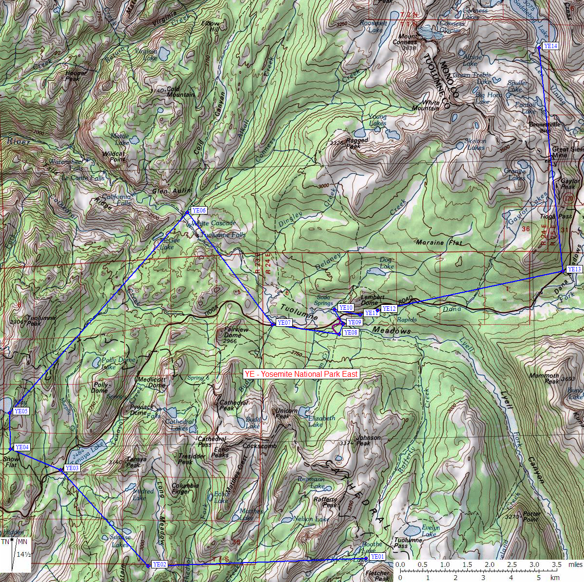
in the GPS route YOSEMITE EAST.
- Notes:
This High Sierra Camp is often accessed from the parking lot near
Lembert Dome, and people walk down the Grand Canyon of the Tuolumne
from here. Walking down canyon, you cross two bridges to get to the
camp, only one bridge to continue down to Waterwheel Falls. The camp
buildings are visible from the second bridge, the camping area is
to the left and behind the buildings. Better campsites are up the hill
north the solar toilet, which is less than 100 yards west of the river.
The bear cable which used to be nearby has been removed.
The bear boxes among the buildings are for camp guests,
backpackers should use the boxes north of the buildings.
- Directions from Peter Labarba, with GPS waypoint, July 2001:
The bear boxes are in 'line of site' between the faucet and the solar
powered toilet. Probably less than 100 feet away. There are only two
bear boxes. This does surprise me, though. Glen Aulin is one of the
most visited of the high sierra camps, and has the fewest boxes.
They appear new and in good condition.
- Directions from Kim Fishburn, July 2003:
The bears are injuring themselves by chewing on the cables.
I read about a year ago that they were going to take them down.
I've heard stories about the
cables such as bears standing on them and bouncing the try to get
the food to slide toward them I was a Hetch Hetchy about 5 years
ago and the ranger told me that the bears had gotten the cables
down at Rancheria Creek and that they wouldn't be replaced.
- Directions from Peter Labarba, July 2001:
By the way, we went looking for the cable described on your site
and couldn't find it. The ranger who checked our wilderness permit
said they'd taken all the cables down. Even the one at the junction
of Lyle canyon and lake ireland, which is used by PCT and JMT hikers.
- Directions from Douglas Smith, Nov 1999:
There's an old cable strung between two trees near Glen Aulin in
Yosemite. I remember it being about 200-300 yards downstream from the
bridge at the High Sierra camp, on the north side of the Tuolumne
River, left of the trail, and visible from the trail. It's at a dusty,
heavily overcamped area where I'd never dream of spending the night, but
it might serve for someone doing Tuolumne Canyon or Wildcat Point.
- YE06 coordinates: (see GPX waypoint download links above)
  (lat,lon) = (37.9101100, -119.4177400) in decimal degrees, NAD83.
  (zone,east,north) = (11S, 287533.0, 4198399.0) in decimal meters, NAD27.
- Scroll down for a regional map of the entire Yosemite Park East region.
Map exported from TOPO! software, used with permission.
Useful Links: