Bear Box at Franklin Lake Lower (MK12)
Generated on 20 Oct 2025 - see revision history - please send updates to the webmaster
Detail Map of waypoint MK12
in Mineral King Area:
(scroll down for directions, waypoints, and area map)
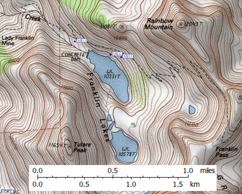
- MK12 is a standard box, at about 10400 feet,
in the GPS route MINERAL KING.
- Directions from Steve Eckert, with GPS waypoint, Oct 2001:
One box on the northeast side of Franklin Lake, roughly
one third of the length of the lake from the dam and 100'
above lake level (about half way from the trail to the lake).
You may not see the box from the trail until you are well
above it, but it's right under the FIRST really big tree
above the dam and just above a cliff which drops into the lake.
A large number of campsites are near the box, with more sites
further south along the eastern shore. Many use trails lead
down the slope from the trail to the lake. A second box is nearby,
but further from the lake and not visible from this one: see BBMK07.
- Directions from Mineral King ranger info sheet, dated 1991:
One box about one fourth or one third of a
mile east of the Franklin Lake dam and southwest of the trail
(take the use trail at the pit toilet sign).
- MK12 coordinates: (see GPX waypoint download links above)
  (lat,lon) = (36.4208100, -118.5584700) in decimal degrees, NAD83.
  (zone,east,north) = (11S, 360363.0, 4031556.0) in decimal meters, NAD27.
- Scroll down for a regional map of the entire Mineral King Area region.
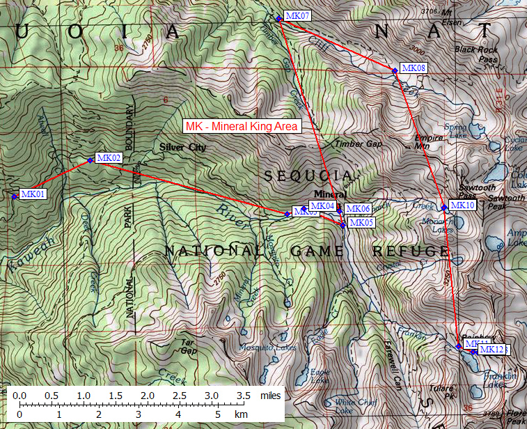
Map exported from TOPO! software, used with permission.
Useful Links: