Bear Box at Pinto Lake (MK08)
Generated on 20 Oct 2025 - see revision history - please send updates to the webmaster
Detail Map of waypoint MK08
in Mineral King Area:
(scroll down for directions, waypoints, and area map)
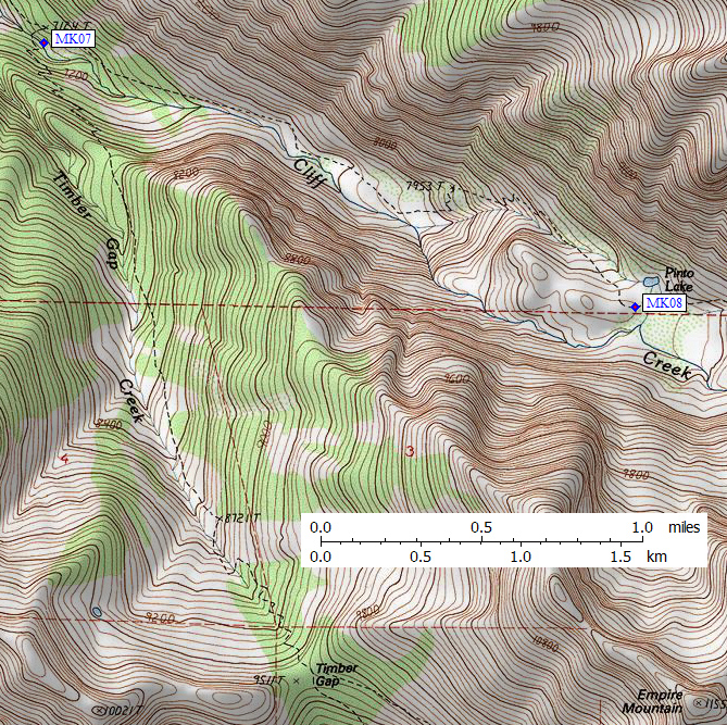
- MK08 is a large box, at about 8700 feet,
in the GPS route MINERAL KING.
- Note: The old 15' maps do not show Pinto Lake at all, and show
the trail crossing Cliff Creek in this area. The new 7.5' maps
show Pinto Lake in a separate parallel creek on the north side of the
valley, NOT drained by Cliff Creek. The trail goes between the two
creeks (so south of the trail is a long ways from the lake).
- Directions from Steve Eckert, with GPS waypoint, June 2008:
One box 20 feet south of the trail on the up-canyon (east) side of
a rocky knoll. You cannot see Pinto Lake at all from the bear box
or from the nearby campsites. Approached from above, the trail crosses
a meadow and the bear box is just before the trail climbs over
the right shoulder of the rocks. From below, the trail tops out
to the left of a knoll and drops slightly to the bear box before
reaching the meadow.
- Directions from Gary Craig, Aug 2002:
The coordinates I took were very close to those given by Paul.
This box is not very close to the lake itself, which is pretty
inaccessible due to brush.
- Directions from Paul Buehler, with GPS waypoint, Aug 2001:
The box at Pinto Lake is on the south side of the trail,
just west of the small stream that joins Cliff Creek and
Pinto Lake, not right by the lake. It is at at the spot
where the trail turns to ascend due east.
- Directions from Mineral King ranger info sheet, dated 1991:
One box on the south [typo??] side of the trail in the main camp area
at Pinto Lake, in the transition zone between granite and meadow/brush vegetation.
- MK08 coordinates: (see GPX waypoint download links above)
  (lat,lon) = (36.4850800, -118.5807100) in decimal degrees, NAD83.
  (zone,east,north) = (11S, 358486.0, 4038718.0) in decimal meters, NAD27.
- Scroll down for a regional map of the entire Mineral King Area region.
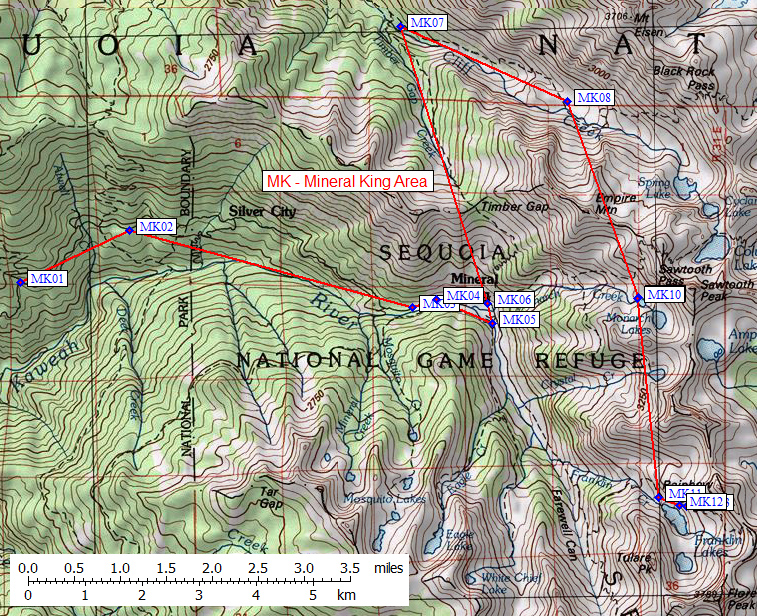
Map exported from TOPO! software, used with permission.
Useful Links: