Bear Box at Bear Creek Trailhead (LE01)
Generated on 20 Oct 2025 - see revision history - please send updates to the webmaster
Detail Map of waypoint LE01
in Lake Edison:
(scroll down for directions, waypoints, and area map)
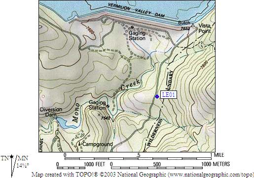
- LE01 is two standard boxes, at about 7600 feet,
in the GPS route LAKE EDISON.
- Directions from Steve Eckert, with GPS waypoint, Sep 2002:
Two regular bear boxes at Bear Creek Trailhead (not the Bear Creek
Diversion Dam trailhead) 30 yards from road, visible from road in
large dirt parking area halfway from road to trailhead sign. This
trailhead is about half a mile south of the Lake Edison spillway,
on the east side of Mono Creek (the dam exit stream).
- LE01 coordinates: (see GPX waypoint download links above)
  (lat,lon) = (37.3622500, -118.9857400) in decimal degrees, NAD83.
  (zone,east,north) = (11N, 324230.0, 4136710.0) in decimal meters, NAD27.
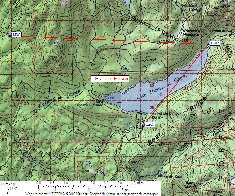
- Scroll down for a regional map of the entire Lake Edison region.
Map exported from TOPO! software, used with permission.
Useful Links: