Homer's Nose is certainly no walk in the park, and I'm ashamed to say it took my party THREE attempts to reach the summit. We first tried too early in the year and were forced to turn back by a mixture of snow and rain just shy of surprise camp. Our second attempt went much better, but just a few thousand feet shy of the summit thick fog rolled in making it virtually impossible to navigate with confidence. Shortly there after one in our party suffered an ankle injury, and we were forced to call it quits. However, the third time's a charm. We allowed ourselves enough time to turn it into a weekend trip and found the journey to be quite enjoyable.
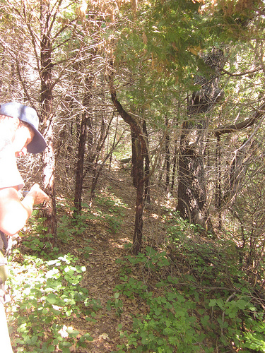
Now, with that being said, navigation isn't the only tricky part of this trip. The brush has totally grown over the majority of the route and it is impossible to avoid it. Thick Manzanita thickets will tear you and your clothes to pieces, and mass amounts of poison oak will do it's best to lather you in it's toxic oils. Mosquitos and other biting insects will also make their presence felt. By the end of the three days I had well over 100 mosquito bites (not an exaggeration).
Luckily our hunger for the summit was greater than our will to escape the pain, and if you have the drive and desire for the summit, go for it. It's all worth it when you're standing on top of the nose with that summit register in your hand. I wish you the best of luck. I will now do my best to sum up our trip below for those of you who want to attempt the Nose for yourself. We didn't follow Eckert's route exactly, but used it for reference many times. Also, my party and I tied bright pink ribbons along the way, especially near our waypoints. Keep yours eyes open for these.
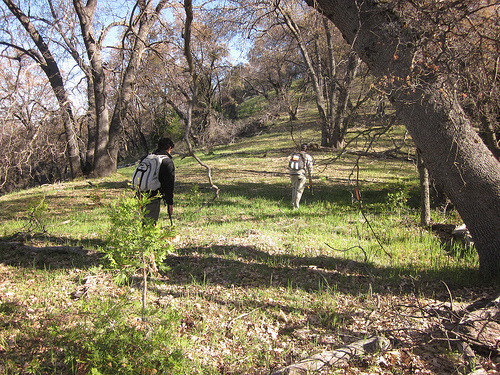
Day One: We arrived at South Fork Campground parking lot ( N 36.34982, W 118.76345) bright and early. After making sure we had everything we needed in our packs we made our way to the Ladybug trailhead, which begins as soon as you cross the old bridge. From here we followed the Ladybug trail until we reached the part of the trail that runs parallel to the old abandoned Homer's Nose trail. From here you must climb uphill through brush to locate the abandoned trail.
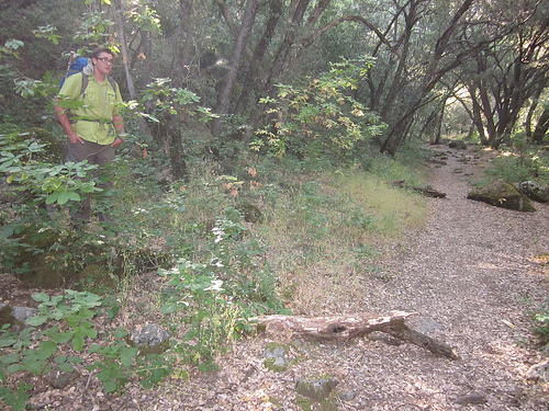
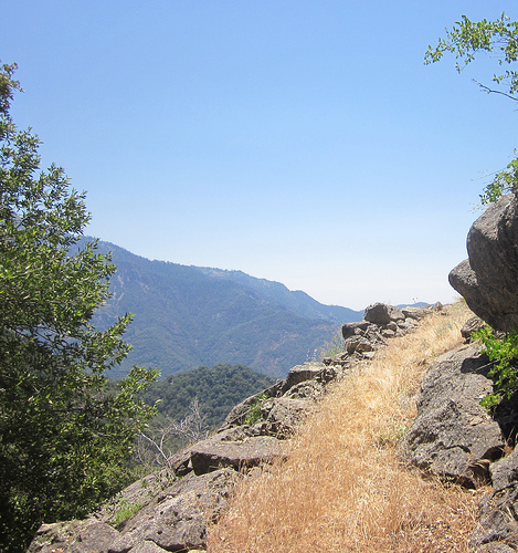
We began heading up hill at the coordinates N 36.34935, W 118.75798 (pictured), and after maneuvering through some brush for a while we eventually ran into the abandoned trail. There are countless game trails along the way which may cause some confusion, but the abandoned trail is still in pretty good shape and you should be able to recognize it without too much trouble.
We followed the trail through some minor brush until we reached out first clear view of the nose at way point Open View (N 36.35284, W 118.75609).
After relaxing in the shade for a bit and taking in the view we continued on along the old trail. A few minutes later we noticed for the first major change of scenery as the trail leads to a dense forest at waypoint Forest (N 36.35515, W 118.75541).
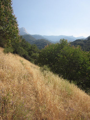
The trail then leads through the forest to a steep but wide open grassy slope at waypoint Grassy (N 36.35682, W 118.75491).
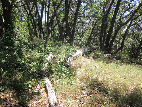
Grassy is pretty easy going, but I advise taking it slow here. It is very steep and one twist of the ankle could quickly ruin your trip. The trail leads you across the hillside at a mostly level pace. Eventually the trail will shift up hill a bit to way point Loggy (36.36148, W 118.75299). There are several fallen trees here and it's a good spot to sit and catch your breath before the unavoidable brush ahead.
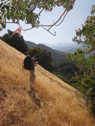
Once past Loggy the trail begins to cut in and out, but we stuck with it as long as possible. Here we hit the unavoidable brush for quite sometime until we broke out into a wide open ridge at waypoint Shoulder (N 36.36413, W 118.75812). Be sure to follow your GPS coordinates closely here, as it is easy to become discouraged while fighting the brush. Stick with your direction and fight your way through the painful brush and spider webs and you shall be rewarded with wide open Shoulder. The views from here are quite breathtaking.
Since it was still very early we decided to have some lunch here while going over the maps. After eating some delicious fruit and downing a Gu we were back on the trail. We were able to locate the trail without too much trouble (If you find this part difficult simply look for the pink markers) and quickly made our way to waypoint Insulator (N 36.36835, W 118.75792).
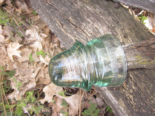
If you keep your eyes toward the ground you'll notice an old insulator still attached to a fallen pole of some sort.
From here on out it is a pretty easy hike to Surprise Camp. We stuck to the trail at waypoint Insulator and made our way to waypoint Knuckle Rocks (N 36.36937, W 118.75776),
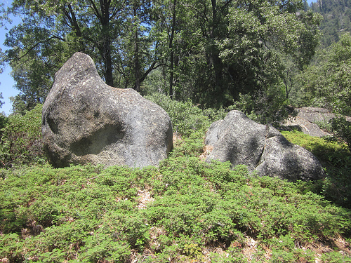
which will be hard to miss. They are two giant boulders that look like fists. Continue following the trail and fight through some mild brush and you will soon break out into waypoint Blast (N 36.37323, W 118.76038).
Here the abandoned trail is clearly evident as you can see where the park service blasted a trail through the rocks with dynamite years before. If you look carefully you can even see some old bars and railings along the path. This sight will be sure to boost your moral. However, not long after thick manzanita begins to grow across the trail. It's tough going for a little while until you discover waypoint Face Rock (N 36.37399, W 118.76476).
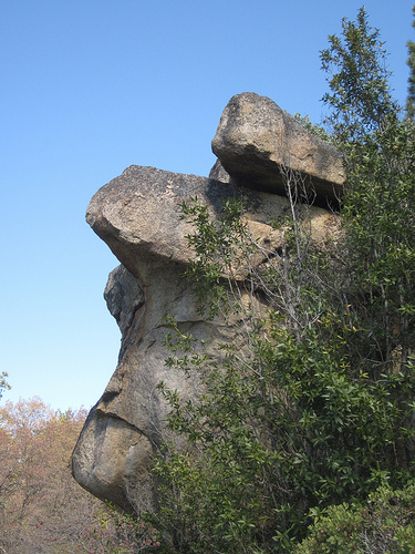
The name says it all, Face Rock is a huge formation of rocks that looks like the profile of a face. Continue along the trail and follow the pink markers and coast on down to Surprise Camp along Bennett Creek.
There really isn't a campsite here anymore considering recent log jams from heavily flowing snow melt. Our GPS coordinate is at the best spot we could find, and I recommend you camp there as well. Be sure to set up your tent ASAP to escape the copious amounts of mosquitos and flies. We arrived around two o'clock, set up camp, washed off poison oak oils in the creek, refilled our canteens and crawled inside our shelters for the night.
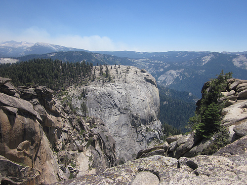
Day 2: We woke up early, pumped our water bottles full, downed a Gu each and headed for the summit. The game plan was to follow Eckert's route from Surprise Camp to the summit, but we wound up creating our own path instead. As Eckert states in his trip report, "There are so many little ridges and gullies that you'll have to make this part up on your own." We went much father North than Eckert's route thinking we could avoid more brush that way, but the decision wound up complicating things even more. We dodged the brush for a while climbing in elevation at a steady pace, but were forced to climb some rather steep and monstrous boulders along the way. I have a feeling that we were above Salt Creek Ridge the majority of the time. Eventually we hit a slight ridge line which eventually took us to the base of the Nose. From here on it was pretty easy going, somewhat steep, but there was no thick brush or rocks to slow us down. We reached the summit just before noon and made a bee line for the summit register. The register box is located at waypoint Summit (N 36.38477, W 118.73899).
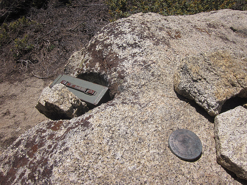
We quickly whipped out our pens to sign the notebook, anxious to become part of the Homer's Nose history. We were SHOCKED to discover that two guys had been there the same exact day as us, only earlier in the morning. What are the odds of that?!?! (I have a strong feeling that they had marked the wrong date by mistake). We spent an hour or so reading through past entries, taking in the extradorinaiy views, and snapping as many photographs as possible. Not wanting to leave, but knowing we had to get back, we headed back to Surprise Camp.
******Note: I created only three waypoints from Surprise Camp to the Summit: Rocky View (N 36.38382, W 118.75612), Rocky Club (N 36.38417, W 118.75143) and Open Rock (N 36.38349, W 118.74841). If you follow our waypoints be sure to keep yours eyes open for the pink markers. We put a lot of them along our route because we were so far off of our intended route. Again, I advise you to take multiple trip reports and Steve Eckert's waypoints with you just to be safe.
On the way back to Surprise we tried following Salt Creek Ridge, but again wound up making our own path back. We did make some really cool discoveries along the way. At Waypoint Magic H20 (N 36.38329, W 118.74802) we discovered a majestic little creek, flowing with crystal clear sierra water.
We chugged our remaining water and refilled our bottles here. I'm sure this creek was a result of the heavy snow fall this year, so no guarantees it'll be here in the future. Also, a short while later while crawling through some very thick brush Addison discovered his water bottle that he had lost on a previous trip in the South Fork Area, only filled with holes from the claws and teeth of a bear. He lost the bottle several thousand feet below where we were at this point, so apparently a Bear had really liked it and carried it home!
We arrived at camp several hours later, crawled into our tent and quickly fell asleep. The next morning we woke up early and made the trek home, arriving in Visalia around noon. We took great pride in the fact that only twenty four hours previous, we were standing on top of the one and only, Homer's Nose.
All in all Homer's Nose is a climb that will push you to your very limits, but offers a great reward. If you manage to make it through the unforgiving brush, past the mosquitos, spiders, bears, scorpions, poison oak, etc. You will witness views that are simply impossible to describe. It's a special feeling seeing sights that only a handful of people get to see per year. I advise you get out there and conquer the nose for yourself, hopefully our trip report will help!
Here are our waypoints:
Parking Lot:           N 36.34982, W 118.76345
Abandoned Trailhead:   N 36.34935, W 118.75798
Open View:             N 36.35284, W 118.75609
Forest:                N 36.35515, W 118.75541
Grassy:                N 36.35682, W 118.75491
Loggy:                 N 36.36148, W 118.75299
Shoulder:              N 36.36413, W 118.75812
Insulator:             N 36.36835, W 118.75792
Knuckle Rocks:         N 36.36937, W 118.75776
Blast:                 N 36.37323, W 118.76038
Face Rock:             N 36.37399, W 118.76476
Campsite:              N 36.37848, W 118.76374
Rocky View:            N 36.38382, W 118.75612
Rocky Club:            N 36.38417, W 118.75143
Open Rock:             N 36.38349, W 118.74841
Summit:                N 36.38477, W 118.73899
Magic H20:             N 36.38329, W 118.74802