Difficulty aside, this historic pass was one of the four major trans-Sierra trails used by the Indians. The evidence of what must have been a bustling flea market can be seen at the Taboose Pass crest. The ground is littered with obsidian shards. Here the Paiutes brought obsidian, salt, and pinenuts to trade for acorn flour, baskets, and shells brought by the Miwok and Yokut.
Richard Stover and I camped the first night at Taboose Creek at 10,300'. We were not yet over the pass, but had climbed 4600' in temperatures over 90 degrees . Descending towards the Kings River the next day, we decided to contour off-trail to the north at about the 10,500' level instead of taking the trail. Much more difficult, but loads more fun. Finally on the third day, we reached our goal: Lake 11,599' (often called Prater Lake) in Upper Basin.
Upper Basin, ringed with peaks, is best visited in August to avoid mosquitoes. It is filled with lakes large and small, puddles and seeps of every description-all eventually coming together to form the headwaters of the mighty Kings River. The spectacular U-shaped basin bears many signature marks of the glacier that formed it. The granite is finished with glacial polish, and there are glacial erratics deposited everywhere.
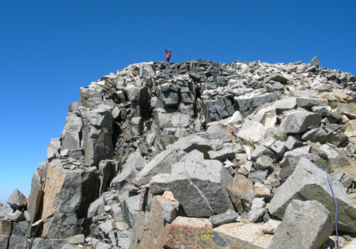
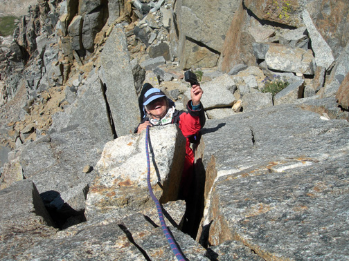
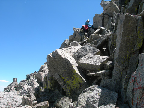
"Prater Lake" is exquisite. Its shore was dotted with Baby Elephant Heads and the most amazing Arctic Willow. These miniature trees are only inches high but fill the ground around the lake like a bonsai forest producing fluff in quantity as it goes to seed. The next morning we were up early to climb Prater. Until you reach the "sidewalk in the sky," Prater is just a routine second class climb. I had brought a short rope hoping to entice Richard to go all the way to the summit, but he was content to remain below and photograph me.
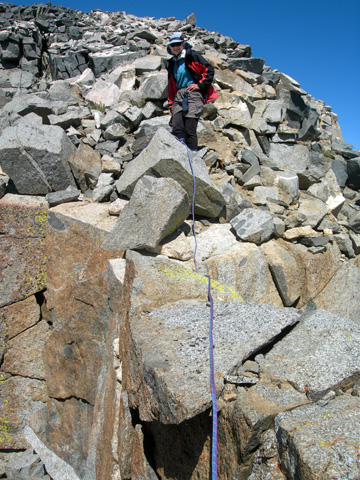
In my enthusiasm to yank off the camera case, I got carried away, and the case went flying over the precipice, nowhere to be seen. "You can say goodbye to that," Richard calmly remarked. (Secretly he was hoping to get to buy a new camera). Aah, the rope to the rescue. I was able to climb down and retrieve the case from a crack where it had luckily landed, almost out of reach.
That night we woke at 4 a.m. and watched a dazzling meteor shower. At 11,500' we had an incomparable view.
The climb of Bolton Brown the next day was a little more challenging. I've always been intrigued with Bolton Brown, Professor of Fine Arts at Stanford. Brown not only was the first person to climb (solo) Mt. Clarence King, he also explored the Sierra with his wife Lucy. In 1899, the Browns spent two months in the Sierra with their 2-year-old daughter, Eleanor. It was Bolton Brown who aptly named Split Mountain, Striped Mountain, and Arrow Peak.
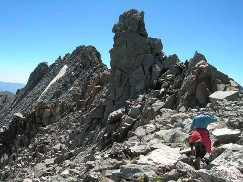
Richard and I ascended Bolton Brown via the saddle to the west of the mountain taking the mostly third class northwest ridge to the summit. The route passes over towers, some airy, and around gendarmes.
By 1:30 p.m. as we reached the summit, I saw a plume of smoke rising far to the west. By the time we were back in camp, the whole upper basin had filled with smoke, and our throats felt like we were in Beijing.
Richard had had enough exposure for the day, so we decided to descend via a second class route which proved scarier than the third class. After we watched a football-sized rock ricochet down over 1000', we opted for the more stable third class rock on the north face. I had to talk Richard down in a few spots, but generally it went well. About 600' down the face we traversed west on scree and jumbled rock, then climbed up to the tower nearest the western saddle. From there we angled down second class rock and scree to the upper bowl we had passed through on the ascent.
We got back to our campsite area after dark and, despite a full moon, spent a weary hour locating our tent. I am definitely decorating it with reflective tape after this. We slept in the next day, recovering, and then packed up to start hiking out. Our campsite that evening was high on the ridge, looking out toward Taboose Pass. We took advantage of our location to explore the lakes high above us the next day. These are essentially in a cul-de-sac and are rarely visited by hikers since they are not on the way to a peak or a trail.
On our last day, eating breakfast above a small cascade, I observe the willow seeds filling the air with their hope of new life. I imagine I am a Miwok with my load of acorns looking toward the pass for the first signs of Paiute traders. Surely it has not changed much in 150 years. Thunderstorms are threatening; it is time to go home.