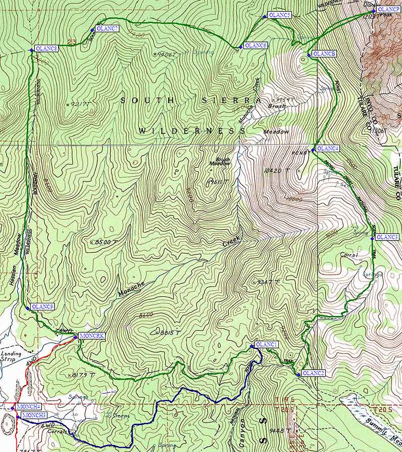
The old driving directions to Monache Meadows were enough to get us there, but with no maps and no waypoints we had some doubts along the way. I've upgraded that page, and refer to the waypoints included there (plotted on the map below). Even with an hour or two of driving on each end of the day, this was by far the easiest way I've climbed Olancha - at 12 miles round trip it fits easily in a day.
There are several places to approach the PCT from Monache, including the blue line on the map below. We chose the parking area right next to Monache Creek (waypoint MONCRK). The red line below was our driving route, the green line was our hiking route. There is a somewhat vague trail that goes east to the Pacific Crest Trail, where you'll see a wooden sign pointing north and south. Go north on this mostly gentle trail until you're due west of Olancha (waypoint OLANCHB) on a broad shoulder suitable for camping (if only there was water). Enjoy duck hunting as you wander up the face to the obvious radio antenna - it's hard to go wrong here.
We lazed around on the summit for a while, then returned to the trail. Daryn somewhat reluctantly agreed that returning cross-country would be shorter, but he extracted a promise that we wouldn't get lost and we wouldn't get back after dark. See the northern part of the green line on the map below for our route - we followed a vague crest down to the Hessian Meadow trail, which was almost a straight shot back to the Jeep. Our only mistake was not staying quite high enough by wayopint OLANC7, but even the sidehilling wasn't too bad since recent fires have cleared the brush nicely. We agreed it was both shorter and faster than returning on the trail... plus (as is always my desire) we got to see some new territory neither of us had been through before.
The end of the day was marked by a 2-inch-deep stream crossing near the Jeep, in which we saw a couple of trout hanging out. Something primitive came over me, and I scooped the biggest one out, tossing it up on land where I could subdue the beast. At 9 inches, it was worth steaming even though I didn't have butter and spices for a proper fish fry.