Ohlone Wilderness
Revised May 2011 - please send updates to the webmaster
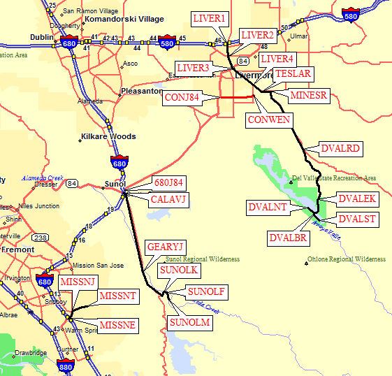
There are four GPS routes in this file, from west to east:
Mission Peak,
Sunol,
Livermore Bypass, and
Del Valle.
More detailed maps are below this overview:
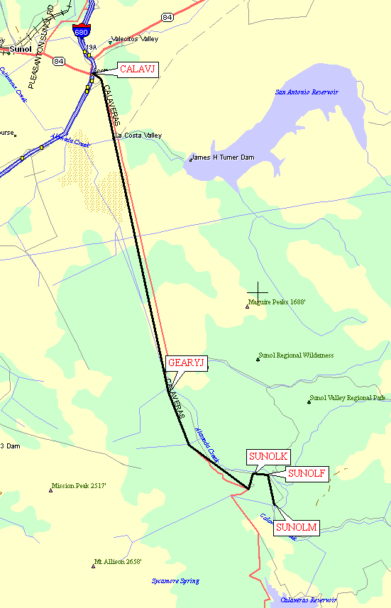
The GPS route SUNOL represents
the waypoints to reach the Sunol Regional Wilderness parking lots from
I-680 along Calaveras Ave and Geary Road. Leave I-680 on Calaveras Ave
(waypoint CALAVJ) about 8.5 miles south of I-580 or about the same
distance north of the southern-most intersection of Mission Blvd and
I-680 (waypoint MISSNE). It's about 7.5 miles from 680 to the entrance
kiosk at Sunol. The turn onto Geary Road is easy to miss - look
for the Welsh Creek Road junction and turn left at the NEXT intersection
(waypoint GEARYJ). There is an entrance/kiosk (waypoint SUNOLK)
where you must pay for parking and buy a 'permit' that is really a
large and informative map. The permit is good for a year, and the map
is well worth the money. The gates close at different times of day
depending on the season, so it's well worth checking before you go!
Park at waypoint SUNOLF for Flag Hill or Indian Joe trails, or
continue on to the end of the road (waypoint SUNOLM) for the McCorkle Trail
or the dirt road (closed to the public) up through 'Little Yosemite'
(the easiest way to reach the backpack campsites).
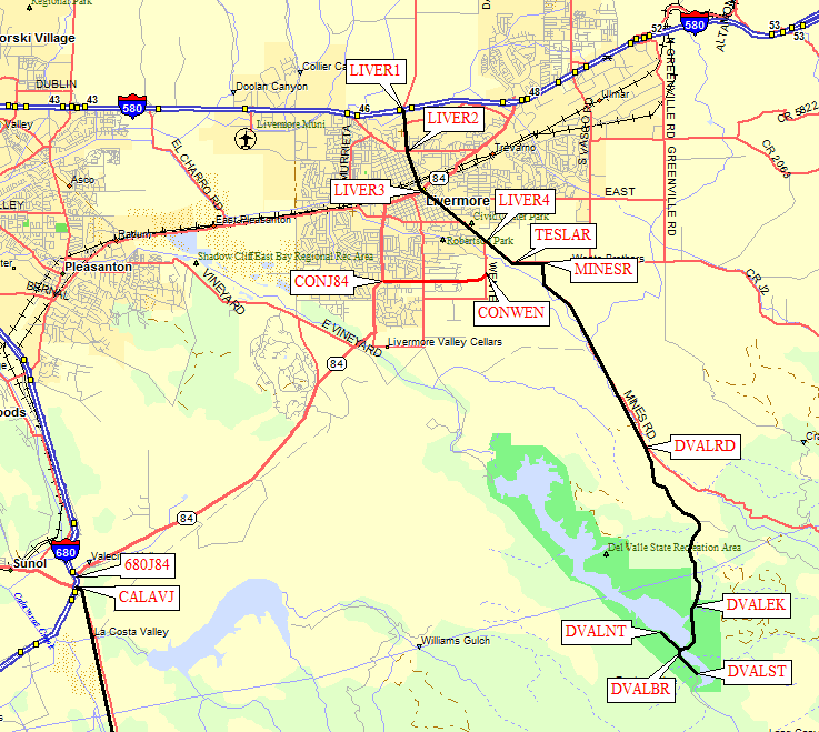
The GPS routes DEL VALLE and LIVERMORE BYPASS contain waypoints to
the northeastern end of the Ohlone Wilderness Trail. Leave I-580 in Livermore
(waypoint LIVER1, 8 miles east of I-680) going south on Livermore Ave
(waypoints LIVER1-LIVER4), or leave I-680 on Hwy 84 east (waypoint 680J84)
and go east on Concannon Blvd (waypoint CONJ84) then north on Wente St
(waypoint CONWEN) to reach Livermore Ave (waypoint LIVER4).
From Livermore Ave, bear east as the road becomes Tesla (waypoint TESLAR) and
then turn south on Mines Rd (waypoint MINESR). Bear right on Del Valle Road
(wapoint DVALRD) and follow it to the entrance kiosk (waypoint DVALEK).
The entrance kiosk isn't always open, and there appears to be no gate here,
but you will get a warning or a ticket if you park without a receipt on
your dashboard.
Go downhill from the kiosk to the bridge across the reservoir (waypoint DVALBR),
then turn right (north) to the picnic area and day use trailhead (waypoint DVALNT)
or turn left (south) to the campground near the other trailhead (waypoint DVALST).
Make sure to park ON PAVEMENT to avoid a warning citation about
catching the grass on fire. The campground entry gate apparently closes
at night but there are one-way spikes that allow you to leave after dark.
I don't know if it's legal to park overnight at the day use trailhead.
The campground trailhead (DVALST) is a steeper single-track trail,
the day use trailhead (DVALNT) is a wider and more gentle dirt road
that soon intersects the other trail.
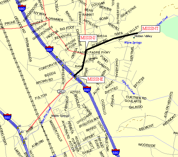
The GPS route MISSION PEAK connects the SOUTHERN intersection of
Mission Blvd and I-680 (waypoint MISSNE) to the trailhead on Stanford Ave
(waypoint MISSNT). There is another intersection of Mission and 680 which
you can use to start at the trailhead on Ohlone College grounds, but I
don't have a waypoint for that trail and most people use the Standford Ave
parking lot when doing the whole Ohlone Trail. Go north from 680 on Mission
Blvd, then turn right on Stanford Ave where one lane goes away (waypoint MISSNJ).
Look carefully for the small signs that specify hours of parking at the
Stanford Ave trailhead - there is no gate, the signs are small, the hours
are late, but overnight parking will cost you quite a bit.
Useful Links: