Donner Summit and Yuba Gap Sno-Parks
Revised Jan 2005 - please send updates to the webmaster
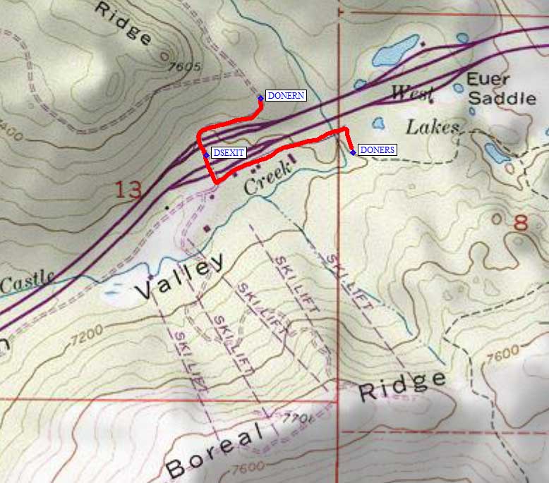
Take the Boreal Ridge / Castle Peak Road / Donner Summit exit, about 2.5 miles east of the Donner Pass Road exit (the normal way to Soda Springs) and about half a mile west of the Donner Summit rest stop. There are parking areas both north and south of the freeway, waypoints DONERN and DONERS respectively, but the north parking area isn't available when there is heavy snow. From the overpass (waypoint DSEXIT) go north or south to the first turn and parallel the freeway roughly a quarter mile to the east to reach the trailheads.
We observed people tent camping with large groups near the south trailhead. There seems to be no problem camping here except you might object to the noise and a few dogs. In the summer, this is a trailhead for the Pacific Crest Trail. In the winter, you can park anywhere between the Boreal Motel and the plowed loops.
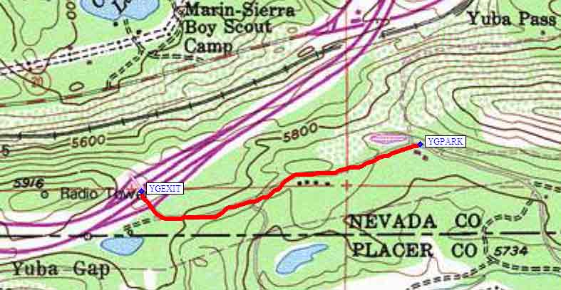
NOTE: There is another Sno-Park at Yuba Gap, which appears to have a store and other facilities, but it's only open until 5pm. The Yuba Gap exit (waypoint YGEXIT) is about 17 miles west of Donner Summit. From YGEXIT, go south to the first junction and then continue east (parallel to the freeway) to waypoint YGPARK.
Useful Links: