Organ Pipe National Monument:
(Kino Peak and Mount Ajo)
Revised Mar 2009 - please send updates to the webmaster
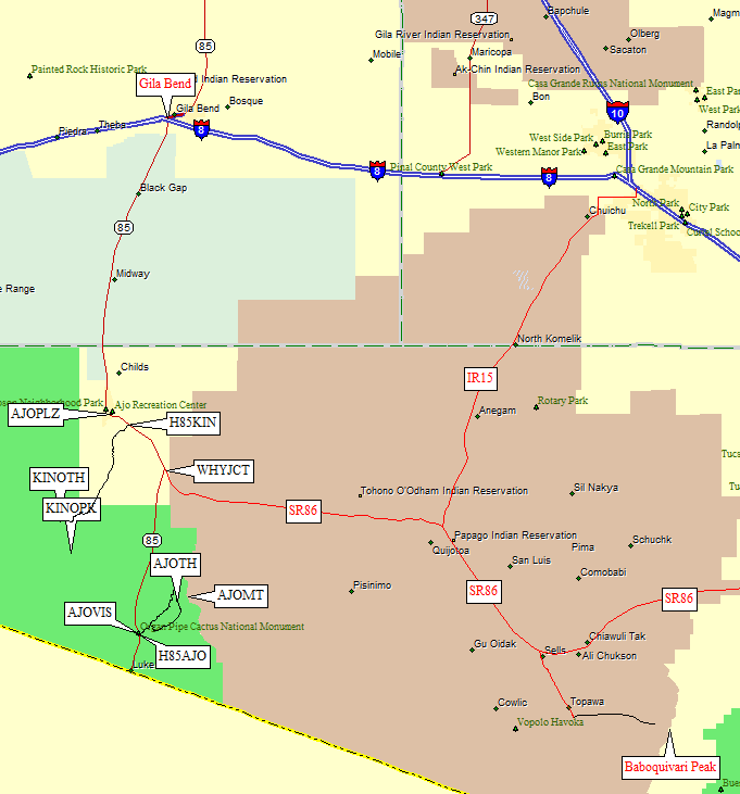
Drive or fly to Phoenix, then take I-10 west and Hwy 85 south through Gila Bend (at the intersection of Hwy 85 and I-8). Continuing south on Hwy 85, go through the town of Ajo (waypoint AJOPLZ) to the junction with Hwy 86 in the town of Why (waypoint WHYJCT). This is significant because you might be bored with the drive and need to ask why about something to pass the time. It is also significant because you would take Hwy 86 east from Why to Baboquivari if you're doing it also. Since you're almost to the border, you can continue south on Hwy 85 to climb Cerro Pinacate in Mexico.
Scroll down for trailhead details on Mt Ajo and Kino Pk. We liked the reasonably priced La Siesta Hotel in Ajo - nothing fancy, but it's got a pool and spa, and it's apparently cleaner than most in the area. It's not huge and might fill up unless you have reservations.
Warning: Editorial paragraph follows! In 2008 the visitor center told us that the area around Kino is closed. There are so many illegal immigrants and smugglers that instead of winning THAT battle the border patrol and the rangers threaten to give U.S. citizens tickets instead. It seems easier to control the legals than the illegals. HOWEVER... In 2009 we went straight to the Kino trailhead (carrying our National Parks Pass so we weren't dodging the fee). We were dropped off and picked up, so we didn't leave a vehicle at the trailhead. Linda, our generous driver, had almost a dozen Border Patrol or Park Rangers stop to talk to her while she was waiting to pick us up. None of them said it was wrong to be there or to be climbing. They said they caught 14 illegals with drugs just down the road from where she was waiting. The trail over the pass near Kino is littered with water bottles and other junk. The danger is real. The closure apparently is not.
Roads leading to Organ Pipe:
|
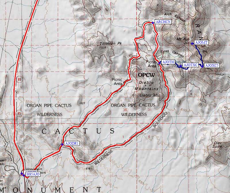
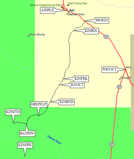
Our trailhead (waypoint KINOTH) was 19 miles from Hwy 85. This was
our best guess about where the DPS Guides's Route B starts... but we
wished we hadn't followed their instructions on how to start walking.
You can watch the mileage (ours didn't agree with the DPS Guide) or you can
watch for a short stretch of road that goes DUE SOUTH, then turns southwest
and approaches a band of trees in a dry drainage. Stop before the trees, between
Point 1405 and Point 1364 - those bumps mark the entrance of the wash.
Don't bother trying to find a trail or a track near the road to start hiking. We found a faded sign on the ground saying "Vehicles Prohibited / Natural Restoration Area", which is a good landmark for meeting up again later. From the trailhead, head due south a quarter mile into open terrain, then enter a wash that tends southeast toward the saddle between Point 1601 and Point 1823. It's all easy walking here, so keep it simple. |
|
One final note: You won't want to leave a vehicle here. Bring a driver to drop you off and pick you up. There is too much illegal activity around to risk leaving a car! While we climbed Kino (Feb 2009), the Border Patrol were catching over a dozen people near us. With drugs. See note above! Try not to surprise anyone you might meet out there.
Useful Links: