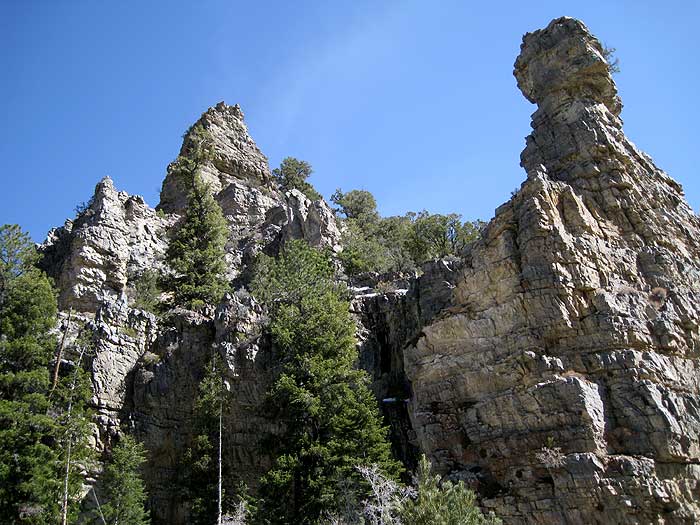
| We left the trailhead before 7am, walking up the old road into a wash. Before long it's clear that this road has been impassable to vehicles for quite a while. The footing is often loose even for pedestrians, especially starting at 6.7k (waypoint DEADC2). Your reward is very cool canyon walls (spires, cliffs, etc) above 7k (waypoint DEADC3), and a remarkably nice Ponderosa forest above 7.4k (waypoint DEADC4, 3.6 miles from the trailhead). It might be fairly cool here even in the summer! There were still patches of snow on the ground where Hidden Forest started. |
Overall map, see below for peak details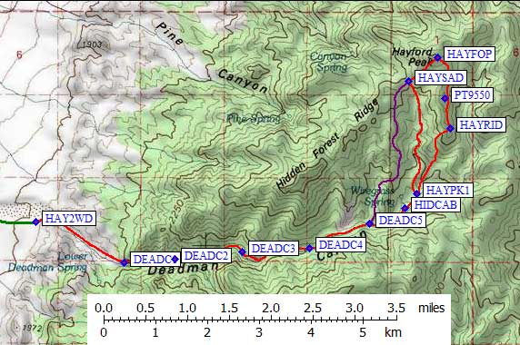
|
Deadman Canyon walls
|
Ignore the ducks and the side drainage just above 7.6k (waypoint DEADC5).
This is not the right canyon or ridge! John reports having climbed this before,
and while it does work there is either a long sidehill or some up-and-down
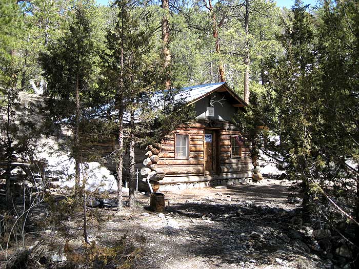
near the top. Hidden Forest Cabin (waypoint HIDCAB, just over 7.8k) is south of
Wiregrass Spring, and there is actually a water hose and bathtub normally
fed by that spring! In 2009 the spring went dry, and in April 2010 it was
barely dripping, so be sure to check with the Wildlife Refuge (702-879-6110)
before counting on running water at the cabin. There were furnishings and
bedding in the very clean cabin, but I'm not sure who gets to use it or if
the mice want to share.
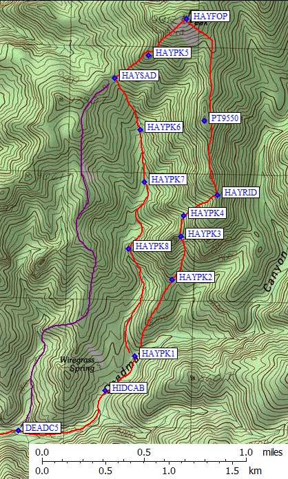
Continue northeast around the right side of the cabin and into the next drainage. There is a fork at 7.9k (waypoint HAYPK1), where you can either bear northwest and stay in the drainage or go north up the toe of Hayford's south ridge. The drainage has better footing for much of the way, the ridge has better views. We went up the ridge and down the drainage, a good choice if you plan to do both routes as a loop. It's nice walking up the ridge until about 8.4k (waypoint HAYPK2), where it gets very brushy and you'll want to sidehill in draw to the right of the ridge. Follow that draw up to the 8.8k saddle to the west of the main ridgeline (waypoint HAYPK3), then go north without gaining much altitude until you enter another draw (waypoint HAYPK4) leading northeast back to the main ridge at a shoulder just above 9.2k (waypoint HAYPK5). I don't think this route matches the DPS Guide, but I do think it's the easiest footing because it avoids rocks and brush on the ridgeline. We traversed on the east side of Point 9550 and slogged through a bit of snow at the saddle immediately south of the peak. For the most part, south-facing slopes were clear of snow all the way to the summit. |
|
We reached the 9912' top of Hayford (waypoint HAYFOP) at 1230pm, which is dominated by huge solar cells and antennas. Another non-wilderness experience and enough radio interference to keep cell phones from working (even though we had 4 bar signals). We left the summit at 120pm, heading southwest on a use trail that cuts nicely through the heavy brush. We went around the north side of a bump (waypoint HAYPK6) and down to the major 9.1k saddle with Point 9290 (waypoint HAYSAD). It's a fast downhill romp in forest duff from here, but going up you'd need to pay close attention to branching drainages.
We got back to cabin at 240pm, picked up water we had left cooling in a snowbank, fired up our MP3 players and got back to the trailhead at 440pm with no major stops. John was worried about his first long day of the season (at 10 hours including almost an hour on the top it wasn't really that bad) and I was worried about an altitude headache (which that hour on the top really helped), but we both enjoyed the scenery and had plenty of sunlight left for the drive out.
Hidden Forest Cabin