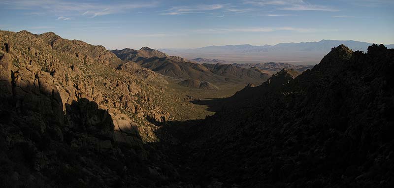
Kingston Wash from the first saddle (KINGS5) at dawn:
|
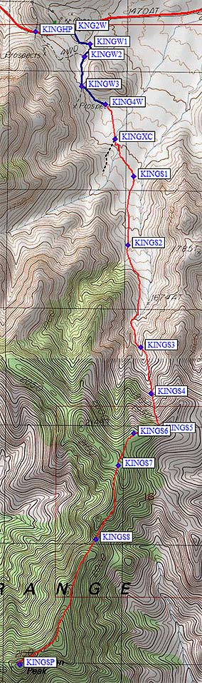
Once you've found the right approach, the hiking is straightforward. Go up the wash, go right on the ridge, go across a plateau, and follow that ridge to the summit. The devil's in the details! If you walk too far on the 4WD road you'll end up climbing too much and either going up the wrong wash traversing back into the right wash, maybe hopping boulders along the way.
Walk or drive up the 4WD road to waypoint KING4W and head SSE from there. We found it easier to hold altitude and drift toward the center of the drainage, turning due south around KINGS1, because this takes you around that boulder field. Down low, the west side of the wash seems to have the least brush. You can't walk a straight line but you shouldn't have to push through walls of branches either. At least not for a while. Around KINGS2 the walking is quite nice. The further you go into the wash, the taller and the thicker the brush gets. Wear long pants and consider DEET - I got a tick somewhere in here, which apparently hitchhiked out and bit me during the drive home. The brush on the west side will eventually convince you to walk down in the drainage for a while, but be sure to climb out on the east side around waypoint KINGS3. Stay 50-100' above the bottom, on the east canyon wall, to almost entirely avoid the brush. By waypoint KINGS4 the brush will be gone and you'll be climbing steeply to the ridge.
When you hit the ridge (waypoint KINGS5), have a nice break and enjoy the view. Then stay on the noth side of the ridge (below ridge pinnacles) on a use trail until you come out on the ridge plateau (waypoint KINGS6). The map makes it look like you can walk anywhere here, but the map doesn't show the gendarmes! Cross the broad plateau, the easiest walking of the day, to a broad saddle at wayoint KINGS7. This plateau has recently burned, and will probably get brushy if it recovers. For now, there are only dead trees and small bushes. At KINGS7 you'll see the sawed stumps where the fire fighters made their stand. Successfully! They also left a large cache of water bottles in one of those stumps, which may or may not still be fit to drink. I found it odd that there were no seedlings. I wonder how long it may take for this area to recover, if ever? We tried traversing around KINGS7 on the way out. Bad idea. Go over that saddle, regain the ridgeline as you go south, and drop steeply down to the saddle at KINGS8. This is the lowest point on the ridge, but it's not the only place you'll drop on the way in. South of this saddle, stay mostly on the left (east) side of the ridge, but not too far from ridgeline. The ridge tends to be rocky with obstacles, the east side has the brush burned off, the west side is older plants. Take your pick! We got to the summit in just under 4 hours (at 10am). It was already in the high 70s, with occasional light wind, and we were glad we started early. The round trip was about 7 hours of walking with 3400' of gain. |
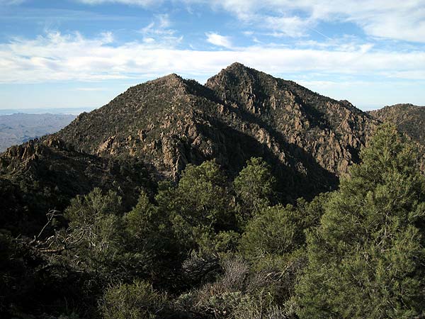
Kingston Peak from the firebreak saddle (KINGS7):
See the trailhead page
for driving and climbing waypoints!