We followed the driving instructions out of Beatty using Zdons' Desert Peaks Guidebook and the DPS Guidebook in order to find the correct dirt road to turn off of Hwy 95, but we got antsy and turned a little early onto the wrong dirt road. The correct dirt road is 0.6 miles beyond signpost 71, but is not marked by any signs even though Zdon says it's called Phinney Canyon Road. There is another dirt road on the other side of highway 95, opposite Phinney Canyon Road. This should help confirm that you found the right road.
For us, following the wrong road for awhile got us on a small plateau that provided a viewpoint for a spectacular sunset over the Grapevine Mtns.
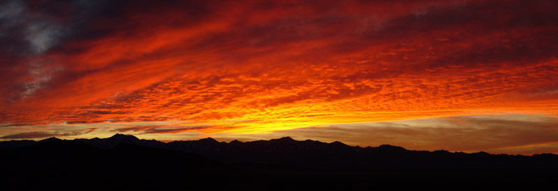
Sunset over Grapevine Mountains - photo by Steve Eckert
Once on the correct road, the Zdons' driving instructions say to stay straight driving west towards the Grapevine Mtns. There are numerous dirt sideroads along the way. Ignore them all and always take the straightest line. Eventually we passed a cattle guard, a fence, and a sign indicating we were entering Death Valley National Park. The dirt road was in good shape up to this point, but got rougher as we continued. Following the Zdon instructions, we turned right 12.3 mi. after leaving the highway and continued about 8 more miles into a small valley called Phinney Canyon where the snow eventually got too deep on the road to continue driving. We camped right there beside the road. This spot was at an elevation 6400 ft, roughly a mile short of the 2WD parking area described in the DPS Guidebook.
The next morning we hiked up the snow-covered road in snowshoes about 2.5 mi. to a 7520-ft saddle.

Hiking up the road in snowshoes. The reflective triangle on the daypack is to help avoid collisions with faster hikers approaching from the rear. - photo by Steve Eckert
A couple of stark differences in the landscape could be seen from this saddle. To the east from where we came, the hillsides were covered by a pinyon-juniper forest. To the west down towards Death Valley, the terrain became immediately desert-like and almost barren of life. Also, looking to the north, the south-facing slopes were almost completely devoid of snow whereas looking south, the north-facing slopes were almost completely snow-covered looking like a winter-wonderland.

Steve on ridgeline to Mt. Palmer
We kept our snowshoes on for the next half-mile as we turned south from the saddle following the ridgeline. This was the slowest part of our hike, as we post-holed our way up some tedious 3-4-foot deep snow drifts. We then sidehilled below Point 7980+ towards the saddle on the California-Nevada border. The snow was patchier along this section affording easier travel and less post-holing. The ridgeline now continued southwest over Point 7780+ to another low point in the ridge. It was here we had our first good look at Mt. Palmer still 2 mi. away. It was also here Jeff decided the whole hike was just taking too long and turned around. Jeff had to be back in the Bay Area by the next day.
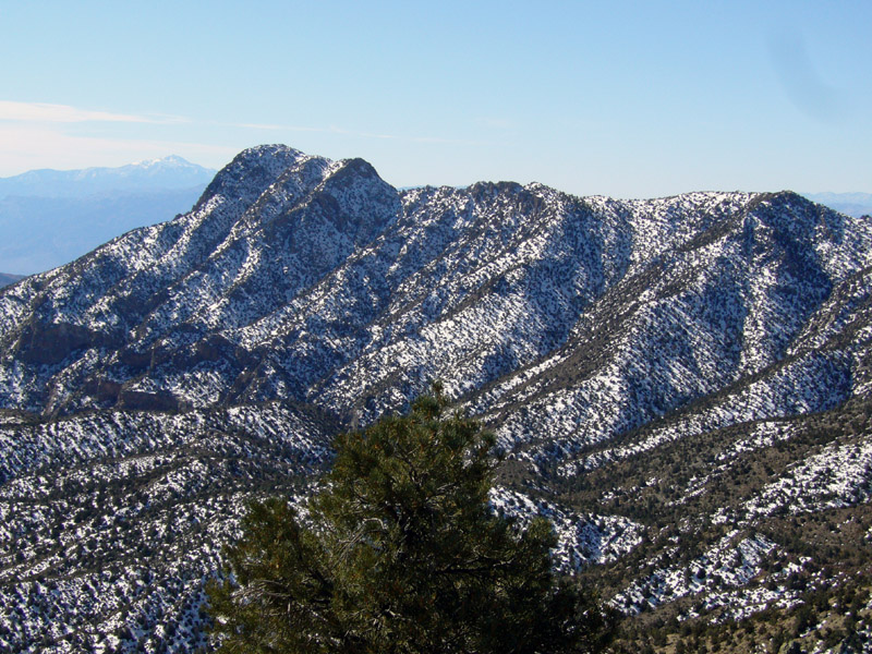
First view of snowy Mt. Palmer. Is it really still that far away? - photo by Steve Eckert
Steve and I continued on after a short break following on or close to the ridgline. The brush became more of an issue than the snow, but was not quite dense enough to call it bushwhacking. However, a faint use trail eventually appeared in places between the snow patches and we made faster time. Within a half-mile of Mt. Palmer we could now overlook part of Death Valley from the ridge. The air temperature rose appropriately, making the hike close to uncomfortably warm.
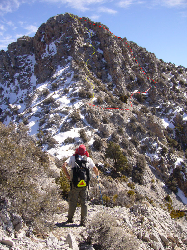
Summit mass of Mt. Palmer. Yellow line is the class 3 route, red line is the class 2 route. - photo by Steve Eckert
The class 3 portion of the climb near the summit was not difficult, even with some snow patches to slog through. Some volcanic peaks, such as Mt. Palmer, can have an excess of crumbly rock. But enough of the rock on the class 3 section of Palmer was solid for a short, but enjoyable climb. Just test every rock before putting weight on it.
The summit view was fantastic. It had amazing view of almost the entire length of Death Valley.
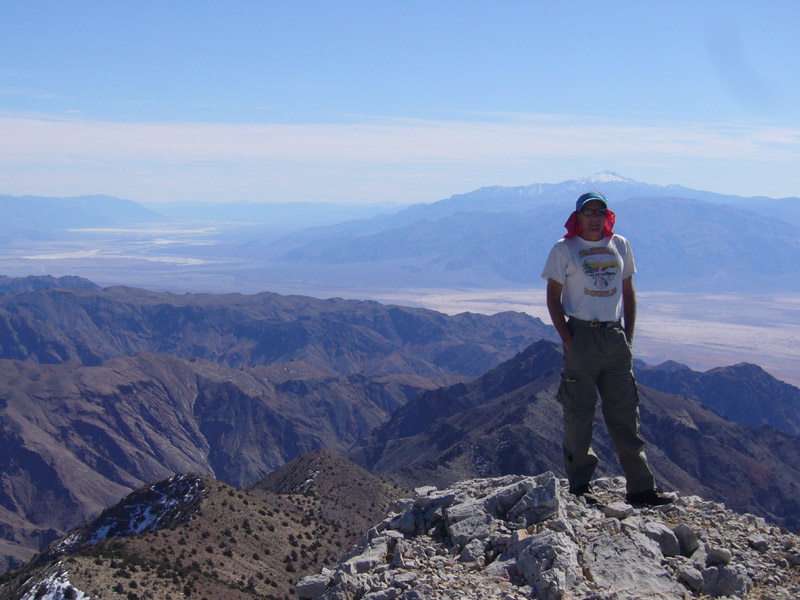
On summit of Mt. Palmer. Death Valley and Telescope Peak in background. - photo by Steve Eckert
After a 40 min stay, we back-tracked our outbound route until the California-Nevada border. We then followed the ridgeline up towards Point 7980+ instead of contouring below it. The ridge that descended to the road NE from Point 7980+ was completely snow covered and Steve thought it looked like it would be good for snowshoeing. Sure enough, the powdery snow provided a wonderful plunging descent on snowshoes back down to the road. We got back to camp at 5:40 pm, making for a 12 mile, 11 hr 10 min round trip hike.
In the morning we headed for Grapevine Peak, the highest point in the Grapevine Range, Hiking back up the road, we turned NW straight up the hillside about 1/3 mile before the saddle. We followed on or below the ridgeline towards the peak passing interesting volcanic rock formations along the top. Although the south facing hillsides were bare of snow, the north facing slopes that we could not see from the Phinney Canyon area was covered with snow. Some places had deep, 3-4 foot drifts of powder. We knew this because we occasionally post-holed up to our waist. When we started up Grapevine Peak itself, the snow was more compact and easier to travel over.
The summit has an absolutely stunning panoramic view of the Nevada desert.
On our way back down, we came upon a jackrabbit sitting absolutely still among the trees. The rabbit thought we could not see him/her if he/she didn't move, but when we got too close, the rabbit hopped away. But not before Steve snapped a picture of him.
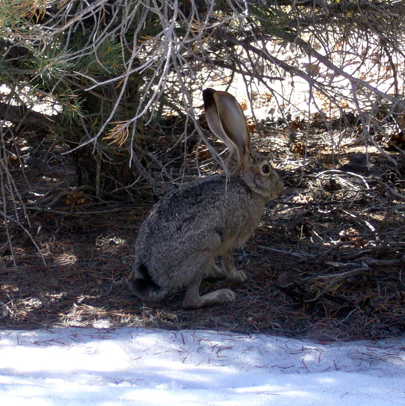
Grapevine rabbit. - photo by Steve Eckert
We took a more direct route back towards the road walking a narrow wash where we saw our first running stream of the trip. Well, it was actually a trickle fed by snow melt, but it was the only running water we saw in 5 days. A little further on was an old test hole some prospector had bored into the hillside. I got out my headlamp to investigate and found it continued for about 100 feet into solid rock before it ended.
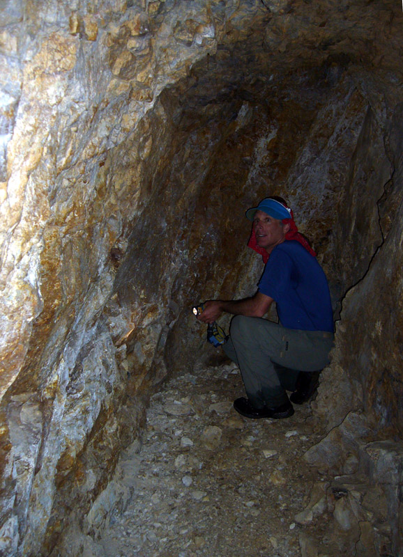
At the end of the tunnel after only 100 feet, no mother lode here. - photo by Steve Eckert
Today's hike was only about 6 hours and not nearly as strenuous as the Palmer hike. Anyone attempting Palmer later in the year when there is no snow should bring lots of water, as it gets hot in the Grapevine Mtns and there will be no running water in Phinney Canyon.