To get there, take Hwy 120 east where it leaves Hwy 395 and follow it past the Mono Craters, eventually turning right onto Sawmill Meadow Road. It's a dusty dirt road from here, but appears passable for passenger vehicles. The view of Glass Mtn from this turnoff is quite impressive. There are several intersections on the way, but just keep following the signs to Sawmill Meadow. The road ends at the Sawmill Campground. Surprisingly, this campground was in a very pleasant forest setting, not at all a desert-like. However, the nearby lake/marsh had already dried up for the year, and no local water supply appeared available. The campground has been used in the past as the party location for DPSers who had their list finish on Glass Mtn.
From the campground, the summit plateau can be seen above the trees, so we started out by heading directly for the summit. We soon veered to the right towards an obvious ridge of Glass Mtn., northwest of the campground. The footing looked more solid on the ridge than with a direct assault to the high point. This mountain is composed entirely of volcanic rock, much of which is obsidian, thus giving the mountain its name.
Once on the ridge, we took a short break in the shade of a tree. Continuing up the ridge we soon left the trees behind and the ridge got steeper, but the entire climb remained class 1-2 in difficulty. The ridge suddenly leveled out onto a plateau, where we could see a metal or stone hut on the named summit to the north, and the actual high point of the mountain to the west of us. We headed for the high point on the plateau.
Panorama of summit plateau (high point on the left). Photo by Steve Eckert.
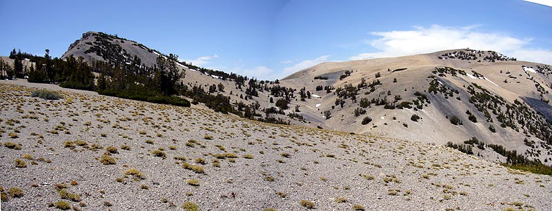
A use trail appeared at a minor saddle just before the final climb to the summit. We were soon on top enjoying the magnificent view of the Sierra Crest to the west. To the east, the desert peaks of Montgomery and Dubois loomed larger than I had ever seen them before.
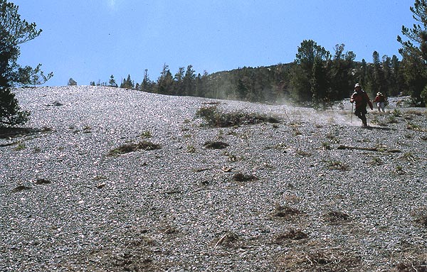
Leaving the summit, we retraced our steps more or less back to the edge of the plateau. From here, we left our ascent route and took a direct line towards the campground we could see far below. The route back was steeper, but worked better than expected. And the route allowed for a unique opportunity: plunge-stepping down through an extensive obsidian scree slope.
Steve and Tim plunge-stepping down an obsidian scree slope sparkling in the sunlight.
Normally, this climb would involve a bit a snow travel at this time of the year (late May). We had none. And the road could have been blocked by snow near the campground. However, the lower than average snow fall during winter left the snow pack at its lowest since 1988.