| (1995) | The Enchanted Ionian | (pre-Climb-O-Rama) one-way trip from Florence Lake to South Lake |
| The 10-year history of Climb-O-Rama's: | ||
| 1996 | Great Western Divide | first trip named 'Climborama', over Shepard Pass to Milestone Basin |
| 1997 | Climborama 97 | a decentralized affair in the Evolution region |
| 1998 | Duke Newcomb and the 16 Peaks | the most prolific Climb-O-Rama ever, in the Whitney area |
| 1999 | Mosquito March '99 | subgroups forming and dissolving from Taboose Pass to Cartridge Pass |
| 2000 | Climborama V | rain and hail ended this Kearsarge Pass and Center Basin trip early |
| 2001 | Climb-O-Rama 2001 | Crowd-O-Rama had a very large group, from Bear Creek to Lake Italy |
| 2002 | Lawd Have Merced | a one-way congenial trip from Yosemite Valley to Tuolumne Meadows |
| 2003 | From Roaring to Lion (The Triple Trip) | our exit was blocked by a forest fire on this Colby Pass area trip |
| 2004 | WESTERN Great Western Divide | unrelenting bad weather on the seldom-visited side of the Milestone Basin |
| 2005 | Climb-O-Rama X (Black and White) | horses made the approach to Blackcap Basin and White Divide easier |
Daryn found out you can drive up to Voyager Rock instead of hiking from the Maxon Trailhead... but he also found out it was a nasty road with huge frame-scraping boulders. Still, he was kind enough to shuttle the group in his Jeep and save a couple of miles! See the Courtright Reservoir trailhead page for details and waypoints.
Our first day involved somewhere around 3500' of gain and 21-24 miles depending on which source you trust. Ron went a day early to break up the long day, the rest of us spent under 10 hours hiking with daypacks. Two of us walked in trail shoes until lunch, then cached them for the walk out and switched to hiking boots.
Slabs near Big Maxon Meadow:
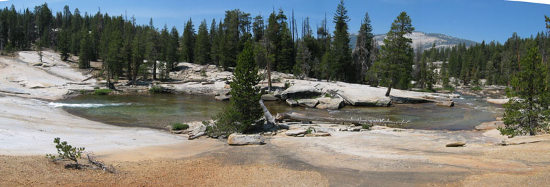
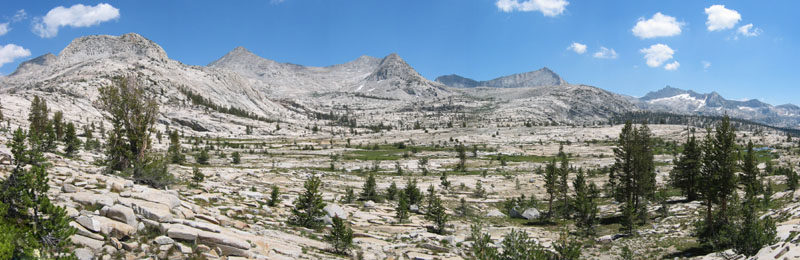
The hike up the North Fork of the Kings River was more scenic than some of us expected. Great slabs and pools around Big Maxon Meadow, a fair amount of shade from tall trees, and not too many switchbacks. Our camp at Portal Lake (10300') was gorgeous! A few bugs, a light breeze, a good sunset, and flat granite slabs for cooking and camping.
We only did about 4 miles with full packs, and perhaps another mile with day packs, so this was a nice easy day after the long first day. Good thing, too. It rained from mid to late afternoon, clearing long enough for dinner.
Instead of dropping into Crown Basin and going over the pass east of Hummingbird Lake (as I did in 1999) we chose go to around the north sides of Midway and Cathedral lakes, crossing the White Divide NW of Finger Peak.
Cathedral Lake, Finger Peak in the back by the clouds:
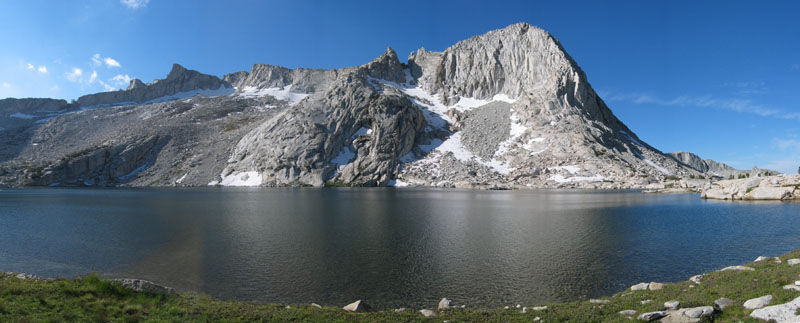
Slabs and a few boulders lead you to the obvious gunsight notch in this ridge from either direction. (This notch is visible toward the left of the picture above, under the clouds.) The packer called it a keyhole, but it's a large notch with no top like a real keyhole. The traverse of the north face of Finger was done staying about level with the notch (11.5k), hopping some large and moderately unstable boulders or kicking steps in the permanent snowfield.
The saddle just east of Finger Peak still had snow on the north side, but the south side was easy slabs and boulders if you swing slightly SE and drop to the tundra before heading down Blue Canyon. Visible rain storms and lightning kept some from doing the peak. Those who did bag Finger got rained on before we got to camp at a small tarn (10.4k, due south of the peak).
|
This would have been a good trip to bring a tent, but I've been
using a bivy for about a decade now and as always it was waterproof.
The condensation was more of a problem than usual, because it got
cold enough at night to freeze the rain/dew, closing the goretex
pores and leaving my down bag a bit sodden.
We camped two nights in the wonderful high alpine setting of upper Blue Canyon. Monday morning dawned solid overcast. There was rain and cloud-to-cloud lightning overnight. I had already climbed Tunemah, and my plan to climb an interesting un-named peak drifted away with the morning mists. No way I was climbing in the rain.
|
Finger Peak from our campsite, after a rain shower: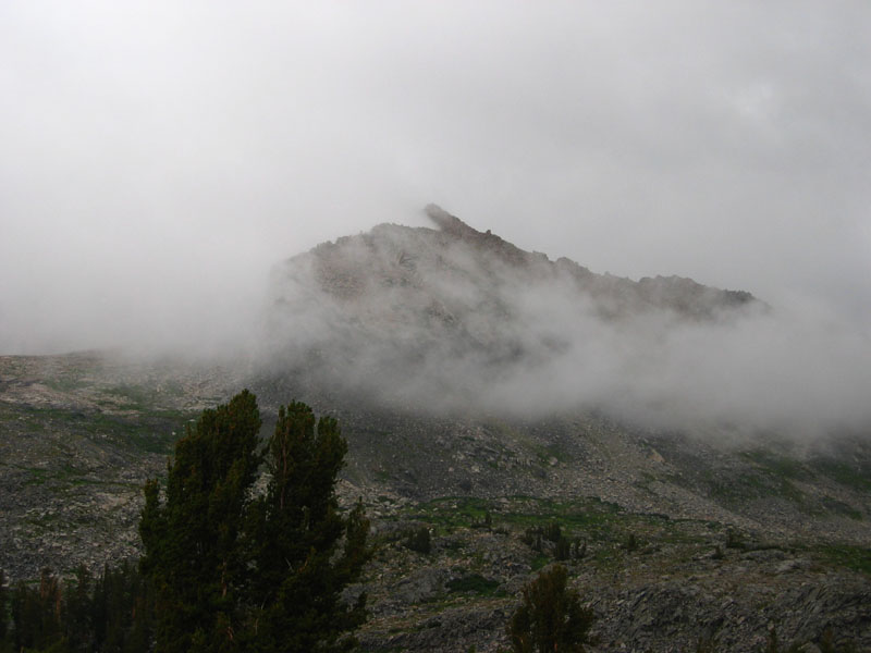
|
Bob, Daryn, Jim, and Lisa, however, got up and about and psyched each other up. Shortly after they left it rained briefly. Then it got nice. Then it rained. Then it got nice. Then it rained the entire afternoon into the evening. They got the peak (returning soaked but happy) while the rest of us got a lot of nap time.
Packing back over Blue Canyon Pass (east of Finger), most of us made a detour to climb Blue Canyon Peak. I wanted it because it had a name and because it was NOT on the official SPS Peaks List. Aaron and Chris went for Finger while Daryn and I went for Blue, the others left camp at least an hour after we did and we didn't re-assemble until we were well down the other side of the pass.
The only trick about Blue Canyon Peak is not to stay too high. There are nice grassy ramps leading up from the tundra, but they start considerably below the pass. The later group took their packs up to the pass and seemed to spend more time traversing due to boulders and slabs. Oh, yes, well, there was that verglas (French for 'black ice') on the rocks up high. Peaks like Goddard had a significant coat of snow from the previous day's storm... but the upside was the mosquitoes were never again very bad. Perhaps the freeze killed some??
Five of us assembled at the pass and headed down the standard route to Goddard Creek - swinging to the west and avoiding the cliffs directly north of the pass. This was really great walking on slabs (high) and tundra (low), with the bonus of some really cool tarns and lakes that had only recently melted out and had no bugs to bug us while we had lunch and soaked our feet in the cool water!
The other group of three chose a steeper route with more talus, swinging east on their way down. They made better time and when the hourly radio check came around we decided to meet at a lake around 10.3k. Surprise! They were doing lunch and water at 10.6k and I was eager to explore a waterfall we had seen from the peak, so we waited to regroup.
The terrain between 10.6k and 10.2k was very interesting, with short cliffs and long narrow lakes at right angles to our direction of travel. We stepped across a creek just above the ~40' waterfall I was looking for, and then we all got together at about 10.1k and stayed well above the stream on easy slabs, cutting around the corner into Goddard Creek Canyon (saving a couple hundred feet of climbing).
Looking back at Finger from 10.7k, and looking toward Ionian Basin from camp:
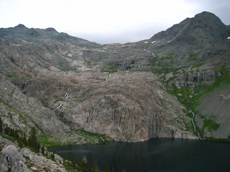
The un-named drainage which flows north into Goddard Creek from the north side of Finger is well worth a visit. Goddard Creek is, at this elevation, grassy meadows with occasional slabs and enough trees to make it interesting without making the walking tough. Stunning. The head of the canyon is a large lake at 10.3k which looks like it could be in Alaska! Large waterfalls cascade thousands of feet down from the Ionian Basin across strangely dark rock with no rubble or plants. It looks out of place for the Sierra.
Our camp (at 10.8k, west of Lake 10232) was referred to as something from a Lord of the Rings set. We got there just as Tuesday's storm started to dump, and put up tents in a drizzle that became a steady rain. Once again it cleared for dinner, but overnight the fog and dew were as heavy as I've ever seen it in the Sierra.
With the peak and 7 miles of cross-country backpacking, this was a long enough day to avoid boredom but not so long that we were exhausted. People stayed up after dark talking.
|
Three Sirens, Scylla (middle), Ragged Spur, behind Lake 11818: (taken on the way back from Goddard, the next day) 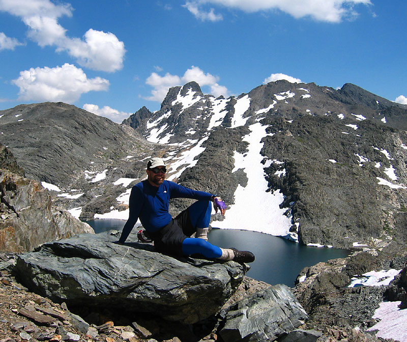
|
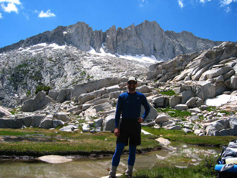
A snowfield blocked our intended route around the lake, but the rock here is forgiving and we found a pretty efficient line to the base of Scylla. Once again battling verglass on the rocks, we found it easier/safer to kick some steps in the snow. Bob, Daryn, Jim, and I went on to the high point of Ragged Spur (sometimes called Hansen Peak) which is complete with a plaque or two from the Hansen family. Lots of butterflies on both peaks, and great views down the Enchanted Gorge. |
Everyone got back to camp before it rained. Or did it just spit? Either way there was time for a dip in the many ponds around our lake before the standard evening clouds and wind came up.
Aaron and Daryn headed to Reinstein (both having climbed Goddard before), Ron and Bob settled in for a rest day, and the rest of us headed back past Lake 11818. This time we turned northwest there and went past the permanent snowfield above Lake 11951 on our way to the southwest ridge of Goddard. There was a steep-looking patch of snow at the base of a talus chute, but the snow was kick-step-solid and the loosest talus/scree could be avoided by staying on the edges.
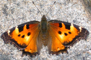
A juvenile Cooper's Hawk looked down at us, and California Tortoiseshell butterflies were everywhere:
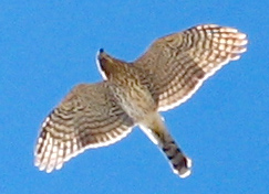
| NOTE: There has been much post-trip-report disagreement about what bird this actually was. Is it a Peregrine Falcon or a Cooper's Hawk? One reader spent some time banding birds and is sure it's a juvenile Cooper's Hawk. The person on the mountain with me who originally identified it as a Peregrine Falcon saw things you can't see in the picture: "deep and very fast wingbeats that distinguish the Peregrine from the Coopers" and "distinctive black helmet with the sidecut". I didn't see the helmet, and the throat coloring seems more like the hawk pictures I've looked up, but hey, what do I know? I know The Canadian Peregrine Foundation has a Cooper's Hawk ID Page and a Peregrine Falcon ID Page where you can clearly see the helmet and the coloring, but wing shape isn't so obvious. Happy researching! |
In no time we were scrambling across the notch to the (10 feet) higher northeast summit. We marveled at the precipitous northwest face, the many lakes, the many butterflies, and the warm wind-free conditions. About an hour and a half went by before we could tear ourselves away. I guess I'm getting old, but lounging on a peak now seems more appealing than trying to run across the basin and bag a second one.
Aaron and Daryn, having just done Reinstein, headed over Reinstein Pass and Valor Pass, then across Blackcap Basin toward Guest Lake. Ron went over the first two passes, decided he had enough, and headed down Lightning Corral Meadow to the trail (we never saw him again but a note at the Meadow Brook cabin assured us he was safely on his way home). The rest of us went up the east ridge of Reinstein and partway down the north ridge before returning to our packs at Reinstein Pass. Radios were very useful in knowing where everyone was and where they were headed!
We really liked the east ridge of Reinstein. The face between the two ridges is 2nd class, but the ridge itself is fun 3rd class boulders. Shouldering packs again, we tried to stay high on the traverse to Valor Pass. That was a mistake. Daryn had picked a better line by dropping over 100' down and coming back up.
In spite of Secor's description saying the southern approach to Valor Pass is on talus, we walked slabs and tundra all the way to Blackcap Basin. Nice! There's a large flat (developed) campsite where the stream levels out below Ambition Lake (around 10.6k), and then it's swamps and slabs and little rises for over a mile across upper Blackcap Basin to the base of Blackcap Pass. Volcanic rock and sand let you know you're not in Kansas anymore!
Blackcap Basin from the base of Blackcap Mtn:
We dropped our packs at the pass and scooted over to Blackcap Mtn. Daryn and Aaron were returning from the summit just as we got ready to head up (we'd been trying to catch up with them all day) and provided useful beta about staying off the ridge until you get close to the peak. Blackcap seems like just a bump on the ridge, but in fact the view is great and the black volcanic rock that makes up the 'cap' is very interesting.
The west side of the pass is easy walking but looks improbable as you wind your way down very steep slabs on very reasonable ledges. We went more or less down the center, but I think there's another option on the south side of the drainage.
Angling down around Guest Lake in pleasant forest duff, we regrouped at the outlet and decided to drop further before setting up camp. People were worried about a 15 mile pack out the next day. Daryn had found the Guest Lake trail while waiting for us, and we followed it the rest of the way down to the main trail. We found a beautiful flat forested shoulder at around 9300', stopping around 5:30pm for dinner and staying up late around a small campfire.
The 7.5' topo doesn't show a trail following Fall Creek (which also drains Guest and McGuire lakes) down to the main trail, but older maps do. We followed a faint use trail and frequent ducks staying within sight of the river down to about 8600' before cutting south in the forest to join the main trail. There's no sign at the junction, but there were some rocks arranged to indicate a 'Y' intersection if you were looking for them. Even without the use trail, the terrain here is easy and it's miles shorter than the trail shown on modern maps. (The newer trail apparently climbs up to the ridge after it pulls away from the stream, but we didn't see that intersection even though we noticed the trail we were on got smaller - there are some vague places, one of which probably had a junction we didn't see.)
|
Once we hit the main trail we were off and running. We made well over 2 mph and reached the cars shortly after 1pm... far earlier than the 8pm pessimistic estimates the day before (when people were trying to decide whether to walk until dark). The North Fork trail is very fast walking because it's not steep. It goes up and down, but always at a reasonable grade. |
Domes near Big Maxon Meadow: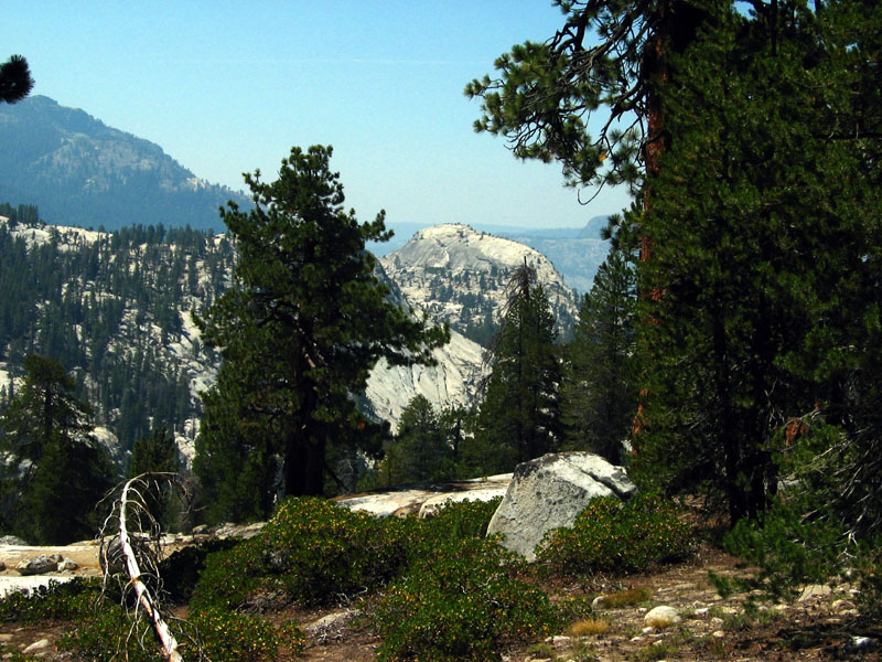
|
This Climb-O-Rama stuck closer to the planned itinerary than any I can remember. We didn't get the most peaks ever, but we had a good time and I'd like to thank everyone who helped make it work!
This is unlikely to become a standard practice for me for two reasons: First, it was over $100 each. Second, there aren't that many places where peak climbers want to walk over 20 miles on relatively flat terrain the first day. Oh, and third: The rules kept shifting and we had to keep re-negotiating to keep the cost from rising. We didn't leave the trailhead anywhere close to when we planned, finally getting underway around 9am. Still, it saved us a full day's hiking with heavy packs.