Today I woke up feeling ill, so I ditched school. By the time noon rolled around I was feeling better and had nothing to do but homework. After taking care of some long put-off errands, I headed up to Oakhurst, armed with computer generated maps for no less than 10 different mountains, all of them within a few miles of each other, and all easily accesible!
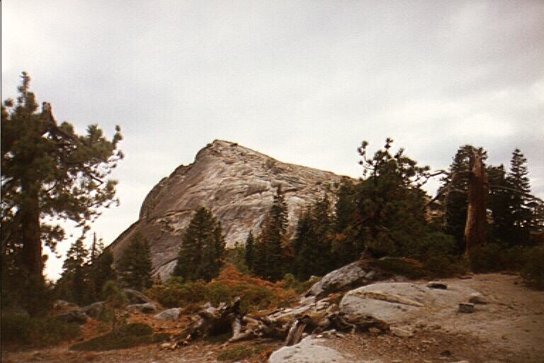
My first objective was 7,540 foot Fresno Dome. The directions I got from Bill Edmund of the Central Sierra Climbing Association (meets every third Wednesday of the month at California Outfitters in Fresno) said that the drive from Fresno was about an hour and a half--maybe from the north side of town. My drive took almost two and a half hours, with the last part spent on super-twisted Sierra Sky Ranch Road. The most irritating part of the drive was the USFS signs, which indicated milages to Fresno Dome campground, interspersed with signs that indicated milages to the trailhead. It was somewhat nerve racking to see a sign that reads 10 miles, and then four minutes later see a sign to the same place that reads 10 miles! Any confusion I had about my location was quickly dispelled when I rounded a corner and was greeted by the sight of Fresno Dome rising over one thousand feet from the opposite side of the meadow.
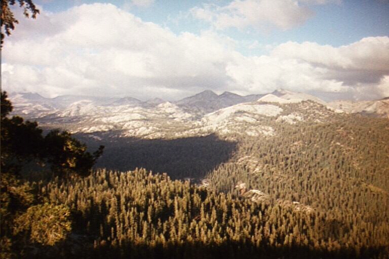
Ten minutes later I was pulling into the trailhead parking lot, which is actually an abandoned logging road. In my haste to get as many peaks as I could, I overshot the trail and ended hiking cross country almost two thirds up the north side of the dome. After finding the well worn trail, I made excellent time, arrving on top after about 15 minutes. Views were near panoramic, with the Iron Mountain formation blocking the northeast view into Yosemite. A storm front had moved through just hours earlier and, in addition to getting everything a little wet, cleared out most (not all) of the smog. Far below was either Hensley Lake, or Lake McClure, I don't know which one, but Ritter, Kaiser and all of the big peaks in between were covered with ominous thunderstorm-looking clouds. Chiquito Ridge filled the view to the south,while the Merced River canyon and lands beyond spread out below me to the north.
There was no register, so I headed back down, taking the trail this time. It was a little after four, and I had 9 other possible destinations. I ruled out Madera, Gale, Sing, Red Top, Shuteye and Squaw Dome because I wasn't in the mood to drive any more than I had to. Then I made an odd decision and went for Quartz Mountain, at the very end of the road...over 30 miles from highway 41. The drive seemed long, but the views entertained me. 29 miles from highway 41 I reached a fork in the road. The left fork was signed for Quartz Mountain trailhead, but the 9,046 foot peak was clearly to the south, so I took the right. A few hundred yards later I reached a sharp turn in the road and parked. From here, the summit was only a mile away, up the gully.
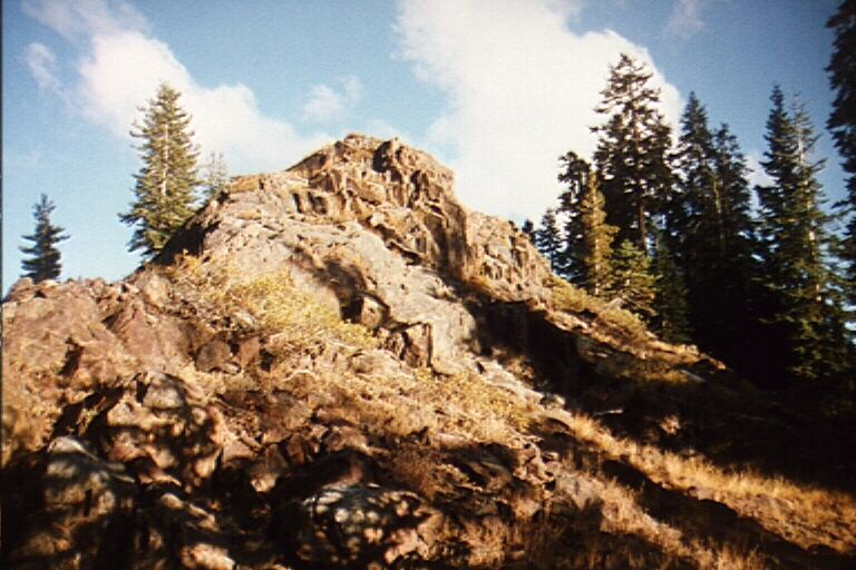
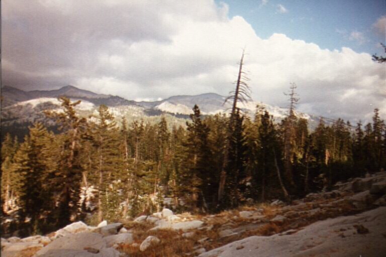
I first hiked south east, gaining the northeast ridge as quickly as possible. At the top of the ridge I found a large flat talus field, comprised of rocks ranging from golf ball sized to car sized. I then headed west to investigate an old mine, and then followed an ancient jeep trail up to the top of Peak 8,962. The traverse to the main peak was an enjoyable walk with amazing views, including expansive views of the Clark Range. Unfortunately, the big peaks were buried in the clouds, and all I could see were Red Top, Madera, Gale and Sing. In fact, I would say this was the most enjoyable and relaxing hike I've had all year. My walk through the woods was put to an abrupt end when I reached the summit block, a large class 3 formation comprised of red metamorphic rock. Although I really didn't want to be doing any real; climbing today, it was short and enjoyable and I reached the summit with no difficulty. Had I not been in such a hurry, I probably would have scouted around the summit and found the break in the cliffs on the east side, a grassy class 1 slope. Oh well, haste makes waste. I took my time to enjoy the view and had a snack. Although I didn't know it at the time, it was my 100th summit since I began counting in April of 1995. It was noticably cold on top, but the lack of wind made for a comfortable resting place. The most amazing views were down the South Fork canyon of the Merced River (to thewest) and the North Fork San Joaquin to the east. After taking some photos I headed back down to the car, which I found with little trouble after only an hour of hiking. I would drive by White Chief and Speckerman on the way down and I still had well over an hour of good daylight left, but it was freezing cold, the clouds were getting bigger, and I still had homework to do. There really wasn't any need to do anymore anyway, as the last three more than filled my appetite.